Compare Nassarius spiratus
| toggle to add to compare list |
Taxonomy
Family: Subfamily: NASSARIIDAE: NASSARIINAE Full Classification: Mollusca (Phylum) > Gastropoda (Class) > Caenogastropoda (Subclass) > Neogastropoda (Order) > Buccinoidea (Superfamily) > Nassariidae (Family) > Nassariinae (Subfamily) > Nassarius (Genus) > spiratus (Species) Genus Synonyms: =Alectrion Montfort, 1810 =Niotha H. & A. Adams, 1853 Synonymised Names: =Alectrion spiratus (A. Adams, 1852) =Nassa spirata A. Adams, 1852 =Nassarius (Alectrion) spiratus (A. Adams, 1852) |
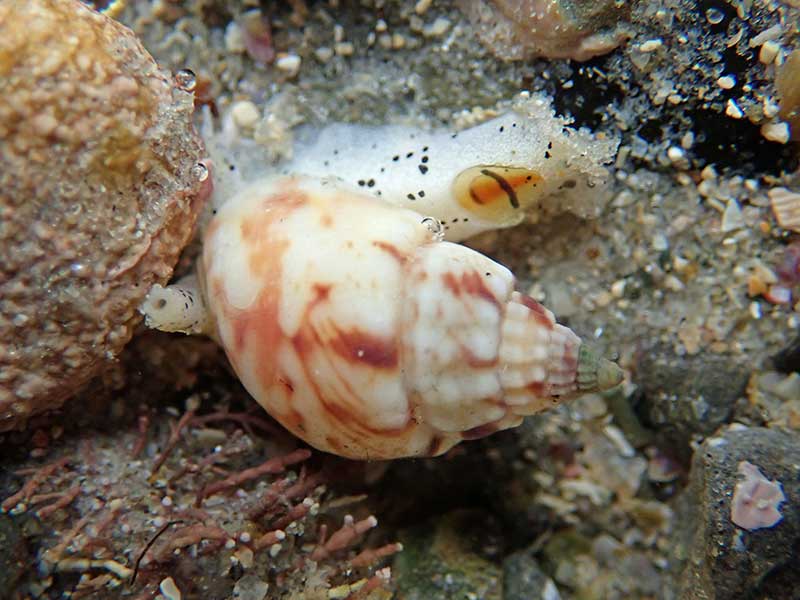
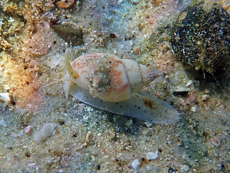
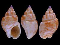
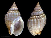
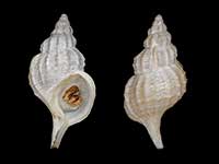
Images: Nassarius spiratus (A. Adams, 1852)
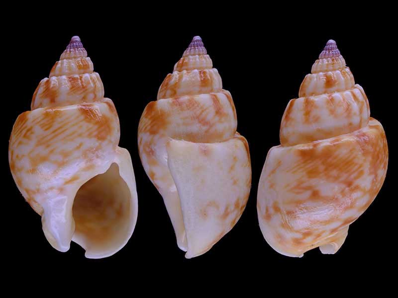
Matai Bay, Northland, NZ. 21mm
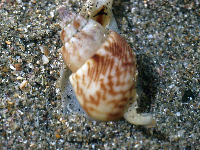
From off Bland Bay, Northland, NZ

From off Bland Bay, Northland, NZ
In a shallow rock pool at low tide, near Rarawa, Far North, NZ. 15mm
1-2 metres in sandy pools, Henderson Bay, Far North, NZ
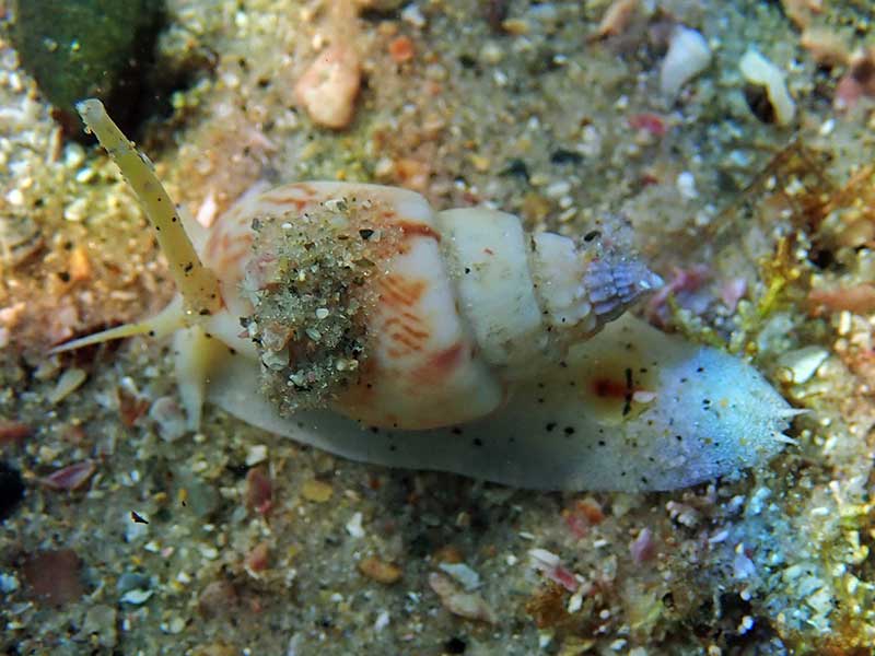
1-2 metres in sandy pools, Henderson Bay, Far North, NZ
Taxonomy
Family: Subfamily: NASSARIIDAE: NASSARIINAE Full Classification: Mollusca (Phylum) > Gastropoda (Class) > Caenogastropoda (Subclass) > Neogastropoda (Order) > Buccinoidea (Superfamily) > Nassariidae (Family) > Nassariinae (Subfamily) > Nassarius (Genus) > spiratus (Species) Genus Synonyms: =Alectrion Montfort, 1810 =Niotha H. & A. Adams, 1853 Synonymised Names: =Alectrion spiratus (A. Adams, 1852) =Nassa spirata A. Adams, 1852 =Nassarius (Alectrion) spiratus (A. Adams, 1852) |
Details: Nassarius spiratus (A. Adams, 1852)
Size/Grows to:
Height 25mm, Width 14mm
Distribution:
Northland east coast. From low tide to over 20 metres. Also NSW Australia, and Lord Howe Island
Geographical Range:
KA
Notes:
Species Links
Distribution Map
References and Publications
- Mead, K., Carson, K., Raven, J.L., Couper, J., Elliot, M., Elliot, C., Bracegirdle, S. Nov/2021 Notes on NZ Collected Species, Cookia, 33 (p.21)
- Cernohorsky, W.O. 1981 Revision of the Australian and New Zealand Tertiary and Recent species of the family Nassariidae (Mollusca: Gastropoda), Records of the Auckland Institute and Museum, 18 (p.141)
- Powell, A.W.B. 1979 New Zealand Mollusca: Marine, Land and Freshwater Shells, Collins, Auckland (p.205)
- Henderson, G. Nov/1976 On Nassarius spiratus (A. Adams) at Bland Bay, Poirieria, 8(5) (p.94)
- Henderson, G. Sep/1975 Nassarius spiratus, Poirieria, 8(1)
*98 © Museum of New Zealand Te Papa Tongarewa (CC-BY-NC-ND)
Key to Geographical Ranges

The symbols K.A.C.F.M.An. are used to indicate the geographical range of the species.
They have been adopted to give an approximation of the range of each species within New Zealand.
K=
Kermadec Islands
A=
Aupourian - Kaipara Harbour, north around North Cape, encompassing the Three Kings Islands and south to East Cape
C=
Cookian - Lower North Island and the northern part of the South Island
F=
Forsterian - Otago, Fiordland and Stewart Island
M=
Moriorian - Chatham Islands, Pitt Island
An=
Antipodean - Subantarctic Islands of New Zealand
Fw =
Freshwater
L =
Land
N =
North Island
S =
South Island
R =
Recent
Sf =
Subfossil
Fo =
Fossil
Compare Species (
/6)