Compare Neilo annectens
| toggle to add to compare list |
Taxonomy
Family: MALLETIIDAE Full Classification: Mollusca (Phylum) > Bivalvia (Class) > Protobranchia (Subclass) > Nuculanida (Order) > Nuculanoidea (Superfamily) > Malletiidae (Family) > Neilo (Genus) > annectens (Species) Genus Synonyms: =Malletia (Neilo) A. A. Adams, 1854 =Neilo (Neilo) A. A. Adams, 1854 accepted, alternate representation Synonymised Names: =Neilo rugata Dell, 1956 |
Images: Neilo annectens Powell, 1931
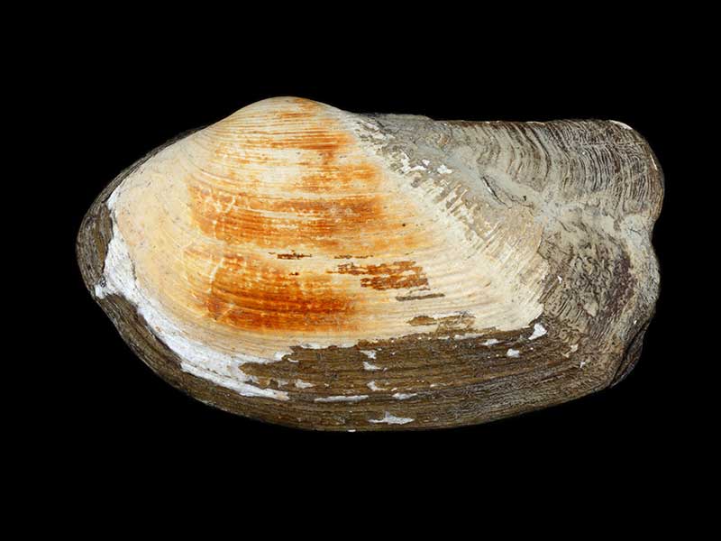
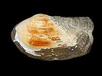
Pegasus Canyon 620 metres, off Lyttelton. 46mm
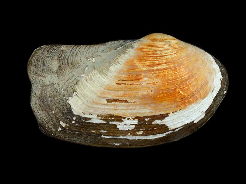
Pegasus Canyon 620 metres, off Lyttelton. 46mm
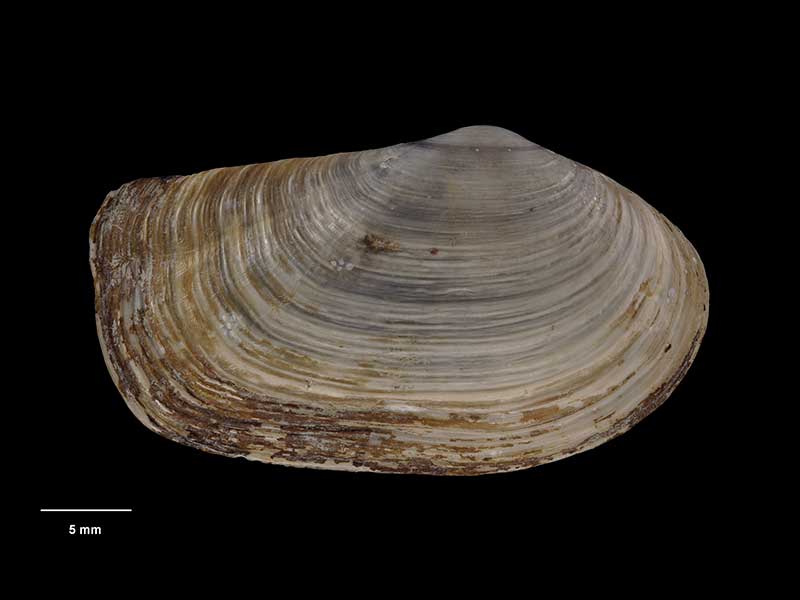
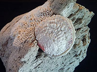
Holotype of Neilo rugata, collected 2 Mar 1954, Saunders Canyon, off Otago Peninsula, NZ (M.009202). © Museum of New Zealand Te Papa Tongarewa (CC-BY-NC-ND)
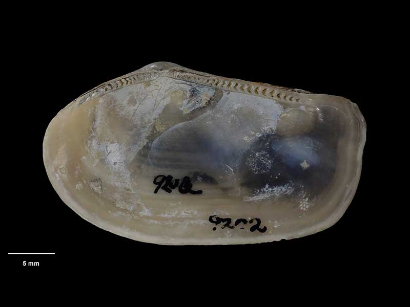
Holotype of Neilo rugata, collected 2 Mar 1954, Saunders Canyon, off Otago Peninsula, NZ (M.009202). © Museum of New Zealand Te Papa Tongarewa (CC-BY-NC-ND)
Taxonomy
Family: MALLETIIDAE Full Classification: Mollusca (Phylum) > Bivalvia (Class) > Protobranchia (Subclass) > Nuculanida (Order) > Nuculanoidea (Superfamily) > Malletiidae (Family) > Neilo (Genus) > annectens (Species) Genus Synonyms: =Malletia (Neilo) A. A. Adams, 1854 =Neilo (Neilo) A. A. Adams, 1854 accepted, alternate representation Synonymised Names: =Neilo rugata Dell, 1956 |
Details: Neilo annectens Powell, 1931
Size/Grows to:
Length 42mm, Height 22mm
Distribution:
Cook Strait and eastern South Island as far south as Otago Peninsula, in approx. 160-700 metres
Geographical Range:
CF
Notes:
Species Links
Distribution Map
References and Publications
- Powell, A.W.B. 1979 New Zealand Mollusca: Marine, Land and Freshwater Shells, Collins, Auckland (p.362)
- Marshall, B.A. Sep/1978 The genus Neilo in New Zealand (Mollusca: Bivalvia), New Zealand Journal of Zoology, 5(3) (p.426)
- Powell, A.W.B. 1931 Waitotaran faunules of the Wanganui System: and descriptions of new species of Mollusca from the New Zealand Pliocene, Records of the Auckland Institute and Museum, 1 (p.92) Original Description
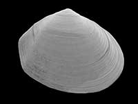
*98 © Museum of New Zealand Te Papa Tongarewa (CC-BY-NC-ND)
Key to Geographical Ranges

The symbols K.A.C.F.M.An. are used to indicate the geographical range of the species.
They have been adopted to give an approximation of the range of each species within New Zealand.
K=
Kermadec Islands
A=
Aupourian - Kaipara Harbour, north around North Cape, encompassing the Three Kings Islands and south to East Cape
C=
Cookian - Lower North Island and the northern part of the South Island
F=
Forsterian - Otago, Fiordland and Stewart Island
M=
Moriorian - Chatham Islands, Pitt Island
An=
Antipodean - Subantarctic Islands of New Zealand
Fw =
Freshwater
L =
Land
N =
North Island
S =
South Island
R =
Recent
Sf =
Subfossil
Fo =
Fossil
Recently Viewed
Compare Species (
/6)