Compare Awanuia dilatata
| toggle to add to compare list |
Taxonomy
Family: EULIMIDAE Full Classification: |
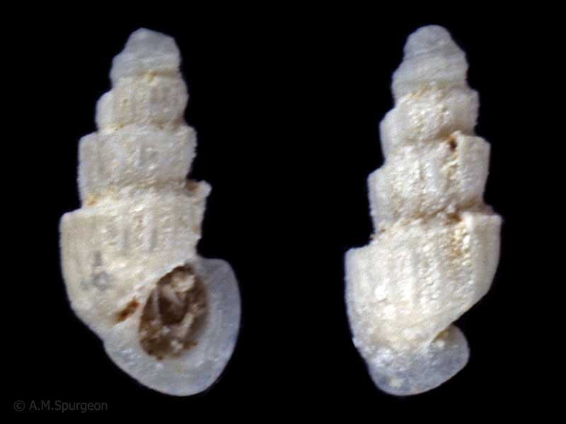
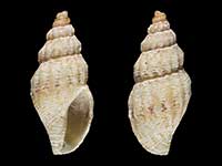
Images: Awanuia dilatata Powell, 1927

Holotype, collected 11-18 metres, off Mangonui Head, Northland, NZ (MA72014). © Auckland Museum (CC-BY)
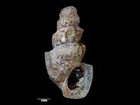
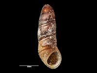
Collected in shell sand, 50 feet, South Harbour, Poor Knights Islands, Northland, NZ
Taxonomy
Family: EULIMIDAE Full Classification: |
Details: Awanuia dilatata Powell, 1927
Size/Grows to:
Height 1.5mm
Distribution:
Northland to Auckland
Geographical Range:
A
Notes:
Species Links
Distribution Map
References and Publications
- Ponder, W.F. 1985 A review of the genera of the Rissoidae (Mollusca: Mesogastropoda: Rissoacea), Records of the Australian Museum (p.105)
- Powell, A.W.B. 1979 New Zealand Mollusca: Marine, Land and Freshwater Shells, Collins, Auckland (p.97)
- Powell, A.W.B. 1927 The genetic relationships of Australasian rissoids. Part 1. Descriptions of new recent genera and species from New Zealand and the Kermadec Islands, Transactions and Proceedings of the New Zealand Institute, 57 (p.539) Original Description
*98 © Museum of New Zealand Te Papa Tongarewa (CC-BY-NC-ND)
Key to Geographical Ranges

The symbols K.A.C.F.M.An. are used to indicate the geographical range of the species.
They have been adopted to give an approximation of the range of each species within New Zealand.
K=
Kermadec Islands
A=
Aupourian - Kaipara Harbour, north around North Cape, encompassing the Three Kings Islands and south to East Cape
C=
Cookian - Lower North Island and the northern part of the South Island
F=
Forsterian - Otago, Fiordland and Stewart Island
M=
Moriorian - Chatham Islands, Pitt Island
An=
Antipodean - Subantarctic Islands of New Zealand
Fw =
Freshwater
L =
Land
N =
North Island
S =
South Island
R =
Recent
Sf =
Subfossil
Fo =
Fossil
Compare Species (
/6)