Compare Diloma zelandicum
| toggle to add to compare list |
Taxonomy
Family: Subfamily: TROCHIDAE: MONODONTINAE Full Classification: Mollusca (Phylum) > Gastropoda (Class) > Vetigastropoda (Subclass) > Trochida (Order) > Trochoidea (Superfamily) > Trochidae (Family) > Monodontinae (Subfamily) > Diloma (Genus) > zelandicum (Species) Genus Synonyms: =Anisodiloma Finlay, 1926 =Cavodiloma Finlay, 1926 =Fractarmilla Finlay, 1926 =Melagraphia Gray, 1847 =Monodonta (Neodiloma) P. Fischer, 1885 =Neodiloma P. Fischer, 1885 =Trochus (Diloma) Philippi, 1845 =Zediloma Finlay, 1926 =Zediloma (Fractarmilla) Finlay, 1926 Synonymised Names: =Monodonta melanoloma var. guttata Hutton, 1884 =Trochus atrovirens Philippi, 1851 =Trochus zelandicus Quoy & Gaimard, 1834 |
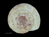
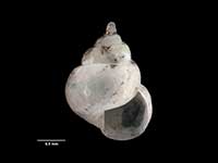
Images: Diloma zelandicum (Quoy & Gaimard, 1834)
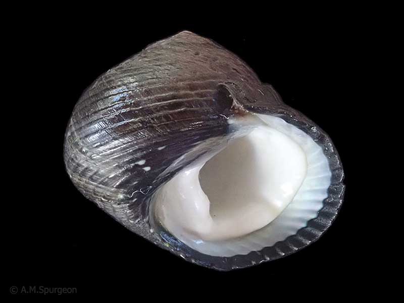
Found under and around rocks throughout the country. 21mm
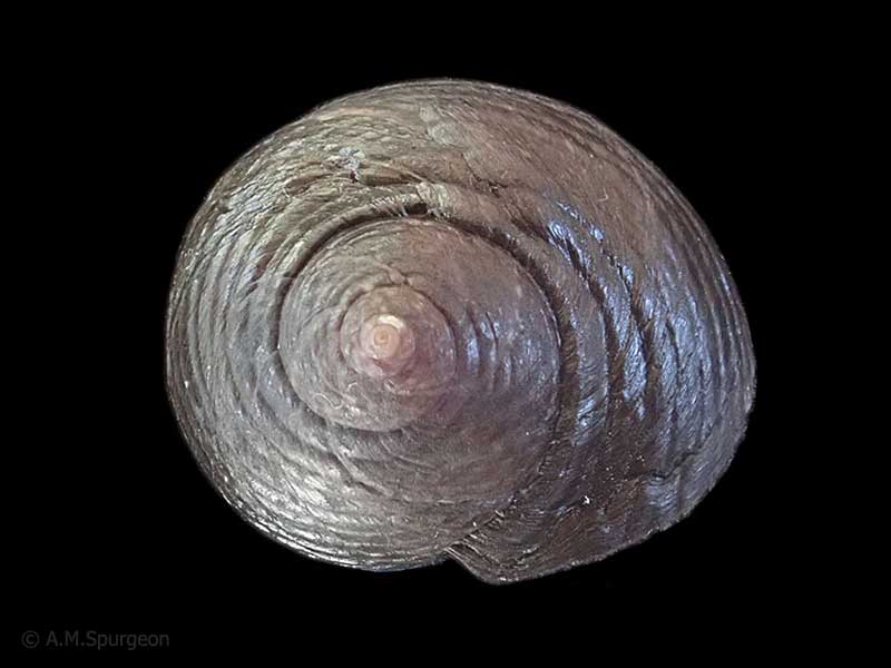
Found under and around rocks throughout the country. 21mm
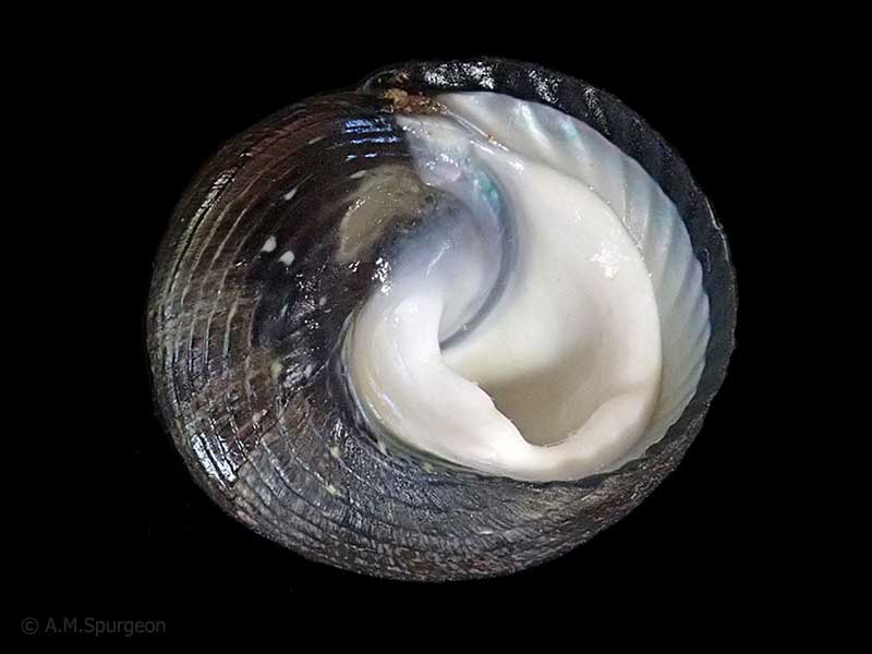
Found under and around rocks throughout the country. 21mm
Taxonomy
Family: Subfamily: TROCHIDAE: MONODONTINAE Full Classification: Mollusca (Phylum) > Gastropoda (Class) > Vetigastropoda (Subclass) > Trochida (Order) > Trochoidea (Superfamily) > Trochidae (Family) > Monodontinae (Subfamily) > Diloma (Genus) > zelandicum (Species) Genus Synonyms: =Anisodiloma Finlay, 1926 =Cavodiloma Finlay, 1926 =Fractarmilla Finlay, 1926 =Melagraphia Gray, 1847 =Monodonta (Neodiloma) P. Fischer, 1885 =Neodiloma P. Fischer, 1885 =Trochus (Diloma) Philippi, 1845 =Zediloma Finlay, 1926 =Zediloma (Fractarmilla) Finlay, 1926 Synonymised Names: =Monodonta melanoloma var. guttata Hutton, 1884 =Trochus atrovirens Philippi, 1851 =Trochus zelandicus Quoy & Gaimard, 1834 |
Details: Diloma zelandicum (Quoy & Gaimard, 1834)
Size/Grows to:
Width 32mm, Height 24mm
Distribution:
North, South and Stewart Island
Geographical Range:
ACF
Notes:
Species Links
Distribution Map
References and Publications
- Donald, K.M., Kennedy, M., Spencer, H.G. 2005 The phylogeny and taxonomy of austral monodontine topshells (Mollusca: Gastropoda: Trochidae), inferred from DNA sequences, Molecular Phylogenetics and Evolution, 37 (p.482)
- Powell, A.W.B. 1979 New Zealand Mollusca: Marine, Land and Freshwater Shells, Collins, Auckland (p.53)
Key to Geographical Ranges

The symbols K.A.C.F.M.An. are used to indicate the geographical range of the species.
They have been adopted to give an approximation of the range of each species within New Zealand.
K=
Kermadec Islands
A=
Aupourian - Kaipara Harbour, north around North Cape, encompassing the Three Kings Islands and south to East Cape
C=
Cookian - Lower North Island and the northern part of the South Island
F=
Forsterian - Otago, Fiordland and Stewart Island
M=
Moriorian - Chatham Islands, Pitt Island
An=
Antipodean - Subantarctic Islands of New Zealand
Fw =
Freshwater
L =
Land
N =
North Island
S =
South Island
R =
Recent
Sf =
Subfossil
Fo =
Fossil
Compare Species (
/6)