Compare Therasia thaisa
| toggle to add to compare list |
Taxonomy
Family: Subfamily: CHAROPIDAE: THERASIINAE Full Classification: Mollusca (Phylum) > Gastropoda (Class) > Heterobranchia (Subclass) > Euthyneura (Infraclass) > Tectipleura (Subterclass) > Eupulmonata (Superorder) > Stylommatophora (Order) > Helicina (Suborder) > [unassigned] Helicina (Infraorder) > Punctoidea (Superfamily) > Charopidae (Family) > Therasiinae (Subfamily) > Therasia (Genus) > thaisa (Species) |
Images: Therasia thaisa Hutton, 1883
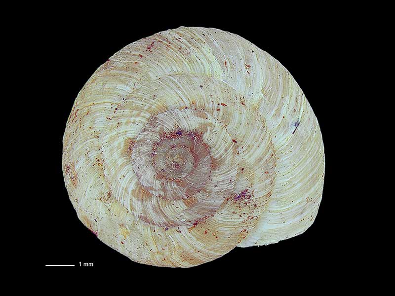
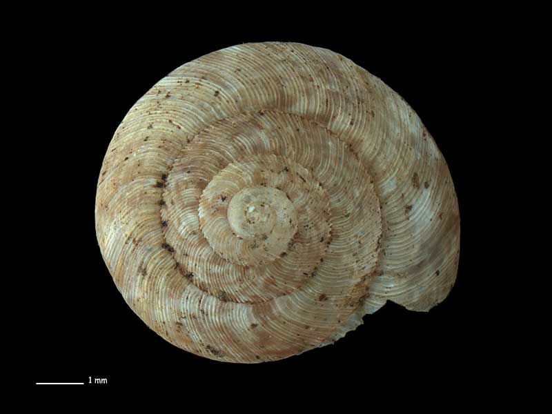
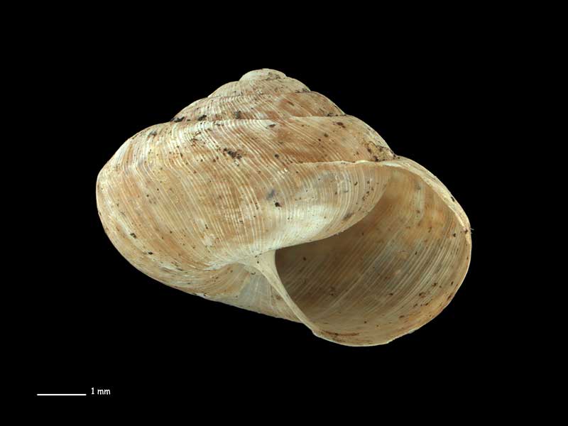
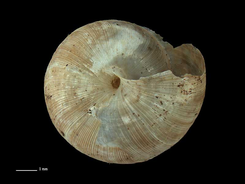
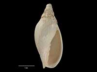
Collected Nov 1948, Sealers Bay, Codfish Island, Stewart Island, NZ. 9.0mm. Reproduced courtesy of Dave Roscoe
Collected Nov 1948, Sealers Bay, Codfish Island, Stewart Island, NZ. 9.0mm. Reproduced courtesy of Dave Roscoe
Collected Nov 1948, Sealers Bay, Codfish Island, Stewart Island, NZ. 9.0mm. Reproduced courtesy of Dave Roscoe
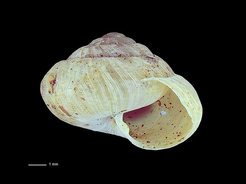
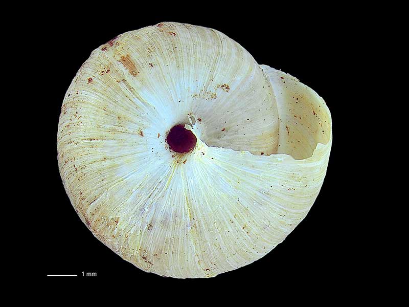
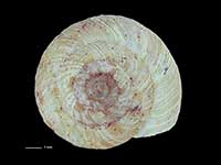
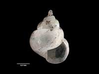
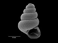
Collected Nov 1983, roadside W of Raes Junction, NE of Tapanui, Otago, NZ. 8.0mm. Reproduced courtesy of Dave Roscoe
Collected Nov 1983, roadside W of Raes Junction, NE of Tapanui, Otago, NZ. 8.0mm. Reproduced courtesy of Dave Roscoe
Collected Nov 1983, roadside W of Raes Junction, NE of Tapanui, Otago, NZ. 8.0mm. Reproduced courtesy of Dave Roscoe
Taxonomy
Family: Subfamily: CHAROPIDAE: THERASIINAE Full Classification: Mollusca (Phylum) > Gastropoda (Class) > Heterobranchia (Subclass) > Euthyneura (Infraclass) > Tectipleura (Subterclass) > Eupulmonata (Superorder) > Stylommatophora (Order) > Helicina (Suborder) > [unassigned] Helicina (Infraorder) > Punctoidea (Superfamily) > Charopidae (Family) > Therasiinae (Subfamily) > Therasia (Genus) > thaisa (Species) |
Details: Therasia thaisa Hutton, 1883
Size/Grows to:
Width 10.3mm, Height 8mm
Distribution:
South and Stewart Island
Geographical Range:
L.S.
Notes:
Species Links
Distribution Map
References and Publications
- Powell, A.W.B. 1979 New Zealand Mollusca: Marine, Land and Freshwater Shells, Collins, Auckland (p.316)
- Hutton, F.W. 1883 Notes on some New Zealand land shells, New Zealand Journal of Science, 1(10) (p.477) Original Description
*98 © Museum of New Zealand Te Papa Tongarewa (CC-BY-NC-ND)
Key to Geographical Ranges

The symbols K.A.C.F.M.An. are used to indicate the geographical range of the species.
They have been adopted to give an approximation of the range of each species within New Zealand.
K=
Kermadec Islands
A=
Aupourian - Kaipara Harbour, north around North Cape, encompassing the Three Kings Islands and south to East Cape
C=
Cookian - Lower North Island and the northern part of the South Island
F=
Forsterian - Otago, Fiordland and Stewart Island
M=
Moriorian - Chatham Islands, Pitt Island
An=
Antipodean - Subantarctic Islands of New Zealand
Fw =
Freshwater
L =
Land
N =
North Island
S =
South Island
R =
Recent
Sf =
Subfossil
Fo =
Fossil
Compare Species (
/6)