Compare Diloma durvillaea
| toggle to add to compare list |
Taxonomy
Family: Subfamily: TROCHIDAE: MONODONTINAE Full Classification: Mollusca (Phylum) > Gastropoda (Class) > Vetigastropoda (Subclass) > Trochida (Order) > Trochoidea (Superfamily) > Trochidae (Family) > Monodontinae (Subfamily) > Diloma (Genus) > durvillaea (Species) Genus Synonyms: =Anisodiloma Finlay, 1926 =Cavodiloma Finlay, 1926 =Fractarmilla Finlay, 1926 =Melagraphia Gray, 1847 =Monodonta (Neodiloma) P. Fischer, 1885 =Neodiloma P. Fischer, 1885 =Trochus (Diloma) Philippi, 1845 =Zediloma Finlay, 1926 =Zediloma (Fractarmilla) Finlay, 1926 |
Images: Diloma durvillaea Spencer, Marshall & Waters, 2009
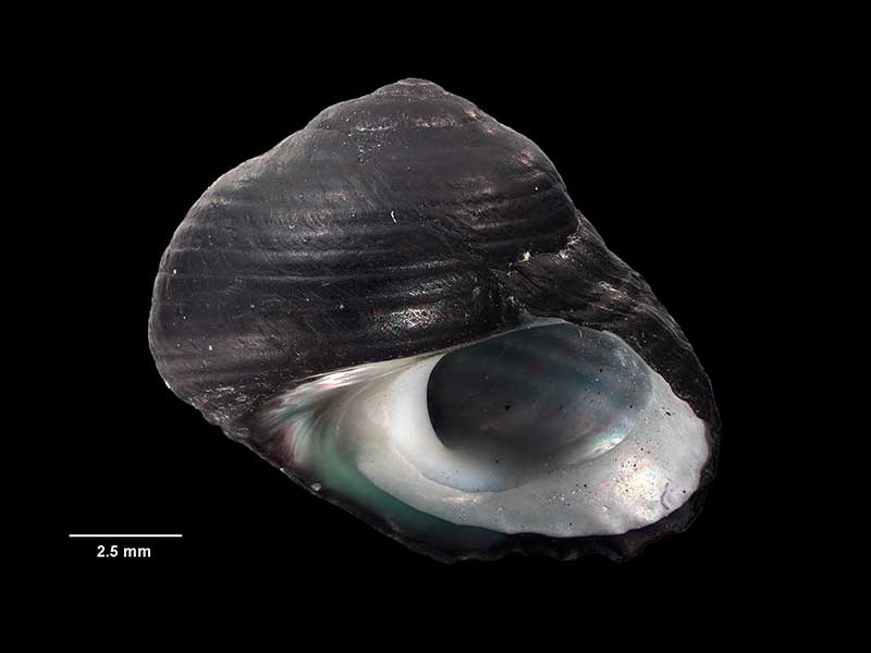
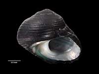
Holotype, collected 26 Jan 2005, Kaka Point, S of Balclutha, NZ (M.278384). 10.8mm x 10.5mm. © Museum of New Zealand Te Papa Tongarewa (CC-BY-NC-ND)
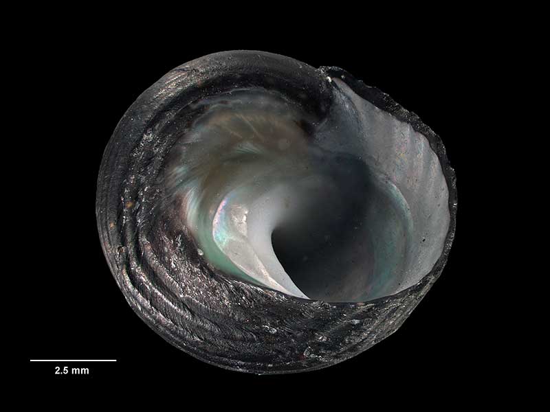
Holotype, collected 26 Jan 2005, Kaka Point, S of Balclutha, NZ (M.278384). 10.8mm x 10.5mm. © Museum of New Zealand Te Papa Tongarewa (CC-BY-NC-ND)
Taxonomy
Family: Subfamily: TROCHIDAE: MONODONTINAE Full Classification: Mollusca (Phylum) > Gastropoda (Class) > Vetigastropoda (Subclass) > Trochida (Order) > Trochoidea (Superfamily) > Trochidae (Family) > Monodontinae (Subfamily) > Diloma (Genus) > durvillaea (Species) Genus Synonyms: =Anisodiloma Finlay, 1926 =Cavodiloma Finlay, 1926 =Fractarmilla Finlay, 1926 =Melagraphia Gray, 1847 =Monodonta (Neodiloma) P. Fischer, 1885 =Neodiloma P. Fischer, 1885 =Trochus (Diloma) Philippi, 1845 =Zediloma Finlay, 1926 =Zediloma (Fractarmilla) Finlay, 1926 |
Details: Diloma durvillaea Spencer, Marshall & Waters, 2009
Size/Grows to:
Width 13mm, Height 12mm
Distribution:
South Island. From Lyttelton Harbour south, under holdfasts & on blades of Durvillaea antarctica & adjacent rocks near low tide level
Geographical Range:
CFAn
Notes:
Species Links
Distribution Map
References and Publications
- Spencer, H.G. Sep/2009 Name changes for some common intertidal snails, Poirieria, 34 (p.6)
- Spencer, H.G., Marshall, B.A., Waters, J.M. 2009 Systematics and phylogeny of a new cryptic species of Diloma Philippi (Mollusca: Gastropoda: Trochidae) from a novel habitat, the bull kelp holdfast communities of Southern New Zealand, Invertebrate Systematics, 23 (p.21) Original Description
Key to Geographical Ranges

The symbols K.A.C.F.M.An. are used to indicate the geographical range of the species.
They have been adopted to give an approximation of the range of each species within New Zealand.
K=
Kermadec Islands
A=
Aupourian - Kaipara Harbour, north around North Cape, encompassing the Three Kings Islands and south to East Cape
C=
Cookian - Lower North Island and the northern part of the South Island
F=
Forsterian - Otago, Fiordland and Stewart Island
M=
Moriorian - Chatham Islands, Pitt Island
An=
Antipodean - Subantarctic Islands of New Zealand
Fw =
Freshwater
L =
Land
N =
North Island
S =
South Island
R =
Recent
Sf =
Subfossil
Fo =
Fossil
Compare Species (
/6)