Compare Montacuta semiradiata
| toggle to add to compare list |
Taxonomy
Family: LASAEIDAE Full Classification: Genus Synonyms: =Montaguia Bucquoy, Dautzenberg & Dollfus, 1892 =Sphenalia S.V. Wood, 1874 Synonymised Names: =Coriareus neozelanicus Dell, 1956 =Montacuta semiradiata neozelanica (Dell, 1956) |
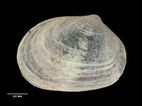
Images: Montacuta semiradiata Tate, 1889
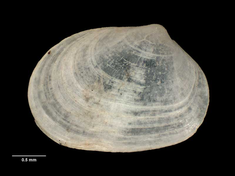
Holotype of Coriareus neozelanicus, collected 3 Feb 1954, SE of Pitt Island, Chatham Islands, NZ (M.009763). 2.7mm. © Museum of New Zealand Te Papa Tongarewa (CC-BY-NC-ND)
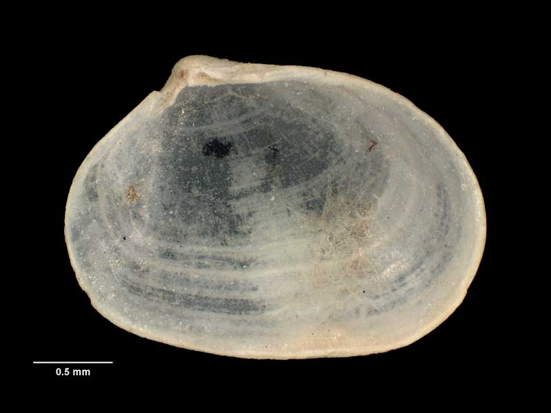
Holotype of Coriareus neozelanicus, collected 3 Feb 1954, SE of Pitt Island, Chatham Islands, NZ (M.009763). 2.7mm. © Museum of New Zealand Te Papa Tongarewa (CC-BY-NC-ND)
Taxonomy
Family: LASAEIDAE Full Classification: Genus Synonyms: =Montaguia Bucquoy, Dautzenberg & Dollfus, 1892 =Sphenalia S.V. Wood, 1874 Synonymised Names: =Coriareus neozelanicus Dell, 1956 =Montacuta semiradiata neozelanica (Dell, 1956) |
Details: Montacuta semiradiata Tate, 1889
Size/Grows to:
Width 2.7mm, Height 1.9mm
Distribution:
Three Kings Islands, North Island, eastern and south-western South Island, and Chatham Islands
Geographical Range:
ACM
Notes:
Species Links
Distribution Map
References and Publications
- Powell, A.W.B. 1979 New Zealand Mollusca: Marine, Land and Freshwater Shells, Collins, Auckland (p.395)
- Tate, R. 1889 Description of some new species of marine Mollusca from South Australia and Victoria, Transactions and Proceedings and Report of the Royal Society of South Australia, 11 (p.63) Original Description
*98 © Museum of New Zealand Te Papa Tongarewa (CC-BY-NC-ND)
Key to Geographical Ranges

The symbols K.A.C.F.M.An. are used to indicate the geographical range of the species.
They have been adopted to give an approximation of the range of each species within New Zealand.
K=
Kermadec Islands
A=
Aupourian - Kaipara Harbour, north around North Cape, encompassing the Three Kings Islands and south to East Cape
C=
Cookian - Lower North Island and the northern part of the South Island
F=
Forsterian - Otago, Fiordland and Stewart Island
M=
Moriorian - Chatham Islands, Pitt Island
An=
Antipodean - Subantarctic Islands of New Zealand
Fw =
Freshwater
L =
Land
N =
North Island
S =
South Island
R =
Recent
Sf =
Subfossil
Fo =
Fossil
Recently Viewed
Compare Species (
/6)