Compare Neilonella benthicola
| toggle to add to compare list |
Taxonomy
Family: NEILONELLIDAE Full Classification: Mollusca (Phylum) > Bivalvia (Class) > Protobranchia (Subclass) > Nuculanida (Order) > Nuculanoidea (Superfamily) > Neilonellidae (Family) > Neilonella (Genus) > benthicola (Species) Genus Synonyms: =Austrotindaria C.A. Fleming, 1948 =Leda (Neilonella) Dall, 1881 =Leda (Saturnia) G. Seguenza, 1877 =Pseudoneilonella Laghi, 1986 =Pseudotindaria Sanders & Allen, 1977 =Saturnia G. Seguenza, 1877 =Tindaria (Neilonella) Dall, 1881 Synonymised Names: =Austrotindaria benthicola Dell, 1956 |
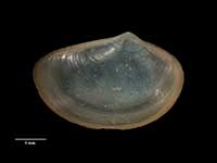
Images: Neilonella benthicola (Dell, 1956)
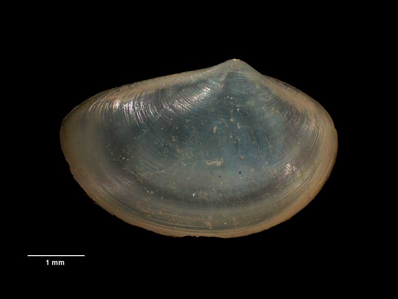
Holotype of Austrotindaria benthicola Dell, 1956, collected 03 Feb 1954, SE of Pitt Island, NZ (M.009759). 4.8mm. © Museum of New Zealand Te Papa Tongarewa (CC-BY-NC-ND)
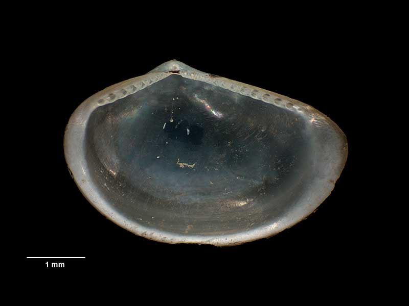
Holotype of Austrotindaria benthicola Dell, 1956, collected 03 Feb 1954, SE of Pitt Island, NZ (M.009759). 4.8mm. © Museum of New Zealand Te Papa Tongarewa (CC-BY-NC-ND)
Taxonomy
Family: NEILONELLIDAE Full Classification: Mollusca (Phylum) > Bivalvia (Class) > Protobranchia (Subclass) > Nuculanida (Order) > Nuculanoidea (Superfamily) > Neilonellidae (Family) > Neilonella (Genus) > benthicola (Species) Genus Synonyms: =Austrotindaria C.A. Fleming, 1948 =Leda (Neilonella) Dall, 1881 =Leda (Saturnia) G. Seguenza, 1877 =Pseudoneilonella Laghi, 1986 =Pseudotindaria Sanders & Allen, 1977 =Saturnia G. Seguenza, 1877 =Tindaria (Neilonella) Dall, 1881 Synonymised Names: =Austrotindaria benthicola Dell, 1956 |
Details: Neilonella benthicola (Dell, 1956)
Size/Grows to:
Length 5mm, Height 3.2mm
Distribution:
Chatham Rise and off Chatham Islands
Geographical Range:
CM
Notes:
Species Links
Distribution Map
References and Publications
- Powell, A.W.B. 1979 New Zealand Mollusca: Marine, Land and Freshwater Shells, Collins, Auckland (p.363)
- Dell, R.K. 1956 The archibenthal Mollusca of New Zealand, Dominion Museum Bulletin, 18 (p.235) Original Description
*98 © Museum of New Zealand Te Papa Tongarewa (CC-BY-NC-ND)
Key to Geographical Ranges

The symbols K.A.C.F.M.An. are used to indicate the geographical range of the species.
They have been adopted to give an approximation of the range of each species within New Zealand.
K=
Kermadec Islands
A=
Aupourian - Kaipara Harbour, north around North Cape, encompassing the Three Kings Islands and south to East Cape
C=
Cookian - Lower North Island and the northern part of the South Island
F=
Forsterian - Otago, Fiordland and Stewart Island
M=
Moriorian - Chatham Islands, Pitt Island
An=
Antipodean - Subantarctic Islands of New Zealand
Fw =
Freshwater
L =
Land
N =
North Island
S =
South Island
R =
Recent
Sf =
Subfossil
Fo =
Fossil
Recently Viewed
Compare Species (
/6)