Compare Canallodiscus elliottae
| toggle to add to compare list |
Taxonomy
Family: Subfamily: CHAROPIDAE: PHENACOHELICINAE Full Classification: Mollusca (Phylum) > Gastropoda (Class) > Heterobranchia (Subclass) > Euthyneura (Infraclass) > Tectipleura (Subterclass) > Eupulmonata (Superorder) > Stylommatophora (Order) > Helicina (Suborder) > [unassigned] Helicina (Infraorder) > Punctoidea (Superfamily) > Charopidae (Family) > Phenacohelicinae (Subfamily) > Canallodiscus (Genus) > elliottae (Species) Synonymised Names: =Phelussa elliottae Gardner, 1968 |
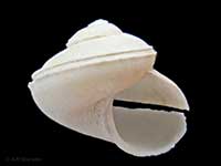
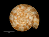
Images: Canallodiscus elliottae (Gardner, 1968)
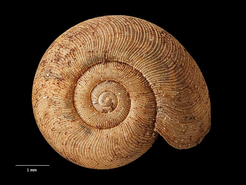
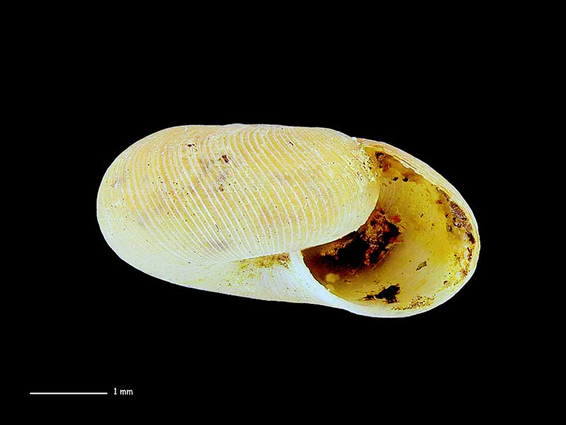
Holotype, collected Jan 1966, Fenian Track, Oparara River Valley, NE of Karamea, Northern Westland, NZ (MA71318). © Auckland Museum (CC-BY)
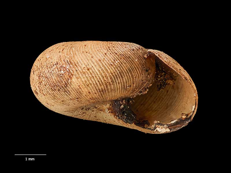
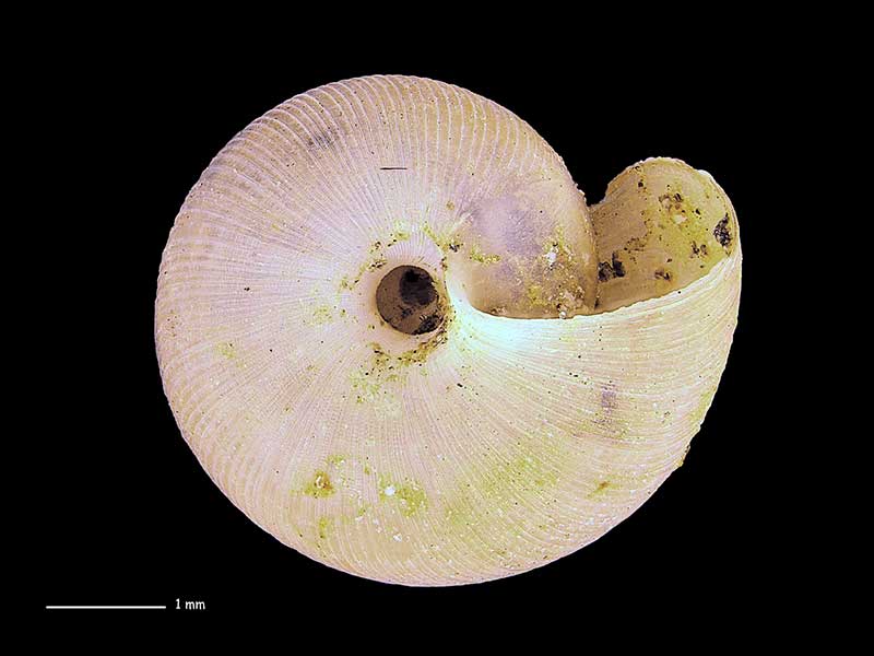
Holotype, collected Jan 1966, Fenian Track, Oparara River Valley, NE of Karamea, Northern Westland, NZ (MA71318). © Auckland Museum (CC-BY)
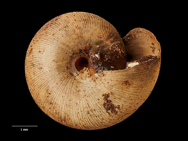
Holotype, collected Jan 1966, Fenian Track, Oparara River Valley, NE of Karamea, Northern Westland, NZ (MA71318). © Auckland Museum (CC-BY)
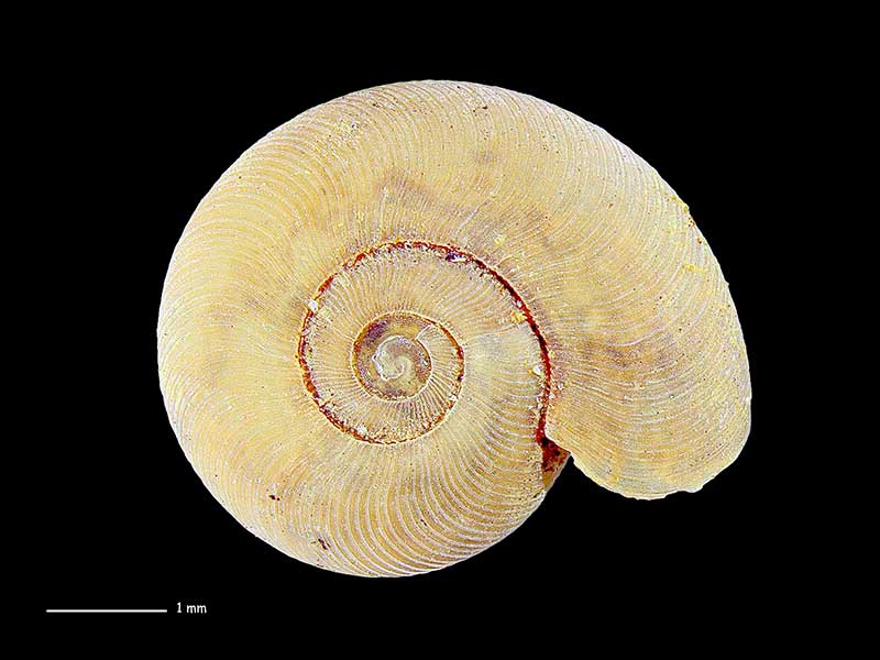
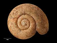
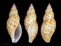
Honeycomb Hill cave system, NE of Karamea, Northern Westland, NZ. 5.0mm. Reproduced courtesy of Dave Roscoe
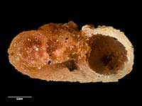
Honeycomb Hill cave system, NE of Karamea, Northern Westland, NZ. 5.0mm. Reproduced courtesy of Dave Roscoe
Honeycomb Hill cave system, NE of Karamea, Northern Westland, NZ. 5.0mm. Reproduced courtesy of Dave Roscoe
Taxonomy
Family: Subfamily: CHAROPIDAE: PHENACOHELICINAE Full Classification: Mollusca (Phylum) > Gastropoda (Class) > Heterobranchia (Subclass) > Euthyneura (Infraclass) > Tectipleura (Subterclass) > Eupulmonata (Superorder) > Stylommatophora (Order) > Helicina (Suborder) > [unassigned] Helicina (Infraorder) > Punctoidea (Superfamily) > Charopidae (Family) > Phenacohelicinae (Subfamily) > Canallodiscus (Genus) > elliottae (Species) Synonymised Names: =Phelussa elliottae Gardner, 1968 |
Details: Canallodiscus elliottae (Gardner, 1968)
Size/Grows to:
Width 5mm, Height 2.5mm
Distribution:
South Island. Nelson area
Geographical Range:
L.S.
Notes:
Species Links
Distribution Map
References and Publications
- Marshall, B.A., Barker, G.M. 2008 A revision of the New Zealand land snails referred to Allodiscus Pilsbry, 1892 and Pseudallodiscus Climo, 1971, with the introduction of three new genera (Mollusca: Gastropoda: Charopidae), Tuhinga: Records of the Museum of New Zealand Te Papa Tongarewa, 19 (p.156)
- Powell, A.W.B. 1979 New Zealand Mollusca: Marine, Land and Freshwater Shells, Collins, Auckland (p.315)
- Gardner, N.W. 1968 Four new species of Land Snails from New Zealand, Transactions of the Royal Society of New Zealand, 10(17) (p.161) Original Description
*98 © Museum of New Zealand Te Papa Tongarewa (CC-BY-NC-ND)
Key to Geographical Ranges

The symbols K.A.C.F.M.An. are used to indicate the geographical range of the species.
They have been adopted to give an approximation of the range of each species within New Zealand.
K=
Kermadec Islands
A=
Aupourian - Kaipara Harbour, north around North Cape, encompassing the Three Kings Islands and south to East Cape
C=
Cookian - Lower North Island and the northern part of the South Island
F=
Forsterian - Otago, Fiordland and Stewart Island
M=
Moriorian - Chatham Islands, Pitt Island
An=
Antipodean - Subantarctic Islands of New Zealand
Fw =
Freshwater
L =
Land
N =
North Island
S =
South Island
R =
Recent
Sf =
Subfossil
Fo =
Fossil
Compare Species (
/6)