Compare Flammulina lateaperta
| toggle to add to compare list |
Taxonomy
Family: Subfamily: CHAROPIDAE: FLAMMULININAE Full Classification: Mollusca (Phylum) > Gastropoda (Class) > Heterobranchia (Subclass) > Euthyneura (Infraclass) > Tectipleura (Subterclass) > Eupulmonata (Superorder) > Stylommatophora (Order) > Helicina (Suborder) > [unassigned] Helicina (Infraorder) > Punctoidea (Superfamily) > Charopidae (Family) > Flammulininae (Subfamily) > Flammulina (Genus) > lateaperta (Species) Genus Synonyms: =Amphidoxa (Calymna) Hutton, 1883 =Flammulina (Calymna) Hutton, 1883 |
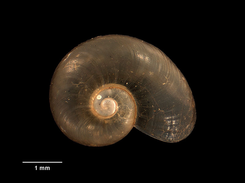
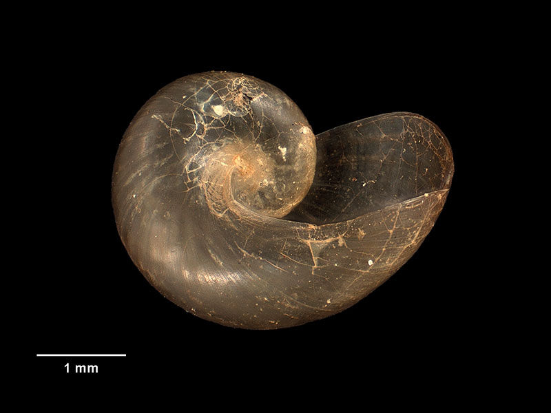
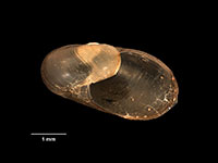
Images: Flammulina lateaperta Dell, 1955

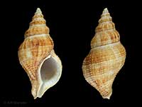
Holotype, collected 13 Mar 1949, Stillwater River, Caswell Sound head, NZ (M.006153). 4mm. © Museum of New Zealand Te Papa Tongarewa (CC-BY-NC-ND)
Holotype, collected 13 Mar 1949, Stillwater River, Caswell Sound head, NZ (M.006153). 4mm. © Museum of New Zealand Te Papa Tongarewa (CC-BY-NC-ND)
Holotype, collected 13 Mar 1949, Stillwater River, Caswell Sound head, NZ (M.006153). 4mm. © Museum of New Zealand Te Papa Tongarewa (CC-BY-NC-ND)
Taxonomy
Family: Subfamily: CHAROPIDAE: FLAMMULININAE Full Classification: Mollusca (Phylum) > Gastropoda (Class) > Heterobranchia (Subclass) > Euthyneura (Infraclass) > Tectipleura (Subterclass) > Eupulmonata (Superorder) > Stylommatophora (Order) > Helicina (Suborder) > [unassigned] Helicina (Infraorder) > Punctoidea (Superfamily) > Charopidae (Family) > Flammulininae (Subfamily) > Flammulina (Genus) > lateaperta (Species) Genus Synonyms: =Amphidoxa (Calymna) Hutton, 1883 =Flammulina (Calymna) Hutton, 1883 |
Details: Flammulina lateaperta Dell, 1955
Size/Grows to:
Width 4.1mm, Height 2.3mm
Distribution:
South Island
Geographical Range:
L.S.
Notes:
Species Links
Distribution Map
References and Publications
- Powell, A.W.B. 1979 New Zealand Mollusca: Marine, Land and Freshwater Shells, Collins, Auckland (p.314)
- Dell, R.K. 1955 The land Mollusca of Fiordland, south-west Otago, Transactions and Proceedings of the Royal Society of New Zealand, 82(5) (p.1140) Original Description
*98 © Museum of New Zealand Te Papa Tongarewa (CC-BY-NC-ND)
Key to Geographical Ranges

The symbols K.A.C.F.M.An. are used to indicate the geographical range of the species.
They have been adopted to give an approximation of the range of each species within New Zealand.
K=
Kermadec Islands
A=
Aupourian - Kaipara Harbour, north around North Cape, encompassing the Three Kings Islands and south to East Cape
C=
Cookian - Lower North Island and the northern part of the South Island
F=
Forsterian - Otago, Fiordland and Stewart Island
M=
Moriorian - Chatham Islands, Pitt Island
An=
Antipodean - Subantarctic Islands of New Zealand
Fw =
Freshwater
L =
Land
N =
North Island
S =
South Island
R =
Recent
Sf =
Subfossil
Fo =
Fossil
Compare Species (
/6)