Compare Cavellia brouni
| toggle to add to compare list |
Taxonomy
Family: Subfamily: CHAROPIDAE: CHAROPINAE Full Classification: Mollusca (Phylum) > Gastropoda (Class) > Heterobranchia (Subclass) > Euthyneura (Infraclass) > Tectipleura (Subterclass) > Eupulmonata (Superorder) > Stylommatophora (Order) > Helicina (Suborder) > [unassigned] Helicina (Infraorder) > Punctoidea (Superfamily) > Charopidae (Family) > Charopinae (Subfamily) > Cavellia (Genus) > brouni (Species) Synonymised Names: =Patula brouni Suter, 1891 =Patula eremita Suter, 1891 |
Images: Cavellia brouni (Suter, 1891)
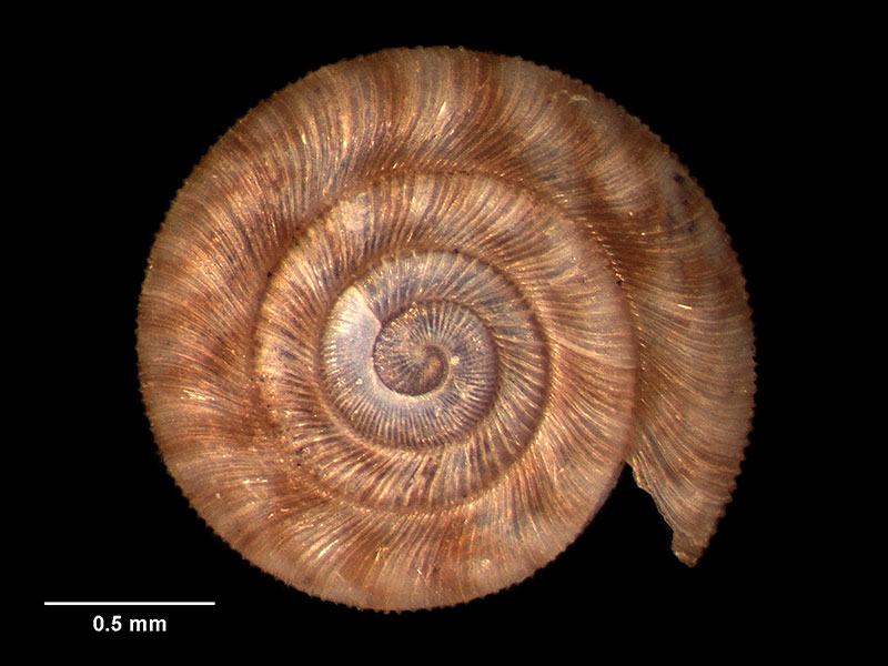
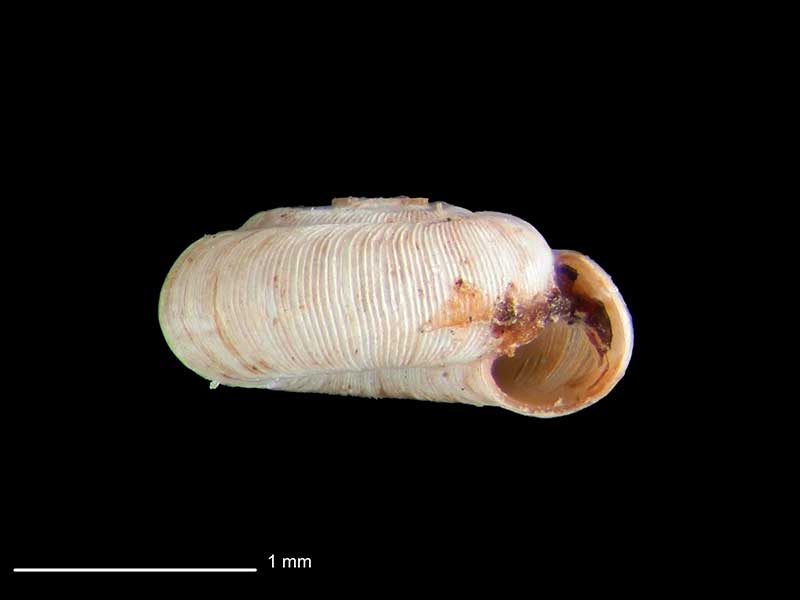
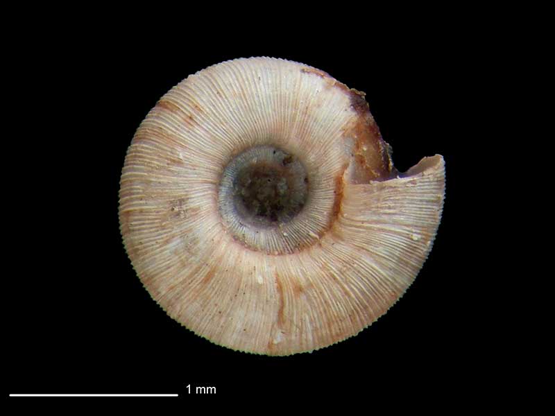
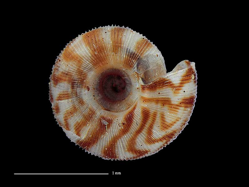
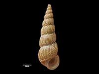
Collected White Horse Hill, Hooker Valley, NNW of Mount Cook Village, NZ (M.125101). 2.5mm. © Museum of New Zealand Te Papa Tongarewa (CC-BY-NC-ND)
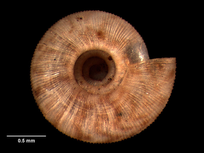
Collected White Horse Hill, Hooker Valley, NNW of Mount Cook Village, NZ (M.125101). 2.5mm. © Museum of New Zealand Te Papa Tongarewa (CC-BY-NC-ND)
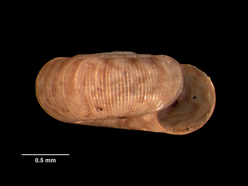
Collected White Horse Hill, Hooker Valley, NNW of Mount Cook Village, NZ (M.125101). 2.5mm. © Museum of New Zealand Te Papa Tongarewa (CC-BY-NC-ND)
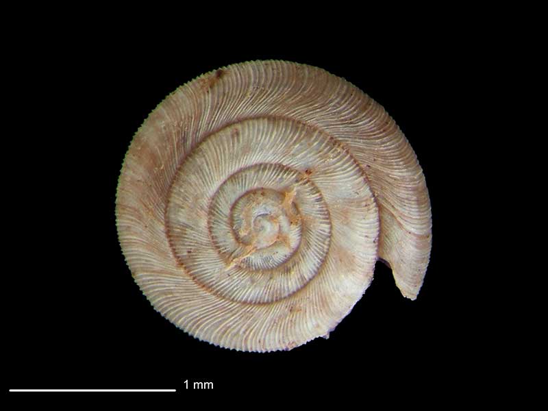
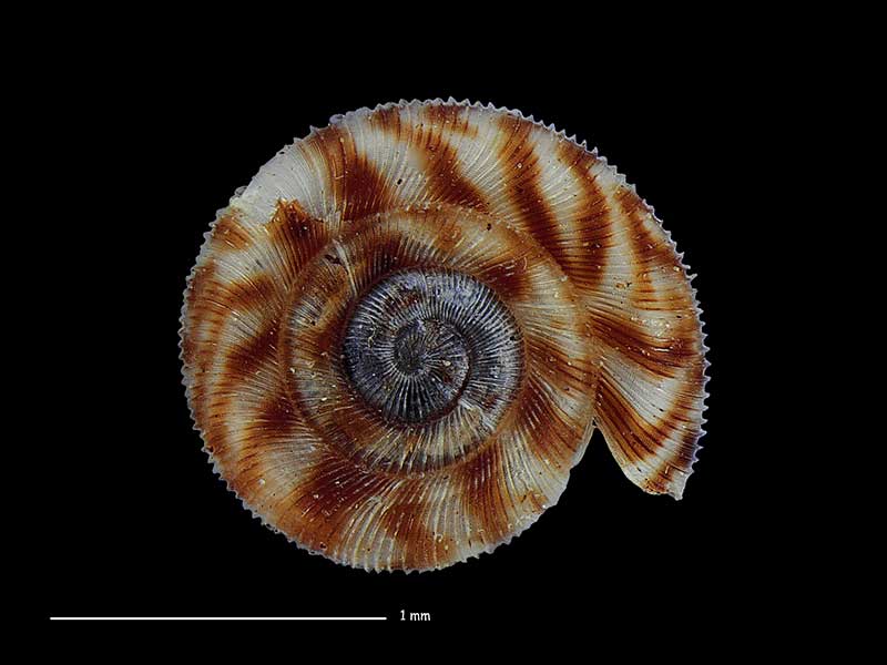
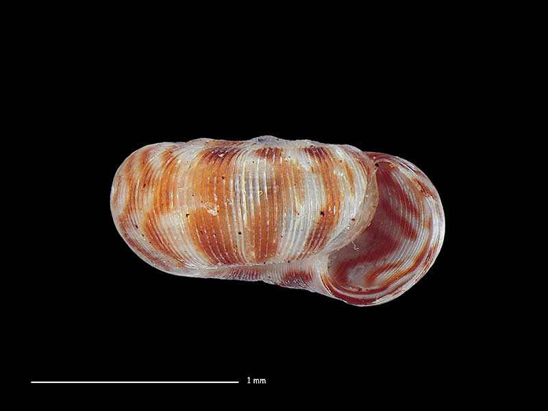
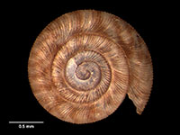
East of Birch Island, Beaumont, Otago, NZ. 2.0mm. Reproduced courtesy of Dave Roscoe
East of Birch Island, Beaumont, Otago, NZ. 2.0mm. Reproduced courtesy of Dave Roscoe
East of Birch Island, Beaumont, Otago, NZ. 2.0mm. Reproduced courtesy of Dave Roscoe
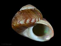
Collected Jan 2016, Kapiti Island, NZ. Reproduced courtesy of Dave Roscoe
Collected Jan 2016, Kapiti Island, NZ. Reproduced courtesy of Dave Roscoe
Collected Jan 2016, Kapiti Island, NZ. Reproduced courtesy of Dave Roscoe
Taxonomy
Family: Subfamily: CHAROPIDAE: CHAROPINAE Full Classification: Mollusca (Phylum) > Gastropoda (Class) > Heterobranchia (Subclass) > Euthyneura (Infraclass) > Tectipleura (Subterclass) > Eupulmonata (Superorder) > Stylommatophora (Order) > Helicina (Suborder) > [unassigned] Helicina (Infraorder) > Punctoidea (Superfamily) > Charopidae (Family) > Charopinae (Subfamily) > Cavellia (Genus) > brouni (Species) Synonymised Names: =Patula brouni Suter, 1891 =Patula eremita Suter, 1891 |
Details: Cavellia brouni (Suter, 1891)
Size/Grows to:
Width 2.5mm, Height 1mm
Distribution:
Lower North and South Islands
Geographical Range:
L.N.S.
Notes:
Species Links
Distribution Map
References and Publications
- Powell, A.W.B. 1979 New Zealand Mollusca: Marine, Land and Freshwater Shells, Collins, Auckland (p.306)
- Suter, H. 1891 Descriptions of new species of New Zealand land and fresh-water shells., Transactions of the New Zealand Institute, 23 (p.86) Original Description
*98 © Museum of New Zealand Te Papa Tongarewa (CC-BY-NC-ND)
Key to Geographical Ranges

The symbols K.A.C.F.M.An. are used to indicate the geographical range of the species.
They have been adopted to give an approximation of the range of each species within New Zealand.
K=
Kermadec Islands
A=
Aupourian - Kaipara Harbour, north around North Cape, encompassing the Three Kings Islands and south to East Cape
C=
Cookian - Lower North Island and the northern part of the South Island
F=
Forsterian - Otago, Fiordland and Stewart Island
M=
Moriorian - Chatham Islands, Pitt Island
An=
Antipodean - Subantarctic Islands of New Zealand
Fw =
Freshwater
L =
Land
N =
North Island
S =
South Island
R =
Recent
Sf =
Subfossil
Fo =
Fossil
Compare Species (
/6)