Compare Powelliphanta hochstetteri anatokiensis
| toggle to add to compare list |
Taxonomy
Family: Subfamily: RHYTIDIDAE: RHYTIDINAE Full Classification: Mollusca (Phylum) > Gastropoda (Class) > Heterobranchia (Subclass) > Euthyneura (Infraclass) > Tectipleura (Subterclass) > Eupulmonata (Superorder) > Stylommatophora (Order) > Helicina (Suborder) > Rhytidoidei (Infraorder) > Rhytidoidea (Superfamily) > Rhytididae (Family) > Rhytidinae (Subfamily) > Powelliphanta (Genus) > hochstetteri anatokiensis (Species) Genus Synonyms: =Paryphanta (Powelliphanta) O'Connor, 1945 Synonymised Names: =Paryphanta hochstetteri anatokiensis Powell, 1938 |
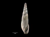
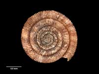
Images: Powelliphanta hochstetteri anatokiensis (Powell, 1938)
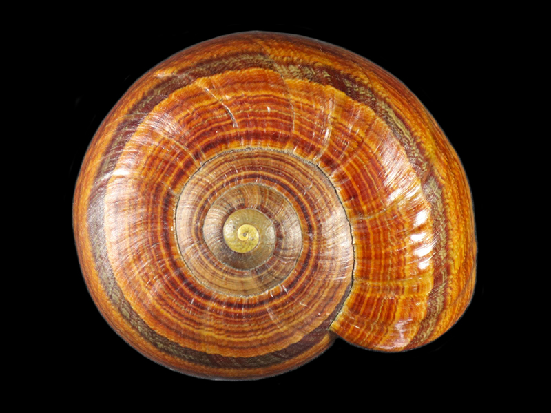
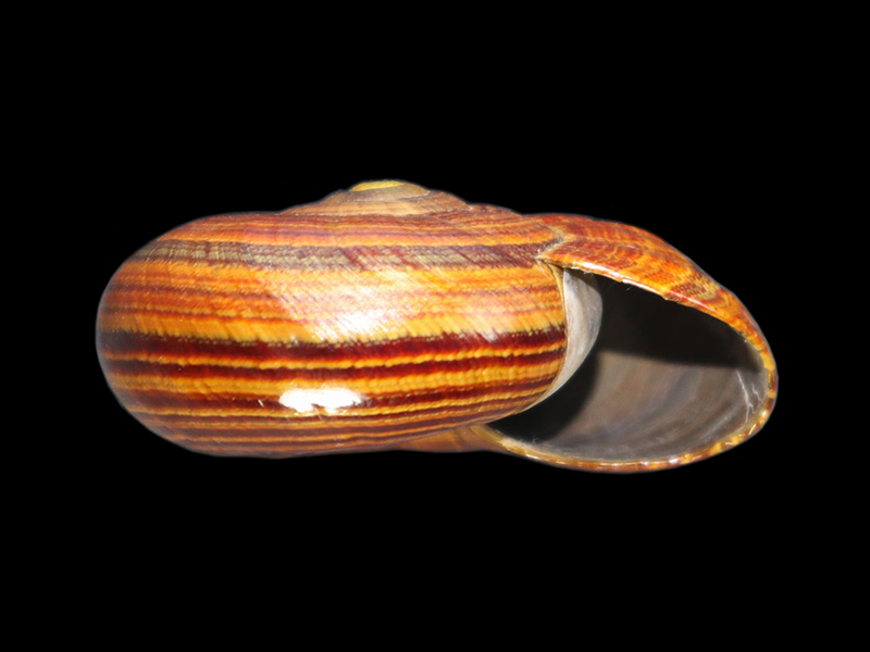
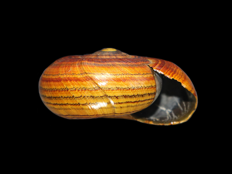
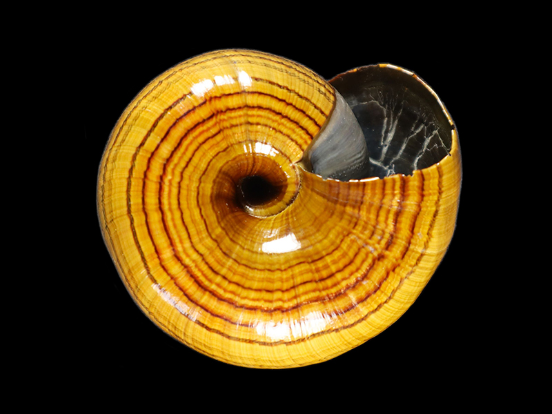
Collected in 1938, Anatoki Forks, SW of Takaka, NZ
Collected in 1938, Anatoki Forks, SW of Takaka, NZ
Collected in 1938, Anatoki Forks, SW of Takaka, NZ
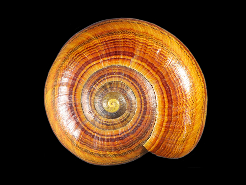
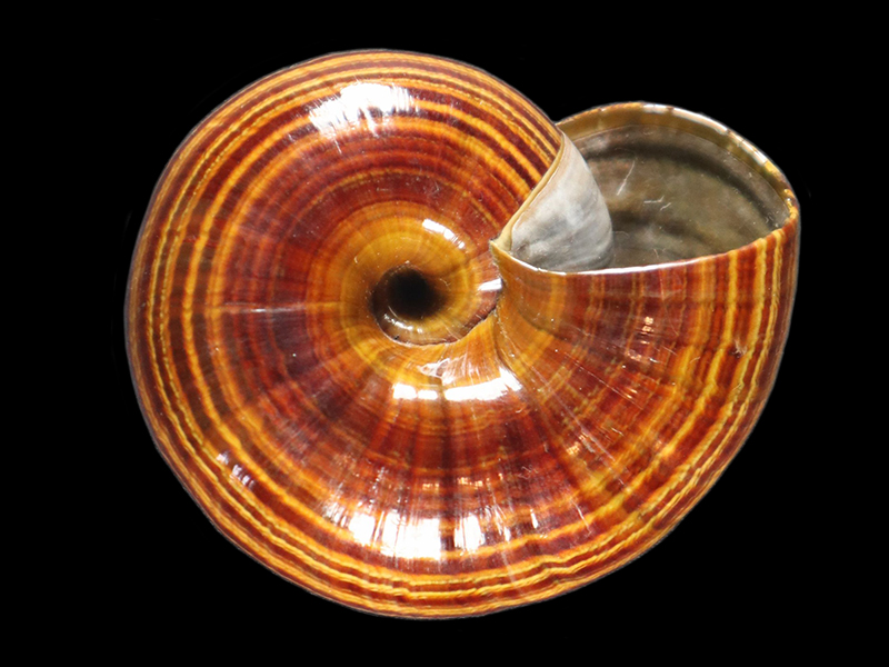
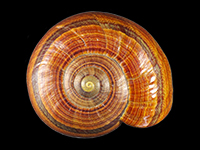
Collected near Parapara Peak Summit, SW of Nelson, NZ
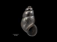
Collected near Parapara Peak Summit, SW of Nelson, NZ
Collected near Parapara Peak Summit, SW of Nelson, NZ
Taxonomy
Family: Subfamily: RHYTIDIDAE: RHYTIDINAE Full Classification: Mollusca (Phylum) > Gastropoda (Class) > Heterobranchia (Subclass) > Euthyneura (Infraclass) > Tectipleura (Subterclass) > Eupulmonata (Superorder) > Stylommatophora (Order) > Helicina (Suborder) > Rhytidoidei (Infraorder) > Rhytidoidea (Superfamily) > Rhytididae (Family) > Rhytidinae (Subfamily) > Powelliphanta (Genus) > hochstetteri anatokiensis (Species) Genus Synonyms: =Paryphanta (Powelliphanta) O'Connor, 1945 Synonymised Names: =Paryphanta hochstetteri anatokiensis Powell, 1938 |
Details: Powelliphanta hochstetteri anatokiensis (Powell, 1938)
Size/Grows to:
Length 74mm, Height 35mm
Distribution:
South Island. Tasman Mountains, Nelson
Geographical Range:
L.S.
Notes:
Species Links
Distribution Map
References and Publications
- Powell, A.W.B. 1979 New Zealand Mollusca: Marine, Land and Freshwater Shells, Collins, Auckland (p.339)
- Powell, A.W.B. 1938 The Paryphantidae of New Zealand No. 4 and the Genus Placostylus in New Zealand, Records of the Auckland Institute and Museum, 2 (p.133) Original Description
Key to Geographical Ranges

The symbols K.A.C.F.M.An. are used to indicate the geographical range of the species.
They have been adopted to give an approximation of the range of each species within New Zealand.
K=
Kermadec Islands
A=
Aupourian - Kaipara Harbour, north around North Cape, encompassing the Three Kings Islands and south to East Cape
C=
Cookian - Lower North Island and the northern part of the South Island
F=
Forsterian - Otago, Fiordland and Stewart Island
M=
Moriorian - Chatham Islands, Pitt Island
An=
Antipodean - Subantarctic Islands of New Zealand
Fw =
Freshwater
L =
Land
N =
North Island
S =
South Island
R =
Recent
Sf =
Subfossil
Fo =
Fossil
Compare Species (
/6)