Compare Delouagapia cordelia
| toggle to add to compare list |
Taxonomy
Family: Subfamily: RHYTIDIDAE: RHYTIDINAE Full Classification: Mollusca (Phylum) > Gastropoda (Class) > Heterobranchia (Subclass) > Euthyneura (Infraclass) > Tectipleura (Subterclass) > Eupulmonata (Superorder) > Stylommatophora (Order) > Helicina (Suborder) > Rhytidoidei (Infraorder) > Rhytidoidea (Superfamily) > Rhytididae (Family) > Rhytidinae (Subfamily) > Delouagapia (Genus) > cordelia (Species) Synonymised Names: =Gerontia cordelia Hutton, 1883 |
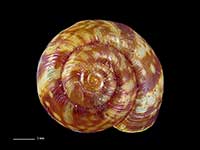
Images: Delouagapia cordelia (Hutton, 1883)
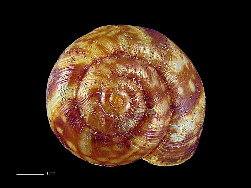
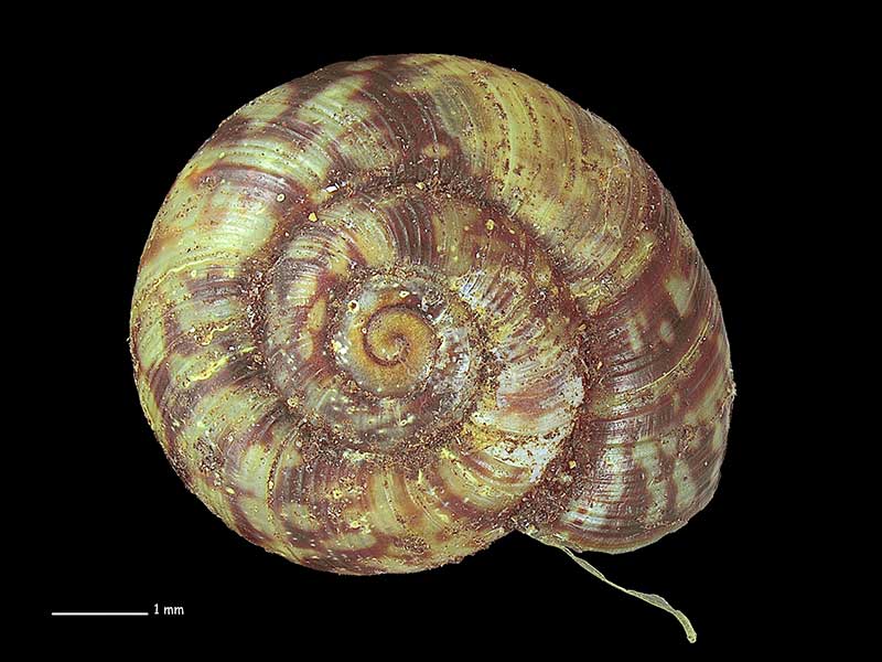
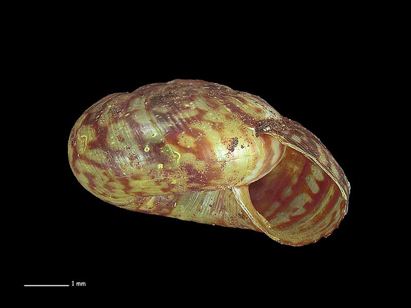
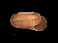
Collected Jan 1975, Tapotupotu Bay, Far North, NZ. 6.1mm. Reproduced courtesy of Dave Roscoe
Collected Jan 1975, Tapotupotu Bay, Far North, NZ. 6.1mm. Reproduced courtesy of Dave Roscoe
Collected Jan 1975, Tapotupotu Bay, Far North, NZ. 6.1mm. Reproduced courtesy of Dave Roscoe
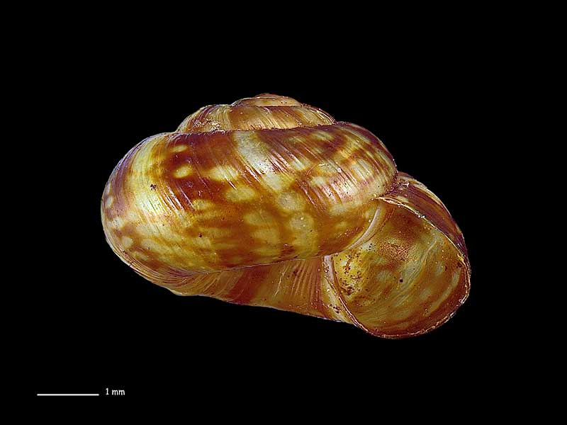
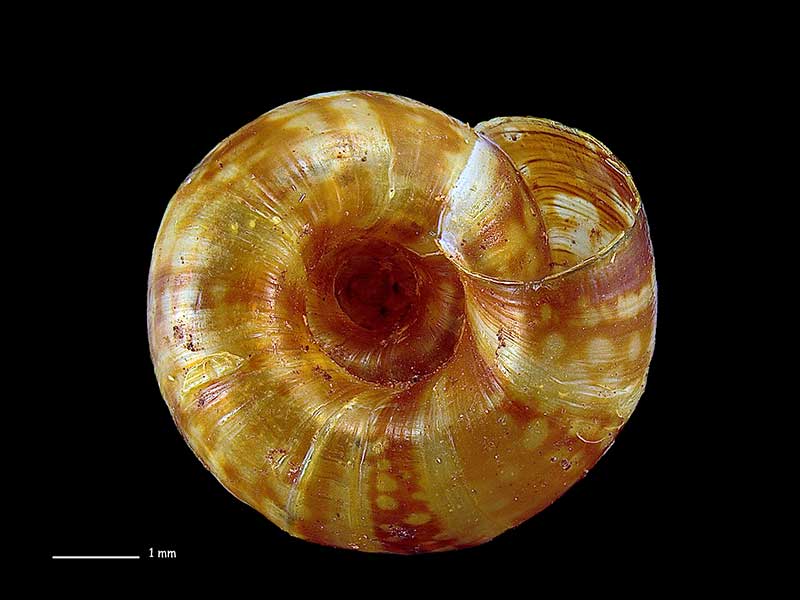
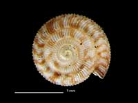
Collected Jun 2008, Serville Cliffs, Far North, NZ. 6.4mm. Reproduced courtesy of Dave Roscoe
Collected Jun 2008, Serville Cliffs, Far North, NZ. 6.4mm. Reproduced courtesy of Dave Roscoe
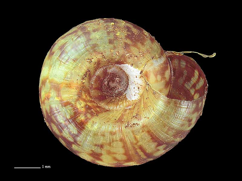
Collected Jun 2008, Serville Cliffs, Far North, NZ. 6.4mm. Reproduced courtesy of Dave Roscoe
Taxonomy
Family: Subfamily: RHYTIDIDAE: RHYTIDINAE Full Classification: Mollusca (Phylum) > Gastropoda (Class) > Heterobranchia (Subclass) > Euthyneura (Infraclass) > Tectipleura (Subterclass) > Eupulmonata (Superorder) > Stylommatophora (Order) > Helicina (Suborder) > Rhytidoidei (Infraorder) > Rhytidoidea (Superfamily) > Rhytididae (Family) > Rhytidinae (Subfamily) > Delouagapia (Genus) > cordelia (Species) Synonymised Names: =Gerontia cordelia Hutton, 1883 |
Details: Delouagapia cordelia (Hutton, 1883)
Size/Grows to:
Width 8mm, Height 4.5mm
Distribution:
Northland Peninsula
Geographical Range:
L.N.
Notes:
Species Links
Distribution Map
References and Publications
- Goulstone, J.F., Mayhill, P.C., Parrish, G.R. 1993 An Illustrated Guide to the Land Mollusca of the Te Paki ecological region, Northland, New Zealand, New Zealand Journal of Zoology, 34 (p.7)
- Powell, A.W.B. 1979 New Zealand Mollusca: Marine, Land and Freshwater Shells, Collins, Auckland (p.348)
- Hutton, F.W. 1883 Notes on some New Zealand land shells, New Zealand Journal of Science, 1(10) (p.476) Original Description
Key to Geographical Ranges

The symbols K.A.C.F.M.An. are used to indicate the geographical range of the species.
They have been adopted to give an approximation of the range of each species within New Zealand.
K=
Kermadec Islands
A=
Aupourian - Kaipara Harbour, north around North Cape, encompassing the Three Kings Islands and south to East Cape
C=
Cookian - Lower North Island and the northern part of the South Island
F=
Forsterian - Otago, Fiordland and Stewart Island
M=
Moriorian - Chatham Islands, Pitt Island
An=
Antipodean - Subantarctic Islands of New Zealand
Fw =
Freshwater
L =
Land
N =
North Island
S =
South Island
R =
Recent
Sf =
Subfossil
Fo =
Fossil
Compare Species (
/6)