Compare Pseudomalaxis zanclaeus meridionalis
| toggle to add to compare list |
Taxonomy
Family: ARCHITECTONICIDAE Full Classification: Mollusca (Phylum) > Gastropoda (Class) > Heterobranchia (Subclass) > 'Lower Heterobranchia' (Infraclass) > Architectonicoidea (Superfamily) > Architectonicidae (Family) > Pseudomalaxis (Genus) > zanclaeus meridionalis (Species) Genus Synonyms: =Discohelix (Discosolis) Dall, 1892 =Discosolis Dall, 1892 =Heliacus (Mangonuia) Mestayer, 1930 =Mangonuia Mestayer, 1930 =Torinia (Pseudomalaxis) P. Fischer, 1885 Synonymised Names: =Mangonuia bollonsi Mestayer, 1930 =Omalaxis meridionalis Hedley, 1903 =Pseudomalaxis solaris Kuroda, 1938 |
Images: Pseudomalaxis zanclaeus meridionalis (Hedley, 1903)
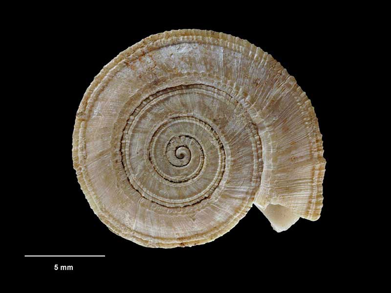
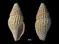
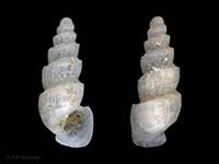
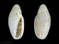
Holotype of Mangonuia bollonsi, collected 8 Sep 1914, N of North Cape, NZ (M.001631). 16mm. © Museum of New Zealand Te Papa Tongarewa (CC-BY-NC-ND)
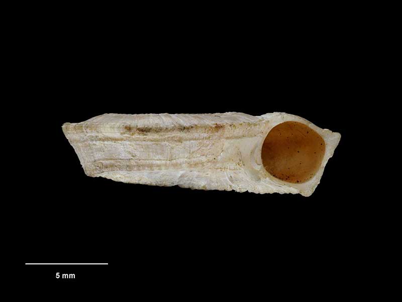
Holotype of Mangonuia bollonsi, collected 8 Sep 1914, N of North Cape, NZ (M.001631). 16mm. © Museum of New Zealand Te Papa Tongarewa (CC-BY-NC-ND)
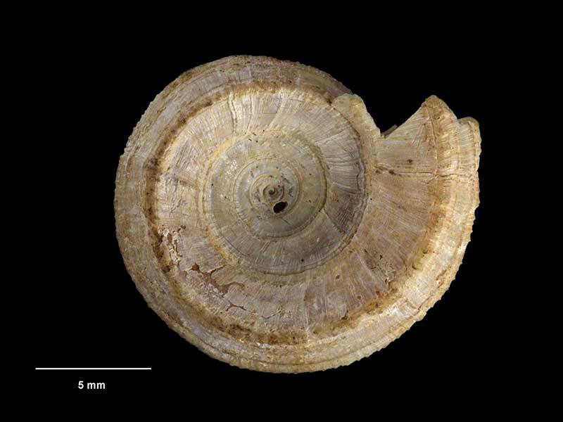
Holotype of Mangonuia bollonsi, collected 8 Sep 1914, N of North Cape, NZ (M.001631). 16mm. © Museum of New Zealand Te Papa Tongarewa (CC-BY-NC-ND)
Taxonomy
Family: ARCHITECTONICIDAE Full Classification: Mollusca (Phylum) > Gastropoda (Class) > Heterobranchia (Subclass) > 'Lower Heterobranchia' (Infraclass) > Architectonicoidea (Superfamily) > Architectonicidae (Family) > Pseudomalaxis (Genus) > zanclaeus meridionalis (Species) Genus Synonyms: =Discohelix (Discosolis) Dall, 1892 =Discosolis Dall, 1892 =Heliacus (Mangonuia) Mestayer, 1930 =Mangonuia Mestayer, 1930 =Torinia (Pseudomalaxis) P. Fischer, 1885 Synonymised Names: =Mangonuia bollonsi Mestayer, 1930 =Omalaxis meridionalis Hedley, 1903 =Pseudomalaxis solaris Kuroda, 1938 |
Details: Pseudomalaxis zanclaeus meridionalis (Hedley, 1903)
Size/Grows to:
Width 16mm, Height 5mm
Distribution:
North Island. Off North Cape to Bay of Plenty
Geographical Range:
A
Notes:
Species Links
Distribution Map
References and Publications
- Bieler, R. 1993 Architectonicidae of the Indo-Pacific (Mollusca, Gastropoda), Abhandlungen des Naturwissenschaftlichen Vereins in Hamburg (NF), 30 (p.315)
- Powell, A.W.B. 1979 New Zealand Mollusca: Marine, Land and Freshwater Shells, Collins, Auckland (p.248)
- Hedley, C. 1903 Scientific results of the trawling expedition of H.M.C.S. 'Thetis' off the coast of New South Wales, in February and March, 1896. Mollusca. Part II. Scaphopoda and Gastropoda., Memoirs of the Australian Museum, 4 Original Description
*98 © Museum of New Zealand Te Papa Tongarewa (CC-BY-NC-ND)
Key to Geographical Ranges

The symbols K.A.C.F.M.An. are used to indicate the geographical range of the species.
They have been adopted to give an approximation of the range of each species within New Zealand.
K=
Kermadec Islands
A=
Aupourian - Kaipara Harbour, north around North Cape, encompassing the Three Kings Islands and south to East Cape
C=
Cookian - Lower North Island and the northern part of the South Island
F=
Forsterian - Otago, Fiordland and Stewart Island
M=
Moriorian - Chatham Islands, Pitt Island
An=
Antipodean - Subantarctic Islands of New Zealand
Fw =
Freshwater
L =
Land
N =
North Island
S =
South Island
R =
Recent
Sf =
Subfossil
Fo =
Fossil
Compare Species (
/6)