Compare Profundiconus teramachii
| toggle to add to compare list |
Taxonomy
Family: CONIDAE Full Classification: Mollusca (Phylum) > Gastropoda (Class) > Caenogastropoda (Subclass) > Neogastropoda (Order) > Conoidea (Superfamily) > Conidae (Family) > Profundiconus (Genus) > teramachii (Species) Genus Synonyms: =Chelyconus (Profundiconus) Kuroda, 1956 =Conus (Profundiconus) Kuroda, 1956 =Leptoconus (Lizaconus) da Motta, 1991 Synonymised Names: =Asprella (Endemoconus) teramachii Kuroda, 1956 =Asprella teramachii Kuroda, 1956 =Conus teramachii (Kuroda, 1956) =Leptoconus teramachii (Kuroda, 1956) |
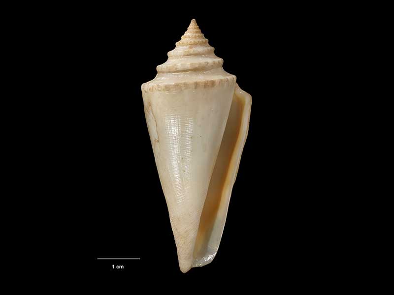
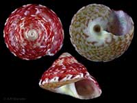
Images: Profundiconus teramachii (Kuroda, 1956)
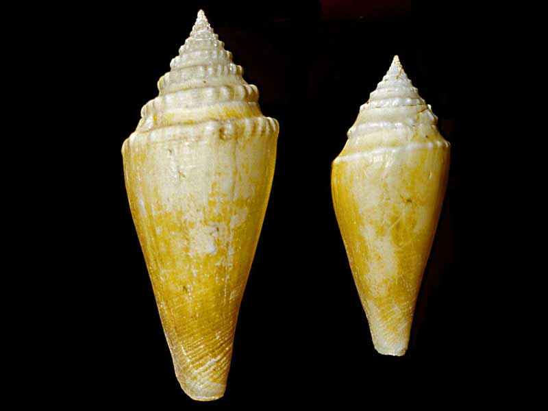
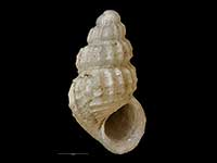
From 450-550m off Wanganella Bank, Norfolk Ridge
Collected 29 Jan 1981, Wanganella Bank, West Norfolk Ridge, eastern slope. (M.234086). © Museum of New Zealand Te Papa Tongarewa (CC-BY-NC-ND)
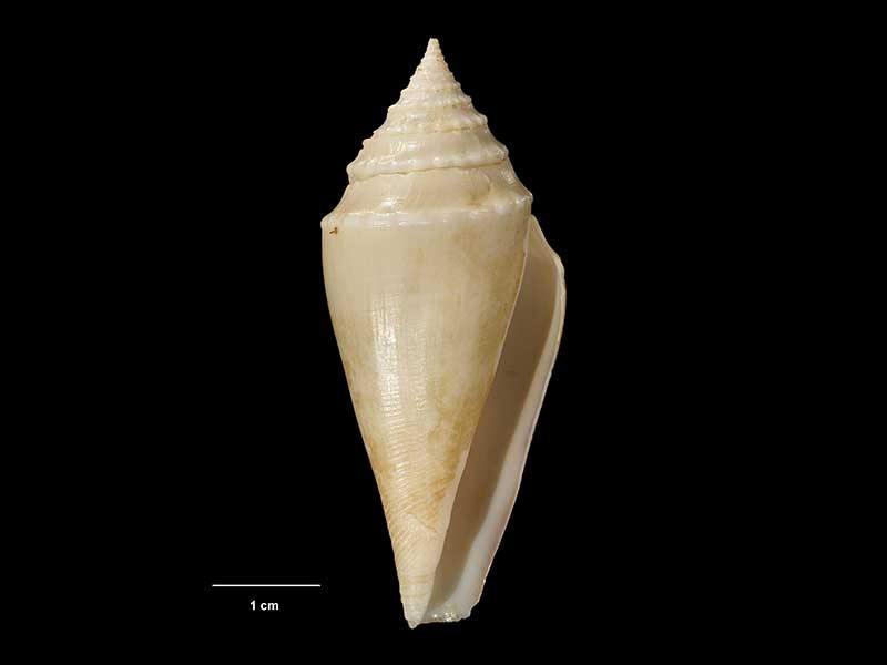
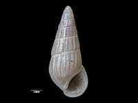
Dredged in approx. 500 metres, off Kermadec Islands, NZ. ~40mm
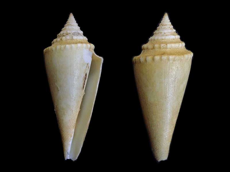
Collected 28 Oct 1975, E of Chanter Islets, Raoul Island, NZ (M.225507). ~40mm. © Museum of New Zealand Te Papa Tongarewa (CC-BY-NC-ND)
Taxonomy
Family: CONIDAE Full Classification: Mollusca (Phylum) > Gastropoda (Class) > Caenogastropoda (Subclass) > Neogastropoda (Order) > Conoidea (Superfamily) > Conidae (Family) > Profundiconus (Genus) > teramachii (Species) Genus Synonyms: =Chelyconus (Profundiconus) Kuroda, 1956 =Conus (Profundiconus) Kuroda, 1956 =Leptoconus (Lizaconus) da Motta, 1991 Synonymised Names: =Asprella (Endemoconus) teramachii Kuroda, 1956 =Asprella teramachii Kuroda, 1956 =Conus teramachii (Kuroda, 1956) =Leptoconus teramachii (Kuroda, 1956) |
Details: Profundiconus teramachii (Kuroda, 1956)
Distribution:
Kermadec Islands, 545-595 metres. Wanganella Bank, 422-437 metres. Kiwi Seamount, northern Three Kings Rise, 300-823 metres
Geographical Range:
KA
Notes:
Species Links
Distribution Map
References and Publications
- Puillandre, N., Duda, T.F., Meyer, C., Olivera, B.M., Bouchet, P. 2015 One, four or 100 genera? A new classification of the cone snails, Journal of Molluscan Studies, 81 (p.4)
- Adams, R. Oct/1995 Conilithes wollastoni, Maxwell and Cone Shells in NZ, Poirieria, 17(4) (p.8)
- Marshall, B.A. 1981 New records of Conidae (Mollusca: Gastropoda) from the New Zealand region, New Zealand Journal of Zoology, 8(4) (p.499)
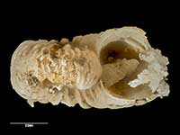
*98 © Museum of New Zealand Te Papa Tongarewa (CC-BY-NC-ND)
Key to Geographical Ranges

The symbols K.A.C.F.M.An. are used to indicate the geographical range of the species.
They have been adopted to give an approximation of the range of each species within New Zealand.
K=
Kermadec Islands
A=
Aupourian - Kaipara Harbour, north around North Cape, encompassing the Three Kings Islands and south to East Cape
C=
Cookian - Lower North Island and the northern part of the South Island
F=
Forsterian - Otago, Fiordland and Stewart Island
M=
Moriorian - Chatham Islands, Pitt Island
An=
Antipodean - Subantarctic Islands of New Zealand
Fw =
Freshwater
L =
Land
N =
North Island
S =
South Island
R =
Recent
Sf =
Subfossil
Fo =
Fossil

Compare Species (
/6)