Compare Gibberula hardingae
| toggle to add to compare list |
Taxonomy
Family: Subfamily: CYSTISCIDAE: CYSTISCINAE Full Classification: Mollusca (Phylum) > Gastropoda (Class) > Caenogastropoda (Subclass) > Neogastropoda (Order) > Volutoidea (Superfamily) > Cystiscidae (Family) > Cystiscinae (Subfamily) > Gibberula (Genus) > hardingae (Species) Genus Synonyms: =Cryptospira (Gibberula) Swainson, 1840 =Diluculum Barnard, 1962 =Epiginella Laseron, 1957 =Granula Jousseaume, 1875 =Kogomea Habe, 1951 =Marginella (Gibberula) Swainson, 1840 =Marginella (Granula) Jousseaume, 1875 =Marginella (Kogomea) Habe, 1951 =Phyloginella Laseron, 1957 Synonymised Names: =Marginella (Kogomea) hardingae Dell, 1956 |
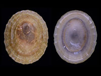
Images: Gibberula hardingae (Dell, 1956)
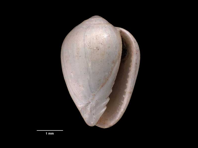
Holotype of Marginella (Kagomea) hardingae, collected 30 Aug 1951, W of Kapiti Island, NZ (M.009331). ~4.3mm. © Museum of New Zealand Te Papa Tongarewa (CC-BY-NC-ND)
Taxonomy
Family: Subfamily: CYSTISCIDAE: CYSTISCINAE Full Classification: Mollusca (Phylum) > Gastropoda (Class) > Caenogastropoda (Subclass) > Neogastropoda (Order) > Volutoidea (Superfamily) > Cystiscidae (Family) > Cystiscinae (Subfamily) > Gibberula (Genus) > hardingae (Species) Genus Synonyms: =Cryptospira (Gibberula) Swainson, 1840 =Diluculum Barnard, 1962 =Epiginella Laseron, 1957 =Granula Jousseaume, 1875 =Kogomea Habe, 1951 =Marginella (Gibberula) Swainson, 1840 =Marginella (Granula) Jousseaume, 1875 =Marginella (Kogomea) Habe, 1951 =Phyloginella Laseron, 1957 Synonymised Names: =Marginella (Kogomea) hardingae Dell, 1956 |
Details: Gibberula hardingae (Dell, 1956)
Size/Grows to:
Height 4.5mm, Width 3.2mm
Distribution:
Off Northland to Cook Strait, to 150 metres
Geographical Range:
AC
Notes:
Species Links
Distribution Map
References and Publications
- Powell, A.W.B. 1979 New Zealand Mollusca: Marine, Land and Freshwater Shells, Collins, Auckland (p.222)
- Dell, R.K. 1956 The archibenthal Mollusca of New Zealand, Dominion Museum Bulletin, 18 (p.126) Original Description
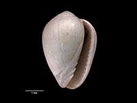
*98 © Museum of New Zealand Te Papa Tongarewa (CC-BY-NC-ND)
Key to Geographical Ranges

The symbols K.A.C.F.M.An. are used to indicate the geographical range of the species.
They have been adopted to give an approximation of the range of each species within New Zealand.
K=
Kermadec Islands
A=
Aupourian - Kaipara Harbour, north around North Cape, encompassing the Three Kings Islands and south to East Cape
C=
Cookian - Lower North Island and the northern part of the South Island
F=
Forsterian - Otago, Fiordland and Stewart Island
M=
Moriorian - Chatham Islands, Pitt Island
An=
Antipodean - Subantarctic Islands of New Zealand
Fw =
Freshwater
L =
Land
N =
North Island
S =
South Island
R =
Recent
Sf =
Subfossil
Fo =
Fossil
Compare Species (
/6)