Compare Serrata maoriana
| toggle to add to compare list |
Taxonomy
Family: Subfamily: MARGINELLIDAE: AUSTROGINELLINAE Full Classification: Mollusca (Phylum) > Gastropoda (Class) > Caenogastropoda (Subclass) > Neogastropoda (Order) > Volutoidea (Superfamily) > Marginellidae (Family) > Austroginellinae (Subfamily) > Serrata (Genus) > maoriana (Species) Genus Synonyms: =Haloginella Laseron, 1957 =Marginella (Haloginella) Laseron, 1957 =Marginella (Serrata) Jousseaume, 1875 =Serrataginella G.A. & H.K. Coovert, 1995 Synonymised Names: =Haloginella maoriana (Powell, 1932) =Marginella (Haloginella) maoriana Powell, 1932 =Marginella (Volvarina) maoriana Powell, 1932 =Marginella maoriana Powell, 1932 =Volvarina maoriana (Powell, 1932) |
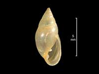
Images: Serrata maoriana (Powell, 1932)
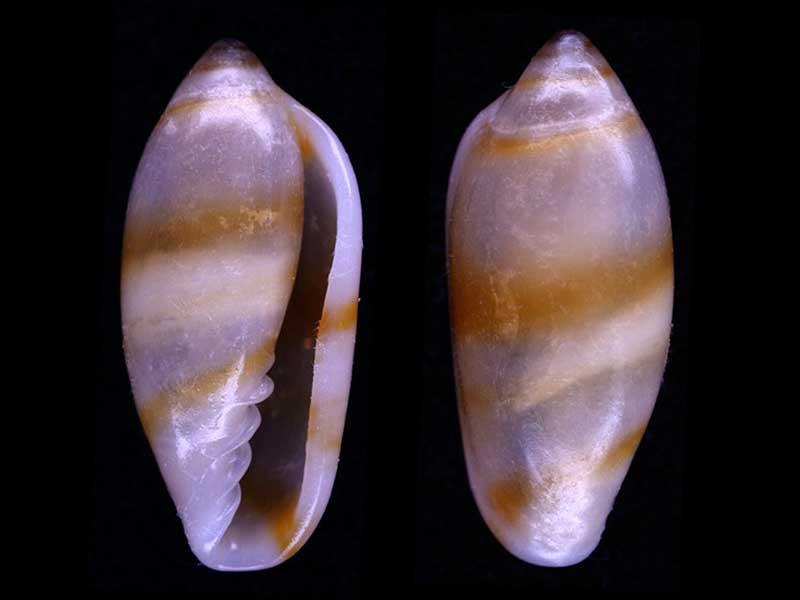
Found in beach drift, Taupiri Bay, Northland, NZ. 9mm
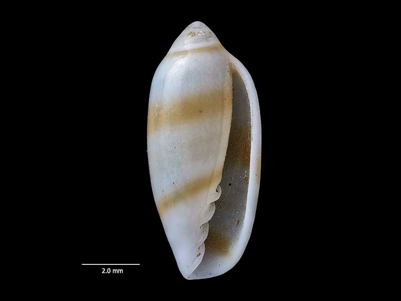
Holotype, collected Jan 1924, Oruawharo Bay, Great Barrier Island, Hauraki Gulf, NZ (MA72088). 10mm. © Auckland Museum (CC-BY)
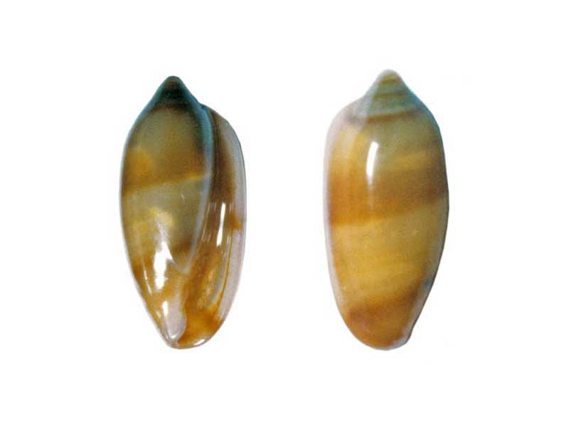
Off Ngunguru, Whangarei, NZ
Taxonomy
Family: Subfamily: MARGINELLIDAE: AUSTROGINELLINAE Full Classification: Mollusca (Phylum) > Gastropoda (Class) > Caenogastropoda (Subclass) > Neogastropoda (Order) > Volutoidea (Superfamily) > Marginellidae (Family) > Austroginellinae (Subfamily) > Serrata (Genus) > maoriana (Species) Genus Synonyms: =Haloginella Laseron, 1957 =Marginella (Haloginella) Laseron, 1957 =Marginella (Serrata) Jousseaume, 1875 =Serrataginella G.A. & H.K. Coovert, 1995 Synonymised Names: =Haloginella maoriana (Powell, 1932) =Marginella (Haloginella) maoriana Powell, 1932 =Marginella (Volvarina) maoriana Powell, 1932 =Marginella maoriana Powell, 1932 =Volvarina maoriana (Powell, 1932) |
Details: Serrata maoriana (Powell, 1932)
Size/Grows to:
Height 10mm, Width 4.5mm
Distribution:
Off Northland east coast to East Cape
Geographical Range:
A
Notes:
Species Links
Distribution Map
References and Publications
- Powell, A.W.B. 1979 New Zealand Mollusca: Marine, Land and Freshwater Shells, Collins, Auckland (p.218)
- Powell, A.W.B. 1932 The recent Marginellidae of New Zealand, with descriptions of some new Species, Transactions and Proceedings of the Royal Society of New Zealand, 62 (p.209) Original Description
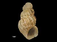
*98 © Museum of New Zealand Te Papa Tongarewa (CC-BY-NC-ND)
Key to Geographical Ranges

The symbols K.A.C.F.M.An. are used to indicate the geographical range of the species.
They have been adopted to give an approximation of the range of each species within New Zealand.
K=
Kermadec Islands
A=
Aupourian - Kaipara Harbour, north around North Cape, encompassing the Three Kings Islands and south to East Cape
C=
Cookian - Lower North Island and the northern part of the South Island
F=
Forsterian - Otago, Fiordland and Stewart Island
M=
Moriorian - Chatham Islands, Pitt Island
An=
Antipodean - Subantarctic Islands of New Zealand
Fw =
Freshwater
L =
Land
N =
North Island
S =
South Island
R =
Recent
Sf =
Subfossil
Fo =
Fossil

Compare Species (
/6)