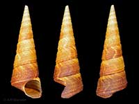
Compare Maoricolpus roseus
| toggle to add to compare list |
Taxonomy
Family: Subfamily: TURRITELLIDAE: TURRITELLINAE Full Classification: Mollusca (Phylum) > Gastropoda (Class) > Caenogastropoda (Subclass) > [unassigned] Caenogastropoda (Order) > Cerithioidea (Superfamily) > Turritellidae (Family) > Turritellinae (Subfamily) > Maoricolpus (Genus) > roseus (Species) Genus Synonyms: =Turritella (Maoricolpus) Finlay, 1926 Synonymised Names: =Maoricolpus proroseus Marwick, 1931 =Maoricolpus roseus manukauensis Powell, 1931 =Turritella (Haustator) rosea Quoy & Gaimard, 1834 =Turritella difficilis Suter, 1908 =Turritella lineolata Kiener, 1843 =Turritella rosea Quoy & Gaimard, 1834 |
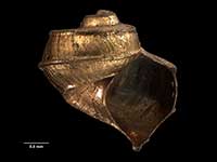
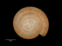
Images: Maoricolpus roseus (Quoy & Gaimard, 1834)
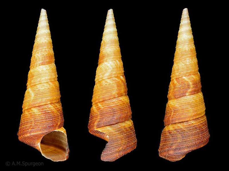
In beach drift, Bland Bay, Northland, NZ. 69mm
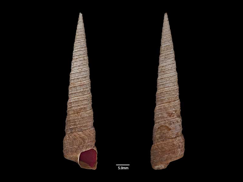
Holotype, dredged between Cornwallis Wharf and Big Muddy Creek, Manukau Harbour, Auckland, NZ (MA70436). © Auckland Museum (CC-BY)
Taxonomy
Family: Subfamily: TURRITELLIDAE: TURRITELLINAE Full Classification: Mollusca (Phylum) > Gastropoda (Class) > Caenogastropoda (Subclass) > [unassigned] Caenogastropoda (Order) > Cerithioidea (Superfamily) > Turritellidae (Family) > Turritellinae (Subfamily) > Maoricolpus (Genus) > roseus (Species) Genus Synonyms: =Turritella (Maoricolpus) Finlay, 1926 Synonymised Names: =Maoricolpus proroseus Marwick, 1931 =Maoricolpus roseus manukauensis Powell, 1931 =Turritella (Haustator) rosea Quoy & Gaimard, 1834 =Turritella difficilis Suter, 1908 =Turritella lineolata Kiener, 1843 =Turritella rosea Quoy & Gaimard, 1834 |
Details: Maoricolpus roseus (Quoy & Gaimard, 1834)
Size/Grows to:
Height 94mm, Width 28mm
Distribution:
North, South, Stewart and Chatham Islands. Introduced to Tasmania, Australia
Geographical Range:
ACFM
Notes:
Species Links
Distribution Map
References and Publications
- Donald, K.M., Spencer, H.G. 2015 New Zealand screw shells Maoricolpus roseus (Gastropoda: Turritellidae): two species, two subspecies or a single variable species?, Molluscan Research, 35(2) (p.123)
- Wotton, M.A., Dawson, E.W. Nov/2004 Maoricolpus roseus - a washup & a commentary, Cookia, 16 (p.57)
- Powell, A.W.B. 1979 New Zealand Mollusca: Marine, Land and Freshwater Shells, Collins, Auckland (p.125)
Key to Geographical Ranges

The symbols K.A.C.F.M.An. are used to indicate the geographical range of the species.
They have been adopted to give an approximation of the range of each species within New Zealand.
K=
Kermadec Islands
A=
Aupourian - Kaipara Harbour, north around North Cape, encompassing the Three Kings Islands and south to East Cape
C=
Cookian - Lower North Island and the northern part of the South Island
F=
Forsterian - Otago, Fiordland and Stewart Island
M=
Moriorian - Chatham Islands, Pitt Island
An=
Antipodean - Subantarctic Islands of New Zealand
Fw =
Freshwater
L =
Land
N =
North Island
S =
South Island
R =
Recent
Sf =
Subfossil
Fo =
Fossil
Compare Species (
/6)