Compare Zeacumantus lutulentus
| toggle to add to compare list |
Taxonomy
Family: BATILLARIIDAE Full Classification: Mollusca (Phylum) > Gastropoda (Class) > Caenogastropoda (Subclass) > [unassigned] Caenogastropoda (Order) > Cerithioidea (Superfamily) > Batillariidae (Family) > Zeacumantus (Genus) > lutulentus (Species) Synonymised Names: =Ataxocerithium perplexum P. Marshall & Murdoch, 1919 =Cerithium bicarinatum Gray, 1843 =Cerithium lutulentum Kiener, 1841 |
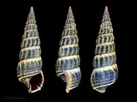
Images: Zeacumantus lutulentus (Kiener, 1841)
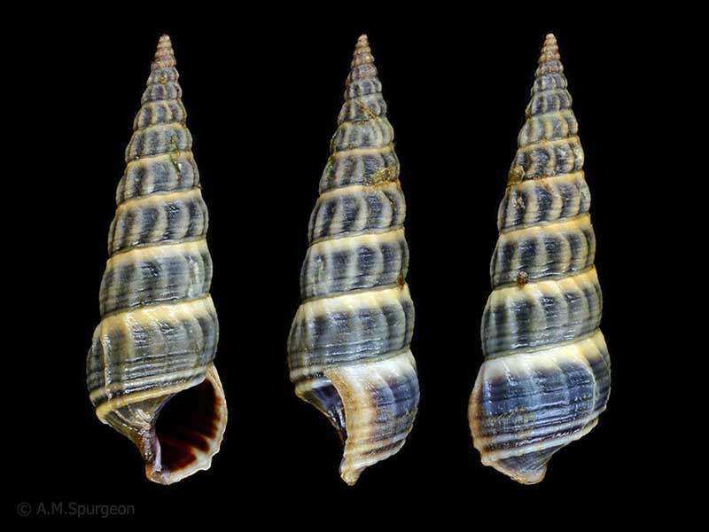
Waipu Estuary, Northland, NZ. 31mm
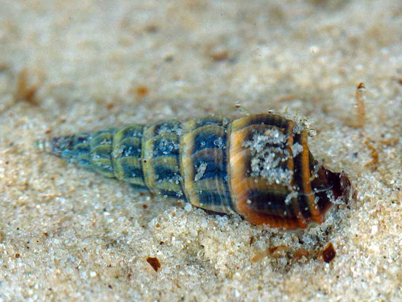
On mid-tidal mud flats, Parengarenga Harbour, Far North, NZ. 29mm
Taxonomy
Family: BATILLARIIDAE Full Classification: Mollusca (Phylum) > Gastropoda (Class) > Caenogastropoda (Subclass) > [unassigned] Caenogastropoda (Order) > Cerithioidea (Superfamily) > Batillariidae (Family) > Zeacumantus (Genus) > lutulentus (Species) Synonymised Names: =Ataxocerithium perplexum P. Marshall & Murdoch, 1919 =Cerithium bicarinatum Gray, 1843 =Cerithium lutulentum Kiener, 1841 |
Details: Zeacumantus lutulentus (Kiener, 1841)
Size/Grows to:
Height 40mm, Width 12mm
Distribution:
North Island and northern part of South Island. Common on mid-tidal mud flats
Geographical Range:
AC
Notes:
Species Links
Distribution Map
References and Publications
- Powell, A.W.B. 1979 New Zealand Mollusca: Marine, Land and Freshwater Shells, Collins, Auckland (p.131)
Key to Geographical Ranges

The symbols K.A.C.F.M.An. are used to indicate the geographical range of the species.
They have been adopted to give an approximation of the range of each species within New Zealand.
K=
Kermadec Islands
A=
Aupourian - Kaipara Harbour, north around North Cape, encompassing the Three Kings Islands and south to East Cape
C=
Cookian - Lower North Island and the northern part of the South Island
F=
Forsterian - Otago, Fiordland and Stewart Island
M=
Moriorian - Chatham Islands, Pitt Island
An=
Antipodean - Subantarctic Islands of New Zealand
Fw =
Freshwater
L =
Land
N =
North Island
S =
South Island
R =
Recent
Sf =
Subfossil
Fo =
Fossil
Recently Viewed
Compare Species (
/6)