Compare Phragmomphalina alabida
| toggle to add to compare list |
Taxonomy
Family: SOLARIELLIDAE Full Classification: Mollusca (Phylum) > Gastropoda (Class) > Vetigastropoda (Subclass) > Trochida (Order) > Trochoidea (Superfamily) > Solariellidae (Family) > Phragmomphalina (Genus) > alabida (Species) Synonymised Names: =Archiminolia alabida (B.A. Marshall, 1979) =Bathymophila alabida (B.A. Marshall, 1979) =Microgaza alabida (B.A. Marshall, 1979) =Solariella (Microgaza) alabida B.A. Marshall, 1979 |
Images: Phragmomphalina alabida (B.A. Marshall, 1979)
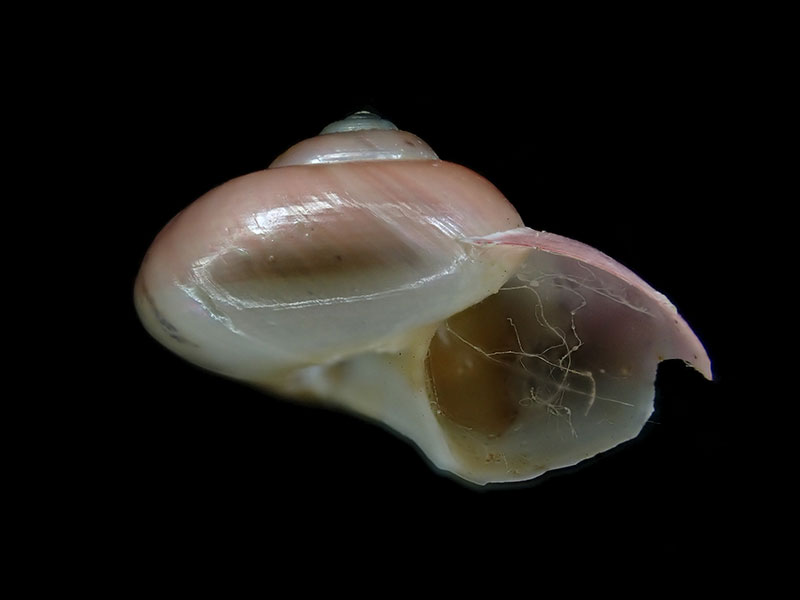
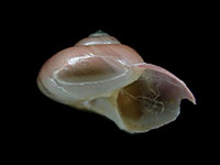
Collected in 1000 metres, Challenger Plateau, NZ
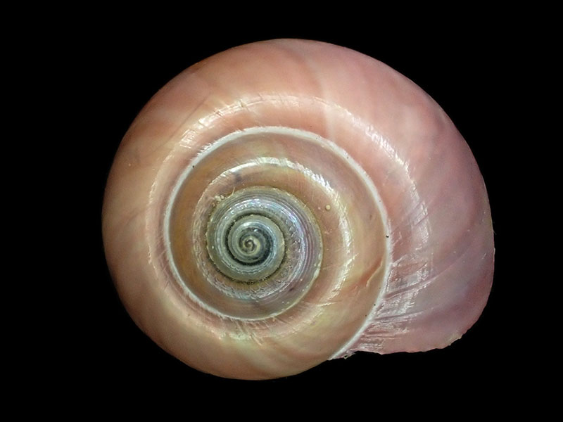
Collected in 1000 metres, Challenger Plateau, NZ
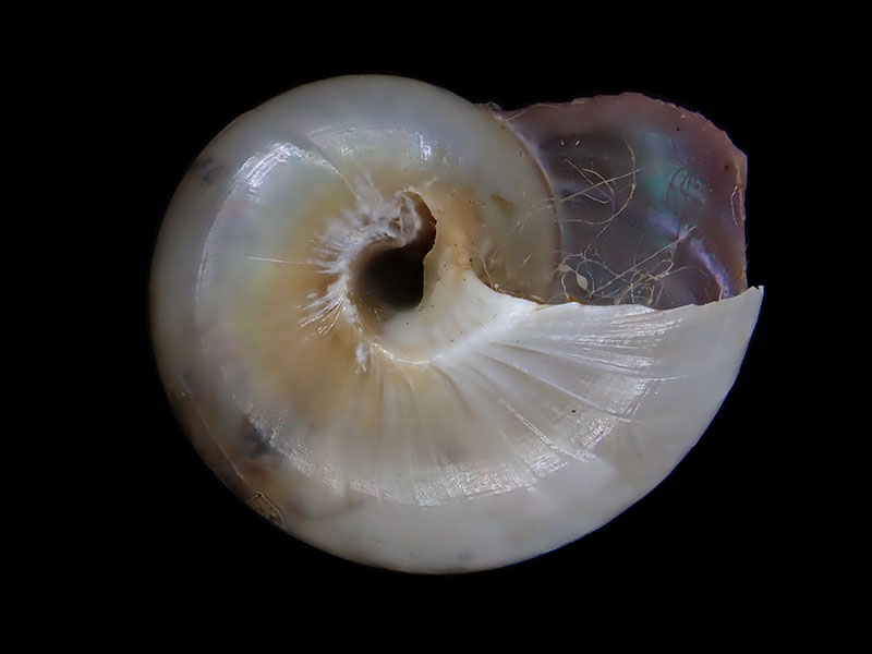
Collected in 1000 metres, Challenger Plateau, NZ
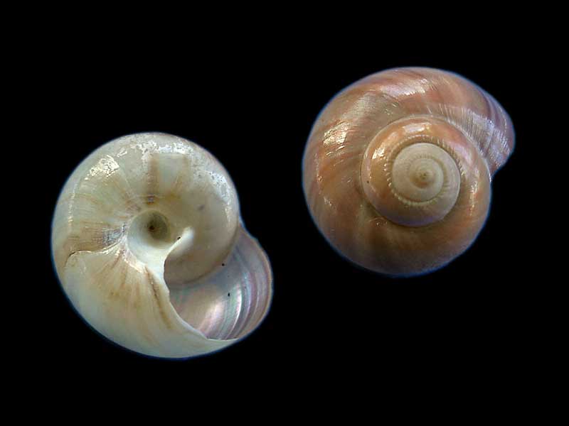
Rumble III, Kermadec Ridge
Taxonomy
Family: SOLARIELLIDAE Full Classification: Mollusca (Phylum) > Gastropoda (Class) > Vetigastropoda (Subclass) > Trochida (Order) > Trochoidea (Superfamily) > Solariellidae (Family) > Phragmomphalina (Genus) > alabida (Species) Synonymised Names: =Archiminolia alabida (B.A. Marshall, 1979) =Bathymophila alabida (B.A. Marshall, 1979) =Microgaza alabida (B.A. Marshall, 1979) =Solariella (Microgaza) alabida B.A. Marshall, 1979 |
Details: Phragmomphalina alabida (B.A. Marshall, 1979)
Size/Grows to:
Width 11.5mm, Height 8.5mm
Distribution:
Three Kings Rise & Kermadec Ridge, 508-1385 metres
Geographical Range:
KA
Notes:
Species Links
Distribution Map
References and Publications
- Williams, S.T., Kano, Y., Warén, A., Herbert, D.G. 2020 Marrying molecules and morphology: first steps towards a reevaluation of solariellid genera (Gastropoda: Trochoidea) in the light of molecular phylogenetic studies, Journal of Molluscan Studies, 86 (p.1)
- Williams, S.T., Smith, L.M., Herbert, D.G., Marshall, B.A., Warén, A., Kiel, S., Dyal, P., Linse, K., Vilvens, C., Kano, Y. 2013 Cenozoic climate change and diversification on the continental shelf and slope: Evolution of gastropod diversity in the family Solariellidae (Trochoidea), Ecology and Evolution, 3 (p.891)
- Marshall, B.A. 1999 A revision of the Recent Solariellinae (Gastropoda: Trochoidea) of the New Zealand Region, The Nautilus, 113(1) (p.24)
- Marshall, B.A. 1979 The Trochidae and Turbinidae of the Kermadec Ridge (Mollusca: Gastropoda), New Zealand Journal of Zoology, 6(4) (p.532) Original Description
*98 © Museum of New Zealand Te Papa Tongarewa (CC-BY-NC-ND)
*88 © NIWA
Key to Geographical Ranges

The symbols K.A.C.F.M.An. are used to indicate the geographical range of the species.
They have been adopted to give an approximation of the range of each species within New Zealand.
K=
Kermadec Islands
A=
Aupourian - Kaipara Harbour, north around North Cape, encompassing the Three Kings Islands and south to East Cape
C=
Cookian - Lower North Island and the northern part of the South Island
F=
Forsterian - Otago, Fiordland and Stewart Island
M=
Moriorian - Chatham Islands, Pitt Island
An=
Antipodean - Subantarctic Islands of New Zealand
Fw =
Freshwater
L =
Land
N =
North Island
S =
South Island
R =
Recent
Sf =
Subfossil
Fo =
Fossil
Recently Viewed
Compare Species (
/6)