Compare Thracia vitrea
| toggle to add to compare list |
Taxonomy
Family: THRACIIDAE Full Classification: Mollusca (Phylum) > Bivalvia (Class) > Autobranchia (Subclass) > Heteroconchia (Infraclass) > Euhetrodonta (Subterclass) > Anomalodesmata (Superorder) > Thracioidea (Superfamily) > Thraciidae (Family) > Thracia (Genus) > vitrea (Species) Genus Synonyms: =Odoncineta O.G. Costa, 1830 =Thracia (Crassithracia) Soot-Ryen, 1941 accepted, alternate representation =Thracia (Odoncineta) O.G. Costa, 1830 accepted, alternate representation =Thracia (Thracia) Blainville, 1824 accepted, alternate representation Synonymised Names: =Lyonsia vitrea Hutton, 1873 |
Images: Thracia vitrea (Hutton, 1873)
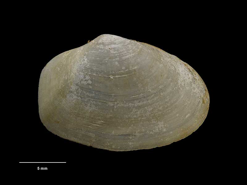
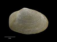
Collected Kau Point, Wellington Harbour, NZ (M.062798). 25mm. © Museum of New Zealand Te Papa Tongarewa (CC-BY-NC-ND)
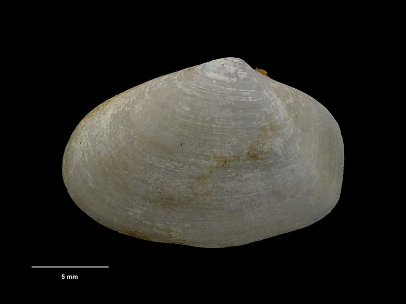
Collected Kau Point, Wellington Harbour, NZ (M.062798). 25mm. © Museum of New Zealand Te Papa Tongarewa (CC-BY-NC-ND)
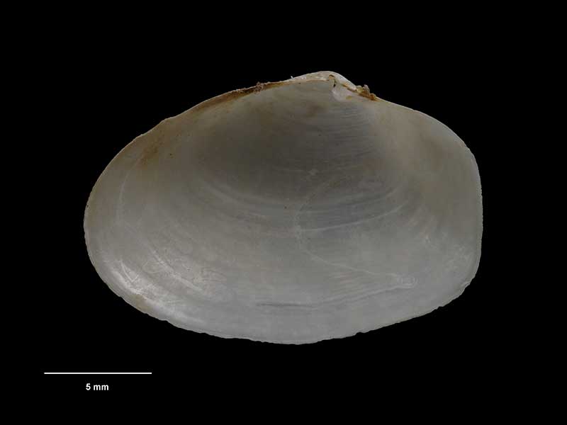
Collected Kau Point, Wellington Harbour, NZ (M.062798). 25mm. © Museum of New Zealand Te Papa Tongarewa (CC-BY-NC-ND)
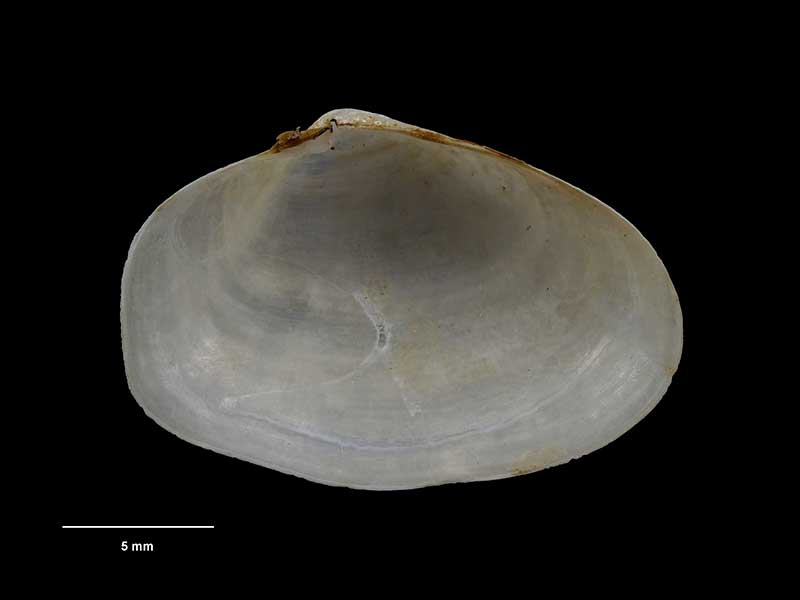
Collected Kau Point, Wellington Harbour, NZ (M.062798). 25mm. © Museum of New Zealand Te Papa Tongarewa (CC-BY-NC-ND)
Taxonomy
Family: THRACIIDAE Full Classification: Mollusca (Phylum) > Bivalvia (Class) > Autobranchia (Subclass) > Heteroconchia (Infraclass) > Euhetrodonta (Subterclass) > Anomalodesmata (Superorder) > Thracioidea (Superfamily) > Thraciidae (Family) > Thracia (Genus) > vitrea (Species) Genus Synonyms: =Odoncineta O.G. Costa, 1830 =Thracia (Crassithracia) Soot-Ryen, 1941 accepted, alternate representation =Thracia (Odoncineta) O.G. Costa, 1830 accepted, alternate representation =Thracia (Thracia) Blainville, 1824 accepted, alternate representation Synonymised Names: =Lyonsia vitrea Hutton, 1873 |
Details: Thracia vitrea (Hutton, 1873)
Size/Grows to:
Width 25mm, Height 17mm
Distribution:
North, South and Stewart Island. Dredged around 15-140 metres
Geographical Range:
ACF
Notes:
Species Links
Distribution Map
References and Publications
- Marshall, B.A. 2002 Some Recent Thraciidae, Periplomatidae, Myochamidae, Cuspidariidae and Spheniopsidae (Anomalodesmata) from the New Zealand region and referral of Thracia reinga Crozier, 1966 and Scintillona benthicola Dell, 1956 to Tellimya Brown, 1827 (Montacutidae) (Mollusca : Bivalvia), Molluscan Research, 22 (p.223)
- Hutton, F.W. 1873 Catalogue of the Marine Mollusca of New Zealand, with diagnoses of the species, Dominion Museum (NZ) Original Description
*98 © Museum of New Zealand Te Papa Tongarewa (CC-BY-NC-ND)
Key to Geographical Ranges

The symbols K.A.C.F.M.An. are used to indicate the geographical range of the species.
They have been adopted to give an approximation of the range of each species within New Zealand.
K=
Kermadec Islands
A=
Aupourian - Kaipara Harbour, north around North Cape, encompassing the Three Kings Islands and south to East Cape
C=
Cookian - Lower North Island and the northern part of the South Island
F=
Forsterian - Otago, Fiordland and Stewart Island
M=
Moriorian - Chatham Islands, Pitt Island
An=
Antipodean - Subantarctic Islands of New Zealand
Fw =
Freshwater
L =
Land
N =
North Island
S =
South Island
R =
Recent
Sf =
Subfossil
Fo =
Fossil
Recently Viewed
Compare Species (
/6)