Compare Oxyperas elongatum
| toggle to add to compare list |
Taxonomy
Family: Subfamily: MACTRIDAE: MACTRINAE Full Classification: Genus Synonyms: =Longimactra Finlay, 1928 =Mactra (Oxyperas) Mörch, 1853 =Mactra (Pseudoxyperas) Sacco, 1901 =Pseudoxyperas Sacco, 1901 Synonymised Names: =Longimactra elongata (Quoy & Gaimard, 1835) =Longimactra elongata komakoensis R.M. Carter, 1972 =Mactra elongata Quoy & Gaimard, 1835 =Mactra mariae A. Adams, 1856 =Mulinia notata Hutton, 1873 =Oxyperas elongata (Quoy & Gaimard, 1835) |
Images: Oxyperas elongatum (Quoy & Gaimard, 1835)
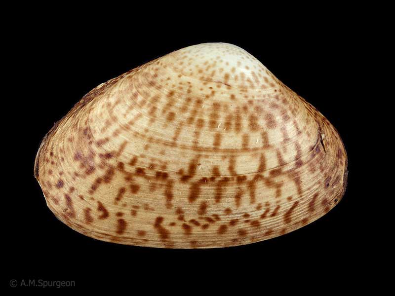
Rangaunu Bay, Northland, NZ. 90mm
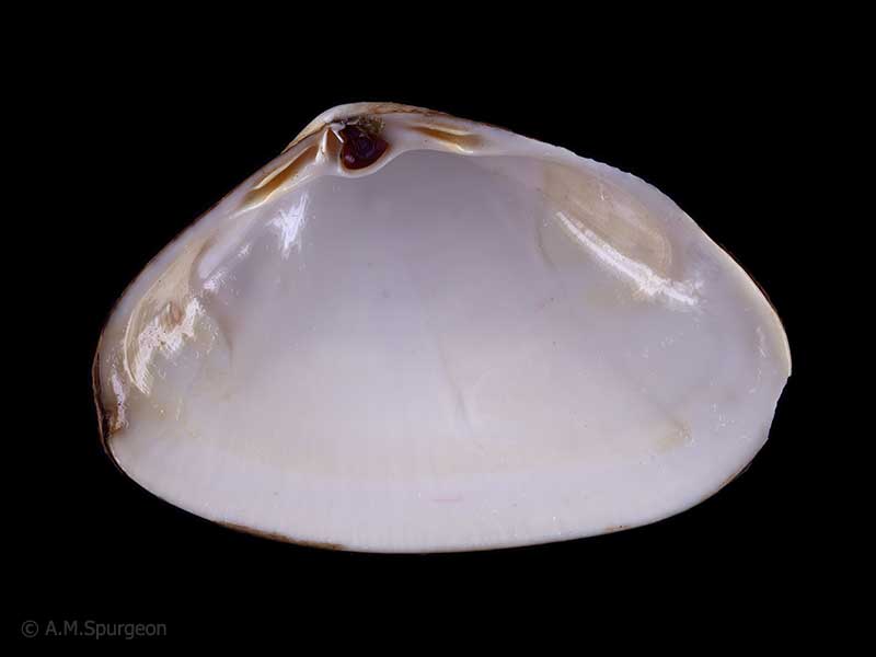
Rangaunu Bay, Northland, NZ. 90mm
Taxonomy
Family: Subfamily: MACTRIDAE: MACTRINAE Full Classification: Genus Synonyms: =Longimactra Finlay, 1928 =Mactra (Oxyperas) Mörch, 1853 =Mactra (Pseudoxyperas) Sacco, 1901 =Pseudoxyperas Sacco, 1901 Synonymised Names: =Longimactra elongata (Quoy & Gaimard, 1835) =Longimactra elongata komakoensis R.M. Carter, 1972 =Mactra elongata Quoy & Gaimard, 1835 =Mactra mariae A. Adams, 1856 =Mulinia notata Hutton, 1873 =Oxyperas elongata (Quoy & Gaimard, 1835) |
Details: Oxyperas elongatum (Quoy & Gaimard, 1835)
Size/Grows to:
Length 111mm, Width 65mm
Distribution:
King Bank and Three Kings Islands, north-eastern and south-western North Island, far northern and eastern South Island, Stewart and Chatham Islands, and Mernoo Bank. Shallow water to over 200 metres
Geographical Range:
ACFM
Notes:
Species Links
Distribution Map
References and Publications
- Powell, A.W.B. 1979 New Zealand Mollusca: Marine, Land and Freshwater Shells, Collins, Auckland (p.414)
*98 © Museum of New Zealand Te Papa Tongarewa (CC-BY-NC-ND)
Key to Geographical Ranges

The symbols K.A.C.F.M.An. are used to indicate the geographical range of the species.
They have been adopted to give an approximation of the range of each species within New Zealand.
K=
Kermadec Islands
A=
Aupourian - Kaipara Harbour, north around North Cape, encompassing the Three Kings Islands and south to East Cape
C=
Cookian - Lower North Island and the northern part of the South Island
F=
Forsterian - Otago, Fiordland and Stewart Island
M=
Moriorian - Chatham Islands, Pitt Island
An=
Antipodean - Subantarctic Islands of New Zealand
Fw =
Freshwater
L =
Land
N =
North Island
S =
South Island
R =
Recent
Sf =
Subfossil
Fo =
Fossil
Recently Viewed
Compare Species (
/6)