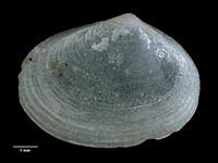
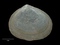
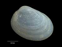
Mollusca (Phylum) > Bivalvia (Class) > Autobranchia (Subclass) > Heteroconchia (Infraclass) > Euhetrodonta (Subterclass) > Imparidentia (Superorder) > Galeommatida (Order) > Galeommatoidea (Superfamily) > Lasaeidae (Family) > Mysella (Genus)
 Filter region:
(greyed out images not recorded from filtered region)
 Click here to filter list on Geographical Range
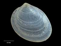
- Mysella alpha Powell, 1937
Width 2.2mm, Height 1.6mm
Marine, Native - Endemic
Middlesex Bank, Three Kings Islands, off Spirits Bay and North Cape, and Ranfurly Bank
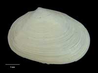
A - Mysella beta Powell, 1937
Width 3.3mm, Height 2.8mm
Marine, Native - Endemic
Middlesex Bank, Three Kings Islands, south-western North Island, and Kermadec Islands
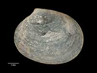
KAC - Mysella henryi Fleming, 1948
Width 3.8mm, Height 3mm
Marine, Native - Endemic
South Island. Fiordland
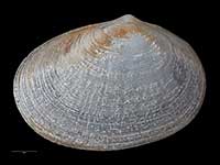
F - Mysella hounselli (Powell, 1931)
Width 6.3mm, Height 4.3mm
Marine, Recent, Fossil, Native - Endemic
Northern and south-western North Island, and South and Stewart Islands
ACFR.Fo. - Mysella lachlani Dell, 1952
Width 6mm, Height 5mm
Marine, Native - Endemic
Three Kings Islands, northern North Island, Chatham Islands and Mernoo Bank
ACM - Mysella larochei Powell, 1940
Width 7.5mm, Height 5mm
Marine, Native - Endemic
North, South and Stewart Islands
ACF - Mysella macquariensis (Hedley, 1916)
Width 3.3mm, Height 2.7mm
Marine, Native - Endemic
Macquarie Island
An - Mysella morioria Dell, 1952
Width 7.5mm, Height 5.5mm
Marine, Native - Endemic
Mernoo Bank and Chatham Islands
M - Mysella tellinula (Odhner, 1924)
Width 5.2mm, Height 4.2mm
Marine, Native - Endemic
Three Kings Islands, and north-eastern North Island as far south as Whangaruru Harbour. Intertidal
A - Mysella unidentata (Odhner, 1924)
Width 3.3mm, Height 2.6mm
Marine, Native - Endemic
South-western North Island, eastern and south-western South Island, and Stewart, Snares, Bounty and Chatham Islands
CFMAn
Key to Geographical Ranges
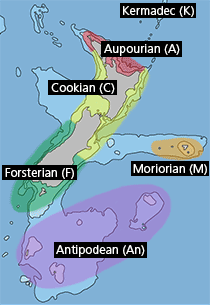
The symbols K.A.C.F.M.An. are used to indicate the geographical range of the species.
They have been adopted to give an approximation of the range of each species within New Zealand.
K=
Kermadec Islands
A=
Aupourian - Kaipara Harbour, north around North Cape, encompassing the Three Kings Islands and south to East Cape
C=
Cookian - Lower North Island and the northern part of the South Island
F=
Forsterian - Otago, Fiordland and Stewart Island
M=
Moriorian - Chatham Islands, Pitt Island
An=
Antipodean - Subantarctic Islands of New Zealand
Fw =
Freshwater
L =
Land
N =
North Island
S =
South Island
R =
Recent
Sf =
Subfossil
Fo =
Fossil
