Compare Micropilina wareni
| toggle to add to compare list |
Taxonomy
Family: MICROPILINIDAE Full Classification: Mollusca (Phylum) > Monoplacophora (Class) > Tryblidiida (Order) > Micropilinidae (Family) > Micropilina (Genus) > wareni (Species) |
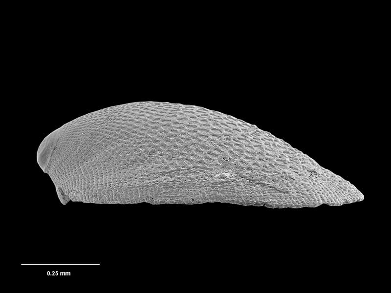
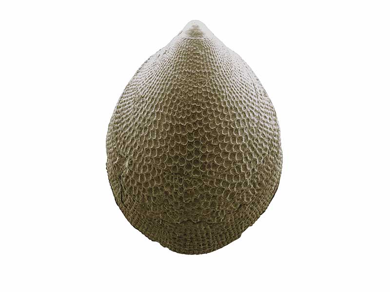
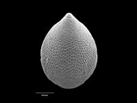
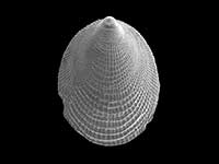
Images: Micropilina wareni B.A. Marshall, 2006

Holotype, collected 02 Jun 2003, West Norfolk Ridge, W of Cape Reinga, NZ (M.171273). © Museum of New Zealand Te Papa Tongarewa (CC-BY-NC-ND)
Holotype, collected 02 Jun 2003, West Norfolk Ridge, W of Cape Reinga, NZ (M.171273). © Museum of New Zealand Te Papa Tongarewa (CC-BY-NC-ND)
Holotype, collected 02 Jun 2003, West Norfolk Ridge, W of Cape Reinga, NZ (M.171273). © Museum of New Zealand Te Papa Tongarewa (CC-BY-NC-ND)
Taxonomy
Family: MICROPILINIDAE Full Classification: Mollusca (Phylum) > Monoplacophora (Class) > Tryblidiida (Order) > Micropilinidae (Family) > Micropilina (Genus) > wareni (Species) |
Details: Micropilina wareni B.A. Marshall, 2006
Size/Grows to:
Length 1.15mm
Distribution:
West Norfolk Ridge, W of Cape Reinga in approx. 800 metres
Geographical Range:
A
Notes:
Species Links
Distribution Map
References and Publications
- Marshall, B.A. 2006 Four new species of Monoplacophora (Mollusca) from the New Zealand region, Molluscan Research, 26(2) (p.66) Original Description
*98 © Museum of New Zealand Te Papa Tongarewa (CC-BY-NC-ND)
Key to Geographical Ranges

The symbols K.A.C.F.M.An. are used to indicate the geographical range of the species.
They have been adopted to give an approximation of the range of each species within New Zealand.
K=
Kermadec Islands
A=
Aupourian - Kaipara Harbour, north around North Cape, encompassing the Three Kings Islands and south to East Cape
C=
Cookian - Lower North Island and the northern part of the South Island
F=
Forsterian - Otago, Fiordland and Stewart Island
M=
Moriorian - Chatham Islands, Pitt Island
An=
Antipodean - Subantarctic Islands of New Zealand
Fw =
Freshwater
L =
Land
N =
North Island
S =
South Island
R =
Recent
Sf =
Subfossil
Fo =
Fossil
Recently Viewed
Compare Species (
/6)