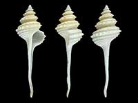
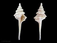
Mollusca (Phylum) > Gastropoda (Class) > Caenogastropoda (Subclass) > Neogastropoda (Order) > Turbinelloidea (Superfamily) > Columbariidae (Family)
 Filter region:
(greyed out images not recorded from filtered region)
 Click here to filter list on Geographical Range
Family: Columbariidae
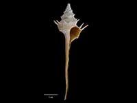
- Columbarium veridicum Dell, 1963
Height 91.4mm, Width 24mm
Marine, Native - Endemic
Trawled east of Poor Knights Islands 560-620 metres, off Mayor Island, Bay of Plenty 753-826 metres, off White Island 685-705 metres, off Cape Runaway 818-898 metres
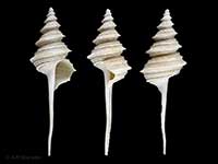
A - Coluzea altocanalis (Dell, 1956)
Height 127mm
Marine, Native - Endemic, Sculpture consists of heavy smooth spiral keels, the strongest one peripheral. Contiguous sutural minor keels combine to create a deeply canaliculate suture
Upper continental slope off the eastern coast of North and South Island, and Chatham Rise, 400-1000 metres
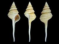
CFM - Coluzea mariae (Powell, 1952)
Height 106mm, Width 25mm
Marine, Native - Endemic, Broader and more squat spire than spiralis. Body whorl more rounded, the peripheral keel less prominent, and the axial folds more numerous, forming 23-24 blunt tubercules per whorl
From Cape Campbell southward along eastern coast of South Island, western Campbell Plateau (off Auckland and Campbell Islands), and along western Chatham Rise
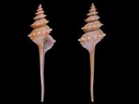
CFMAn - Coluzea spiralis (A. Adams, 1856)
Height 134mm, Width 30mm
Marine, Recent, Fossil, Native - Endemic
North Cape to Cape Campbell, east coast South Island. Dredged 20-200 metres
ACR.Fo. - Coluzea wormaldi Powell, 1971
Height 134mm, Width 32mm
Marine, Native - Endemic
Trawled off North Island east coast to Bay of Plenty, 290-700 metres
AC - Fulgurofusus marshalli Harasewych, 2011
Height 43mm
Marine, Native - Endemic
Bounty Plateau, 280-457 metres
An - Fulgurofusus maxwelli Harasewych, 2011
Height 86mm
Marine, Native - Endemic
Northern Bounty Trough, the Bounty Plateau, and the eastern margins of the Campbell Plateau, 476-1386 metres
CFMAn
Key to Geographical Ranges
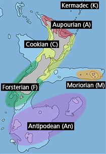
The symbols K.A.C.F.M.An. are used to indicate the geographical range of the species.
They have been adopted to give an approximation of the range of each species within New Zealand.
K=
Kermadec Islands
A=
Aupourian - Kaipara Harbour, north around North Cape, encompassing the Three Kings Islands and south to East Cape
C=
Cookian - Lower North Island and the northern part of the South Island
F=
Forsterian - Otago, Fiordland and Stewart Island
M=
Moriorian - Chatham Islands, Pitt Island
An=
Antipodean - Subantarctic Islands of New Zealand
Fw =
Freshwater
L =
Land
N =
North Island
S =
South Island
R =
Recent
Sf =
Subfossil
Fo =
Fossil
