Compare Columbarium veridicum
| toggle to add to compare list |
Taxonomy
Family: COLUMBARIIDAE Full Classification: Mollusca (Phylum) > Gastropoda (Class) > Caenogastropoda (Subclass) > Neogastropoda (Order) > Turbinelloidea (Superfamily) > Columbariidae (Family) > Columbarium (Genus) > veridicum (Species) |
Images: Columbarium veridicum Dell, 1963
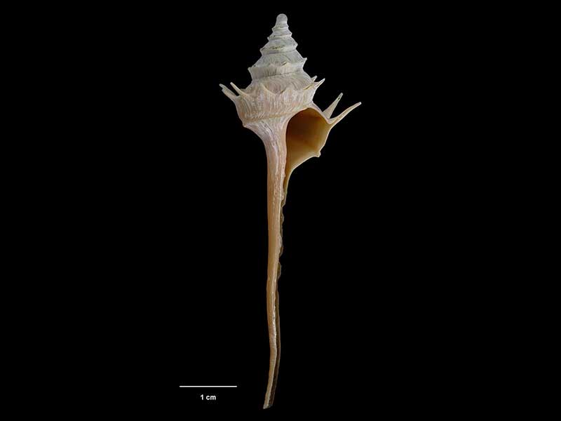
Holotype, collected 11 Nov 1962, E of Poor Knights Islands, NZ (M.016274). © Museum of New Zealand Te Papa Tongarewa (CC-BY-NC-ND)
Trawled W of White Island, Bay of Plenty, NZ
Taxonomy
Family: COLUMBARIIDAE Full Classification: Mollusca (Phylum) > Gastropoda (Class) > Caenogastropoda (Subclass) > Neogastropoda (Order) > Turbinelloidea (Superfamily) > Columbariidae (Family) > Columbarium (Genus) > veridicum (Species) |
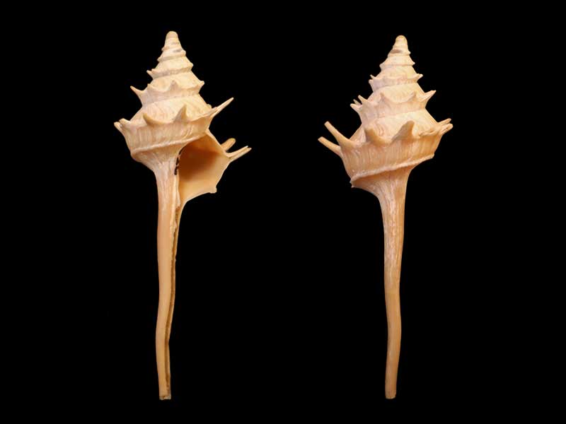
Details: Columbarium veridicum Dell, 1963
Size/Grows to:
Height 91.4mm, Width 24mm
Distribution:
Trawled east of Poor Knights Islands 560-620 metres, off Mayor Island, Bay of Plenty 753-826 metres, off White Island 685-705 metres, off Cape Runaway 818-898 metres
Geographical Range:
A
Notes:
Species Links
Distribution Map
References and Publications
- Harasewych, M.G. 2011 The Living Columbariinae (Gastropoda: Neogastropoda: Turbinellidae) of New Zealand, Zootaxa, 2744 (p.4)
- Powell, A.W.B. 1979 New Zealand Mollusca: Marine, Land and Freshwater Shells, Collins, Auckland (p.169)
- Dell, R.K. 1963 Archibenthal Mollusca from northern New Zealand, Transactions of the Royal Society of New Zealand, 3(6) (p.211) Original Description
*98 © Museum of New Zealand Te Papa Tongarewa (CC-BY-NC-ND)
Key to Geographical Ranges

The symbols K.A.C.F.M.An. are used to indicate the geographical range of the species.
They have been adopted to give an approximation of the range of each species within New Zealand.
K=
Kermadec Islands
A=
Aupourian - Kaipara Harbour, north around North Cape, encompassing the Three Kings Islands and south to East Cape
C=
Cookian - Lower North Island and the northern part of the South Island
F=
Forsterian - Otago, Fiordland and Stewart Island
M=
Moriorian - Chatham Islands, Pitt Island
An=
Antipodean - Subantarctic Islands of New Zealand
Fw =
Freshwater
L =
Land
N =
North Island
S =
South Island
R =
Recent
Sf =
Subfossil
Fo =
Fossil
Recently Viewed

Compare Species (
/6)