Compare Micrelenchus huttonii
| toggle to add to compare list |
Taxonomy
Family: Subfamily: TROCHIDAE: CANTHARIDINAE Full Classification: Mollusca (Phylum) > Gastropoda (Class) > Vetigastropoda (Subclass) > Trochida (Order) > Trochoidea (Superfamily) > Trochidae (Family) > Cantharidinae (Subfamily) > Micrelenchus (Genus) > huttonii (Species) Genus Synonyms: =Cantharidus (Mawhero) B.A. Marshall, 1998 =Mawhero B.A. Marshall, 1998 =Micrelenchus (Mawhero) B.A. Marshall, 1998 =Micrelenchus (Micrelenchus) Finlay, 1926 =Trochus (Gibbium) Gray, 1843 (invalid, junior homonym of Gibbium Scopoli, 1777) Synonymised Names: =Cantharidus huttonii (E.A. Smith, 1876) =Gibbula plumbea Hutton, 1878 =Micrelenchus (Micrelenchus) huttonii (E.A. Smith, 1876) accepted, alternate representation =Trochus (Cantharidus) huttonii E.A. Smith, 1876 |
Images: Micrelenchus huttonii (E.A. Smith, 1876)

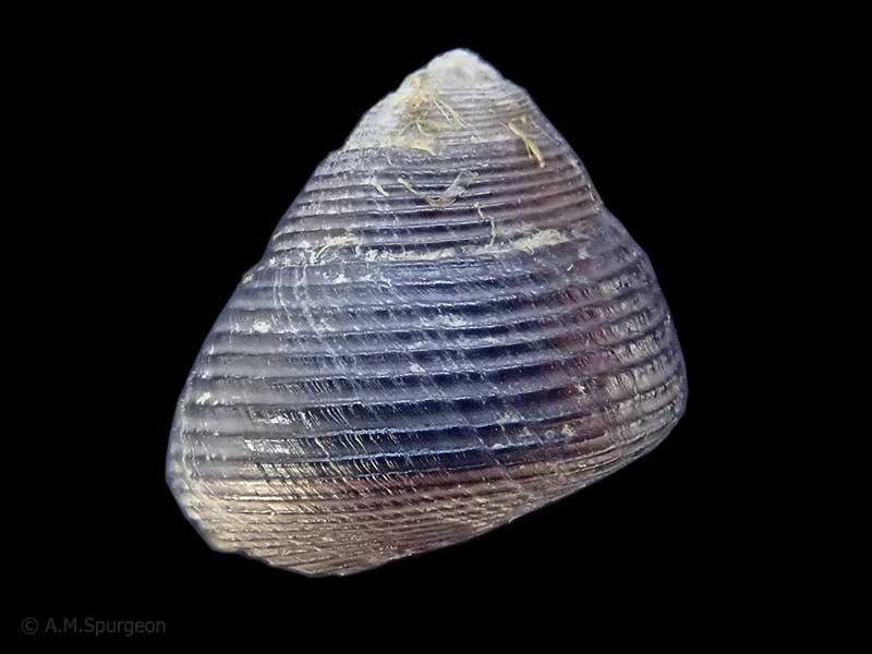
On algae and rocks at low tide. Tahunanui estuary, Nelson, NZ. 8mm
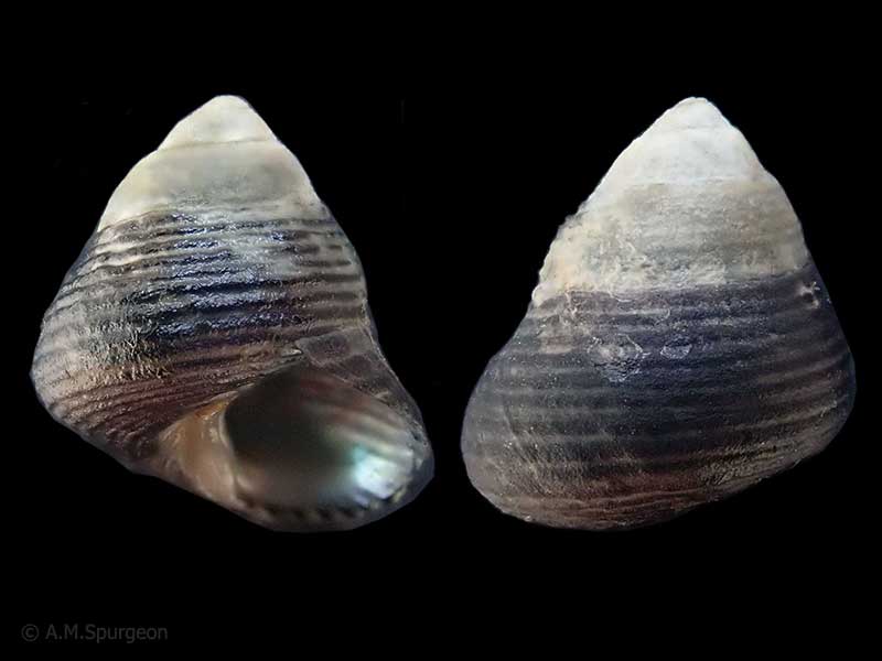
On algae and rocks at low tide. Tahunanui estuary, Nelson, NZ. 8mm
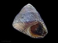
On algae and rocks at low tide. Tahunanui estuary, Nelson, NZ. 10mm
Taxonomy
Family: Subfamily: TROCHIDAE: CANTHARIDINAE Full Classification: Mollusca (Phylum) > Gastropoda (Class) > Vetigastropoda (Subclass) > Trochida (Order) > Trochoidea (Superfamily) > Trochidae (Family) > Cantharidinae (Subfamily) > Micrelenchus (Genus) > huttonii (Species) Genus Synonyms: =Cantharidus (Mawhero) B.A. Marshall, 1998 =Mawhero B.A. Marshall, 1998 =Micrelenchus (Mawhero) B.A. Marshall, 1998 =Micrelenchus (Micrelenchus) Finlay, 1926 =Trochus (Gibbium) Gray, 1843 (invalid, junior homonym of Gibbium Scopoli, 1777) Synonymised Names: =Cantharidus huttonii (E.A. Smith, 1876) =Gibbula plumbea Hutton, 1878 =Micrelenchus (Micrelenchus) huttonii (E.A. Smith, 1876) accepted, alternate representation =Trochus (Cantharidus) huttonii E.A. Smith, 1876 |
Details: Micrelenchus huttonii (E.A. Smith, 1876)
Size/Grows to:
Height 11.5mm
Distribution:
Bay of Islands south, and Stewart Island. 0-7 metres, Inhabits sheltered waters, especially Zostera, sea-grass, on tidal flats and sheltered rock pools
Notes:
Species Links
Distribution Map
References and Publications
- Donald, K.M., Spencer, H.G. 2016 Phylogeographic patterns in New Zealand and temperate Australian cantharidines (Mollusca: Gastropoda: Trochidae: Cantharidinae): Trans-Tasman divergences are ancient, Molecular Phylogenetics and Evolution, 100 (p.341)
- Marshall, B.A. 1998 The New Zealand Recent species of Cantharidus Montfort, 1810 and Micrelenchus Finlay, 1926 (Mollusca: Gastropoda: Trochidae), Molluscan Research, 19 (p.126)
- Smith, E.A. 1876 A list of marine shells, chiefly from the Solomon Islands, with descriptions of several new species, Journal of the Linnean Society of London, 12 (p.558) Original Description
*98 © Museum of New Zealand Te Papa Tongarewa (CC-BY-NC-ND)
NZ Geographical Regions

Key to symbols used in Checklist.
Fw =
Freshwater
L =
Land
N =
North Island
S =
South Island
R =
Recent
Sf =
Subfossil
Fo =
Fossil
Recently Viewed
Compare Species (
/6)