Compare Tawera sphaericula
| toggle to add to compare list |
Taxonomy
Family: VENERIDAE Full Classification: Genus Synonyms: =Plurigens Finlay, 1930 Synonymised Names: =Chamelea bollonsi (Powell, 1932) =Chamelea sphaericula (Deshayes, 1853) =Chione sphaericula (Deshayes, 1853) =Dione sphaericula Deshayes, 1853 =Tawera bollonsi Powell, 1932 |
Images: Tawera sphaericula (Deshayes, 1853)
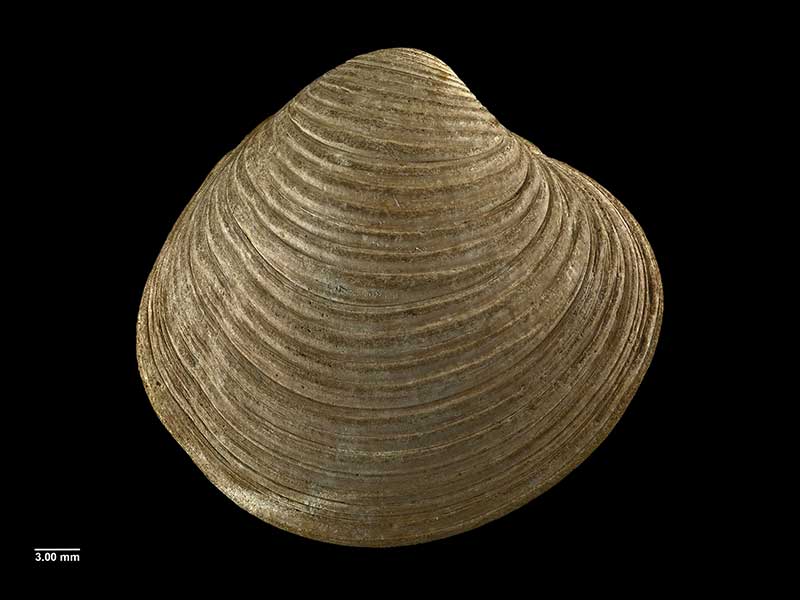
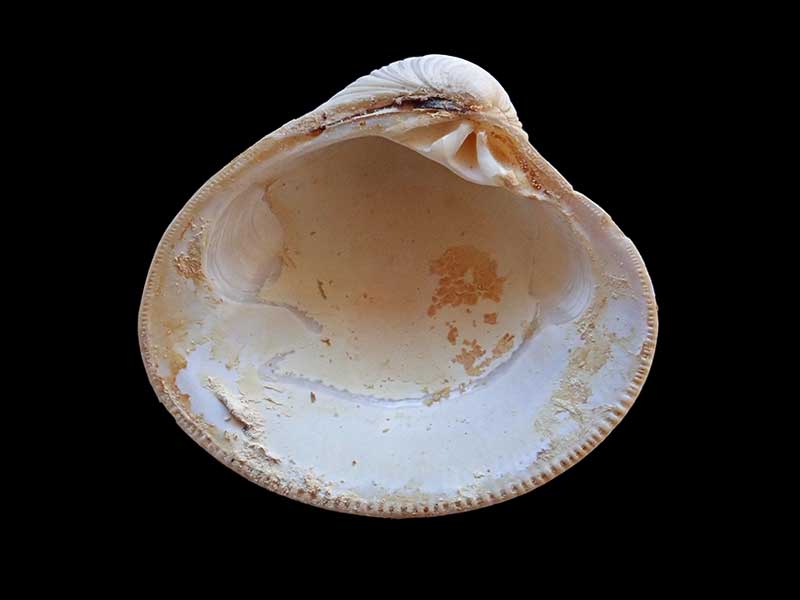
Holotype of Tawera bollonsi, Carnley Harbour, Auckland Islands, NZ (MA70758). © Auckland Museum (CC-BY)
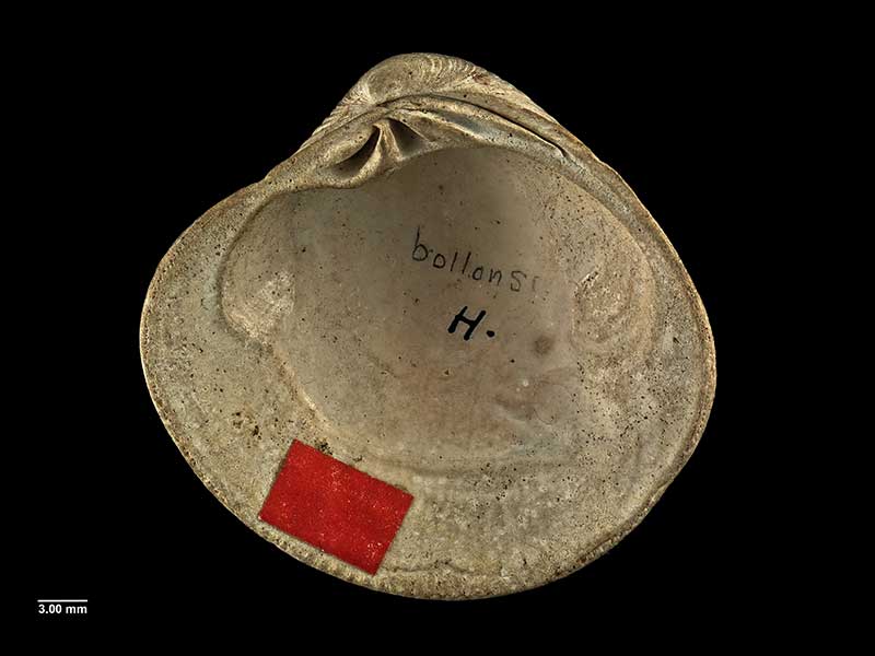
Holotype of Tawera bollonsi, Carnley Harbour, Auckland Islands, NZ (MA70758). © Auckland Museum (CC-BY)
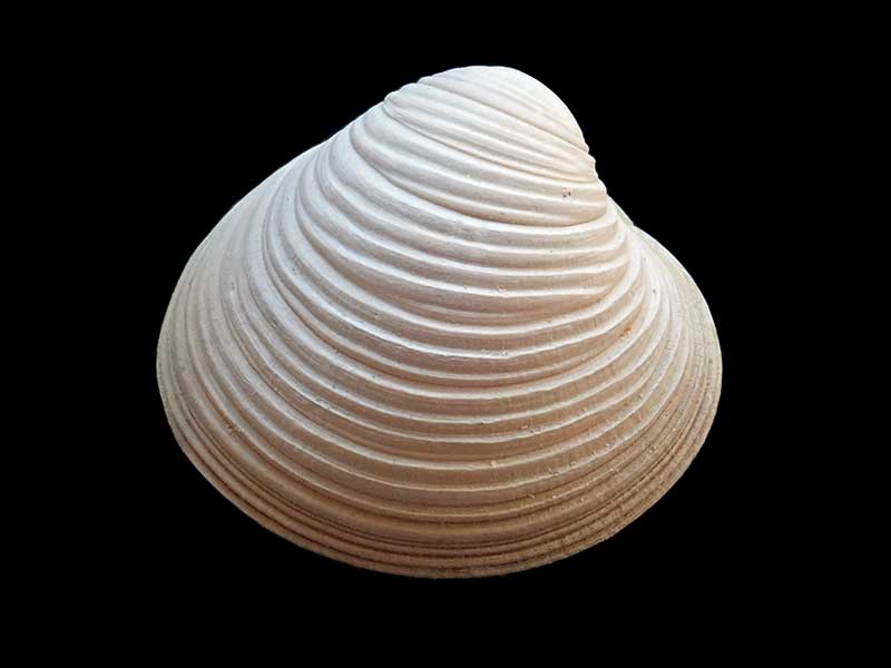
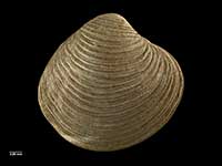
Collected Auckland Islands, NZ. 34.5mm

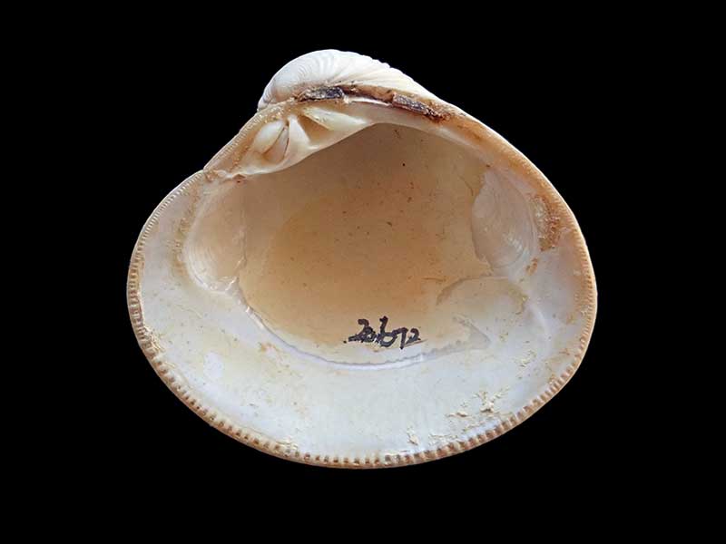
Collected Auckland Islands, NZ. 34.5mm
Collected Auckland Islands, NZ. 34.5mm
Collected Auckland Islands, NZ. 34.5mm
Taxonomy
Family: VENERIDAE Full Classification: Genus Synonyms: =Plurigens Finlay, 1930 Synonymised Names: =Chamelea bollonsi (Powell, 1932) =Chamelea sphaericula (Deshayes, 1853) =Chione sphaericula (Deshayes, 1853) =Dione sphaericula Deshayes, 1853 =Tawera bollonsi Powell, 1932 |
Details: Tawera sphaericula (Deshayes, 1853)
Size/Grows to:
Width 36mm, Height 35mm
Distribution:
Auckland Islands, dredged 15-65 metres
Geographical Range:
An
Notes:
Species Links
Distribution Map
References and Publications
- Marshall, B.A., Spencer, H.G. 2013 Comments on some taxonomic changes affecting marine Bivalvia of the New Zealand region recently introduced in Huber's Compendium of bivalves, with some additional taxonomic changes, Molluscan Research, 33(1) (p.44)
- Huber, M. 2010 Compendium of Bivalves 1, ConchBooks: Hackenheim, Germany (p.717)
- Powell, A.W.B. 1979 New Zealand Mollusca: Marine, Land and Freshwater Shells, Collins, Auckland (p.424)
Key to Geographical Ranges

The symbols K.A.C.F.M.An. are used to indicate the geographical range of the species.
They have been adopted to give an approximation of the range of each species within New Zealand.
K=
Kermadec Islands
A=
Aupourian - Kaipara Harbour, north around North Cape, encompassing the Three Kings Islands and south to East Cape
C=
Cookian - Lower North Island and the northern part of the South Island
F=
Forsterian - Otago, Fiordland and Stewart Island
M=
Moriorian - Chatham Islands, Pitt Island
An=
Antipodean - Subantarctic Islands of New Zealand
Fw =
Freshwater
L =
Land
N =
North Island
S =
South Island
R =
Recent
Sf =
Subfossil
Fo =
Fossil
Recently Viewed
Compare Species (
/6)