Compare Cardita distorta
| toggle to add to compare list |
Taxonomy
Family: Subfamily: CARDITIDAE: CARDITINAE Full Classification: Mollusca (Phylum) > Bivalvia (Class) > Heterodonta (Subclass) > Archiheterodonta (Infraclass) > Carditida (Order) > Carditoidea (Superfamily) > Carditidae (Family) > Carditinae (Subfamily) > Cardita (Genus) > distorta (Species) Genus Synonyms: =Cardita (Mytilicardia) Herrmannsen, 1847 =Jesonia Gray, 1847 =Mytilicardia Herrmannsen, 1847 =Mytilicardita Anton, 1838 Synonymised Names: =Cardita aoteana Finlay, 1926 |
Images: Cardita distorta Reeve, 1843

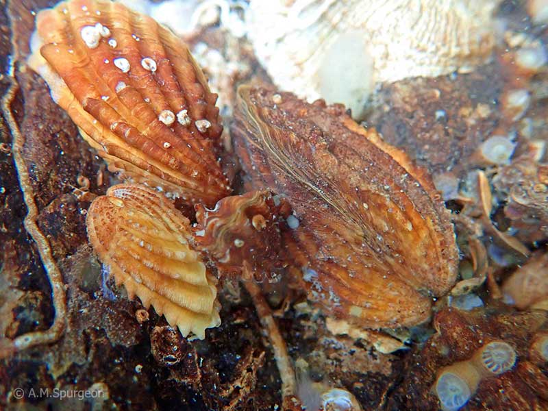
Under rocks, below low tide, Mathesons Bay, Leigh, Northland, NZ. 20mm
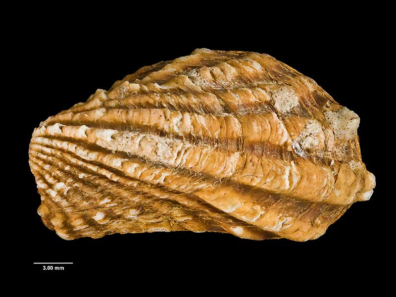
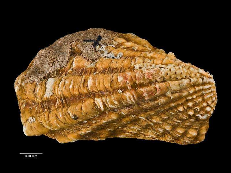
Holotype of Cardita aoteana Finlay, collected Dowling Bay, Otago Harbour, NZ (MA70134). © Auckland Museum (CC-BY)
Holotype of Cardita aoteana Finlay, collected Dowling Bay, Otago Harbour, NZ (MA70134). © Auckland Museum (CC-BY)
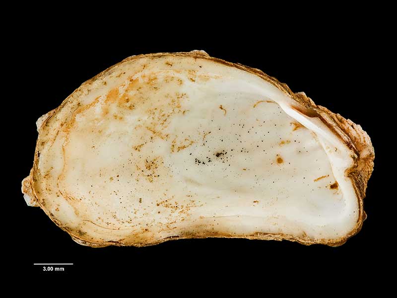
Holotype of Cardita aoteana Finlay, collected Dowling Bay, Otago Harbour, NZ (MA70134). © Auckland Museum (CC-BY)
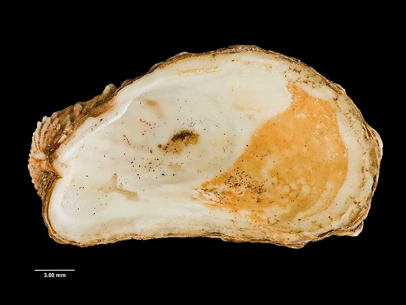
Holotype of Cardita aoteana Finlay, collected Dowling Bay, Otago Harbour, NZ (MA70134). © Auckland Museum (CC-BY)
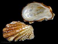
Under rocks, at extreme low tide, Cissy Bay, Marlborough, NZ. 25-30mm
Taxonomy
Family: Subfamily: CARDITIDAE: CARDITINAE Full Classification: Mollusca (Phylum) > Bivalvia (Class) > Heterodonta (Subclass) > Archiheterodonta (Infraclass) > Carditida (Order) > Carditoidea (Superfamily) > Carditidae (Family) > Carditinae (Subfamily) > Cardita (Genus) > distorta (Species) Genus Synonyms: =Cardita (Mytilicardia) Herrmannsen, 1847 =Jesonia Gray, 1847 =Mytilicardia Herrmannsen, 1847 =Mytilicardita Anton, 1838 Synonymised Names: =Cardita aoteana Finlay, 1926 |
Details: Cardita distorta Reeve, 1843
Size/Grows to:
Length 38mm, Width 26mm
Distribution:
Middlesex and King banks, Three Kings, North, South, Stewart, Snares, Auckland and Chatham Islands. From low tide to about 600 metres
Geographical Range:
ACFMAn
Notes:
Species Links
Distribution Map
References and Publications
- Huber, M. 2010 Compendium of Bivalves 1, ConchBooks: Hackenheim, Germany (p.652)
- Powell, A.W.B. 1979 New Zealand Mollusca: Marine, Land and Freshwater Shells, Collins, Auckland (p.406)
*98 © Museum of New Zealand Te Papa Tongarewa (CC-BY-NC-ND)
Key to Geographical Ranges

The symbols K.A.C.F.M.An. are used to indicate the geographical range of the species.
They have been adopted to give an approximation of the range of each species within New Zealand.
K=
Kermadec Islands
A=
Aupourian - Kaipara Harbour, north around North Cape, encompassing the Three Kings Islands and south to East Cape
C=
Cookian - Lower North Island and the northern part of the South Island
F=
Forsterian - Otago, Fiordland and Stewart Island
M=
Moriorian - Chatham Islands, Pitt Island
An=
Antipodean - Subantarctic Islands of New Zealand
Fw =
Freshwater
L =
Land
N =
North Island
S =
South Island
R =
Recent
Sf =
Subfossil
Fo =
Fossil
Recently Viewed
Compare Species (
/6)