Compare Limatula maoria
| toggle to add to compare list |
Taxonomy
Family: LIMIDAE Full Classification: Genus Synonyms: =Limatula (Stabilima) Iredale, 1939 accepted, alternate representation =Stabilima Iredale, 1939 =Limatula (Limatuletta) C. A. C.A. Fleming, 1978 accepted, alternate representation =Limatuletta C.A. Fleming, 1978 Synonymised Names: =Limatula (Limatula) maoria Finlay, 1926 =Limatula (Stabilima) maoria Finlay, 1926 accepted, alternate representation =Limatula maoria var. janetae R.M. Carter, 1972 |
Images: Limatula maoria Finlay, 1926
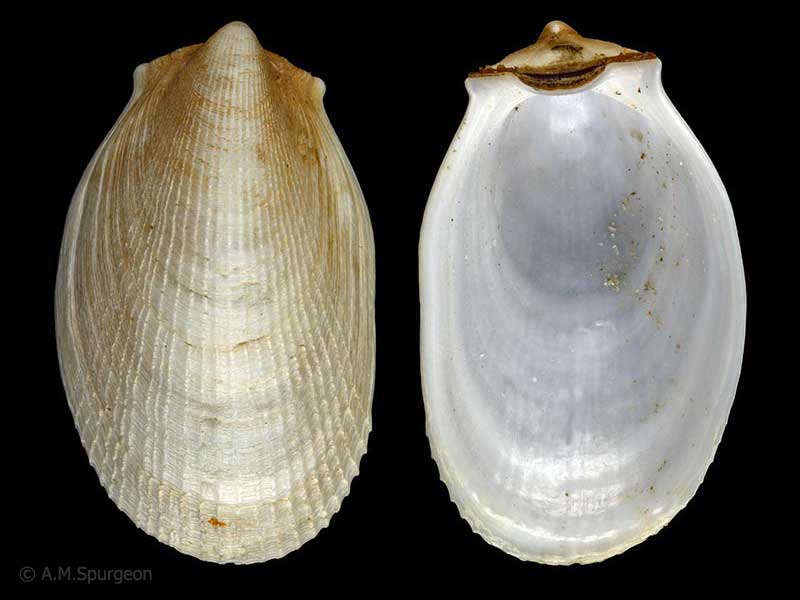
Houhora Harbour, Far North, NZ. 29mm
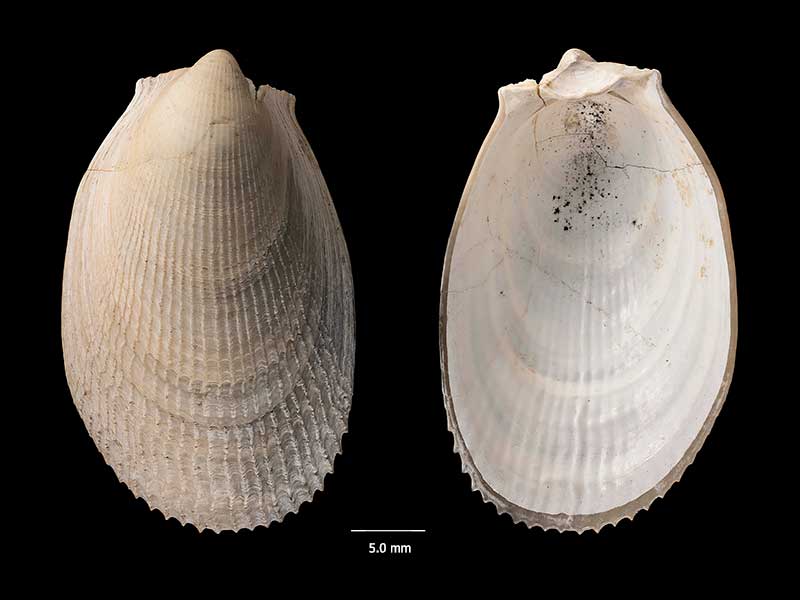
Holotype, collected Castlecliff (Upper Pleistocene), Wanganui, NZ (MA70396). © Auckland Museum (CC-BY)
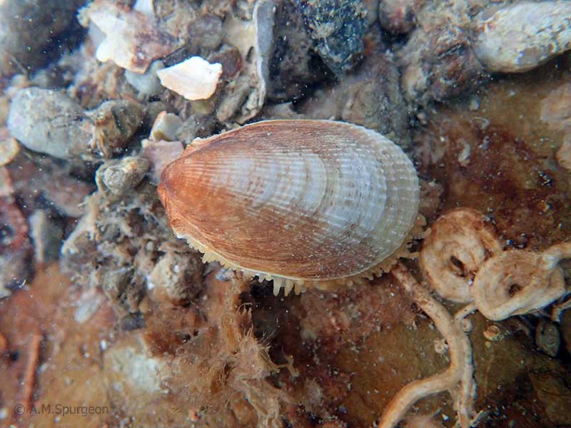
Under rocks at extreme low tide, Cissy Bay, Marlborough Sounds, NZ. ~25mm
Taxonomy
Family: LIMIDAE Full Classification: Genus Synonyms: =Limatula (Stabilima) Iredale, 1939 accepted, alternate representation =Stabilima Iredale, 1939 =Limatula (Limatuletta) C. A. C.A. Fleming, 1978 accepted, alternate representation =Limatuletta C.A. Fleming, 1978 Synonymised Names: =Limatula (Limatula) maoria Finlay, 1926 =Limatula (Stabilima) maoria Finlay, 1926 accepted, alternate representation =Limatula maoria var. janetae R.M. Carter, 1972 |
Details: Limatula maoria Finlay, 1926
Size/Grows to:
Height 40mm, Width 20mm
Distribution:
North, South, Stewart and Chatham Islands. Shallow water to over 500 metres
Geographical Range:
ACFM
Notes:
Species Links
Distribution Map
References and Publications
- Huber, M. 2010 Compendium of Bivalves 1, ConchBooks: Hackenheim, Germany (p.638)
- Powell, A.W.B. 1979 New Zealand Mollusca: Marine, Land and Freshwater Shells, Collins, Auckland (p.382)
- Fleming, C.A. 1978 The bivalve genus Limatula: a list of described species and a review of living and fossil species in the Southwest Pacific, Journal of the Royal Society of New Zealand, 8 (p.49)
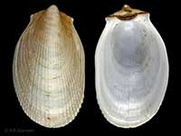
*98 © Museum of New Zealand Te Papa Tongarewa (CC-BY-NC-ND)
Key to Geographical Ranges

The symbols K.A.C.F.M.An. are used to indicate the geographical range of the species.
They have been adopted to give an approximation of the range of each species within New Zealand.
K=
Kermadec Islands
A=
Aupourian - Kaipara Harbour, north around North Cape, encompassing the Three Kings Islands and south to East Cape
C=
Cookian - Lower North Island and the northern part of the South Island
F=
Forsterian - Otago, Fiordland and Stewart Island
M=
Moriorian - Chatham Islands, Pitt Island
An=
Antipodean - Subantarctic Islands of New Zealand
Fw =
Freshwater
L =
Land
N =
North Island
S =
South Island
R =
Recent
Sf =
Subfossil
Fo =
Fossil
Recently Viewed
Compare Species (
/6)