Compare Phrixgnathus brunneus
| toggle to add to compare list |
Taxonomy
Family: Subfamily: PUNCTIDAE: LAOMINAE Full Classification: Mollusca (Phylum) > Gastropoda (Class) > Heterobranchia (Subclass) > Euthyneura (Infraclass) > Tectipleura (Subterclass) > Eupulmonata (Superorder) > Stylommatophora (Order) > Helicina (Suborder) > [unassigned] Helicina (Infraorder) > Punctoidea (Superfamily) > Punctidae (Family) > Laominae (Subfamily) > Phrixgnathus (Genus) > brunneus (Species) Genus Synonyms: =Laoma (Phrixgnathus) Hutton, 1882 |
Images: Phrixgnathus brunneus Climo & Goulstone, 1993
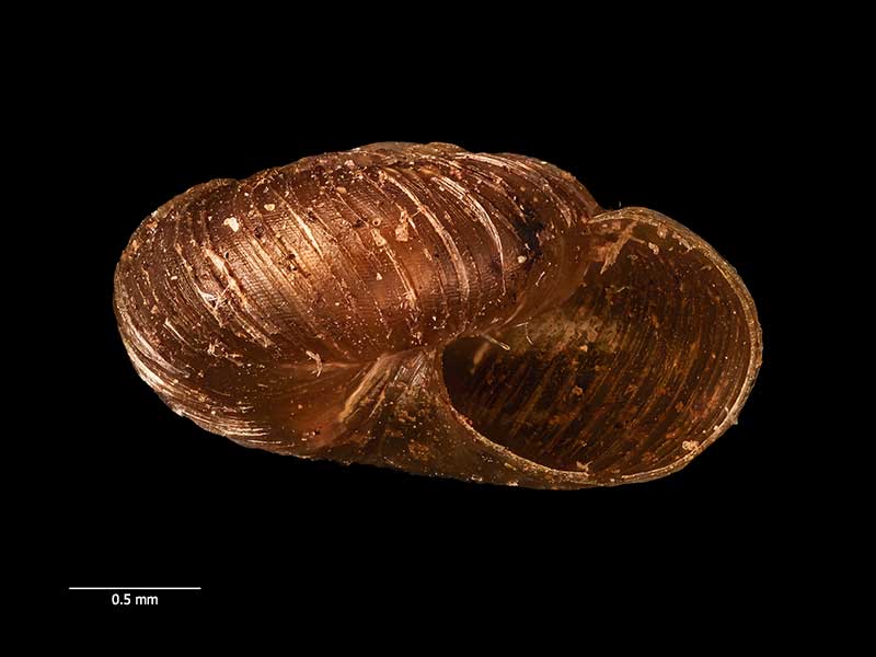
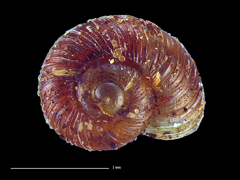
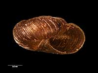
Holotype, collected in 1930, Motu River Bridge, E Bay of Plenty, NZ (MA71562). 2.5mm. © Auckland Museum (CC-BY)
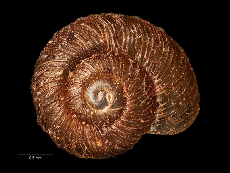
Holotype, collected in 1930, Motu River Bridge, E Bay of Plenty, NZ (MA71562). 2.5mm. © Auckland Museum (CC-BY)
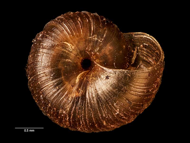
Holotype, collected in 1930, Motu River Bridge, E Bay of Plenty, NZ (MA71562). 2.5mm. © Auckland Museum (CC-BY)
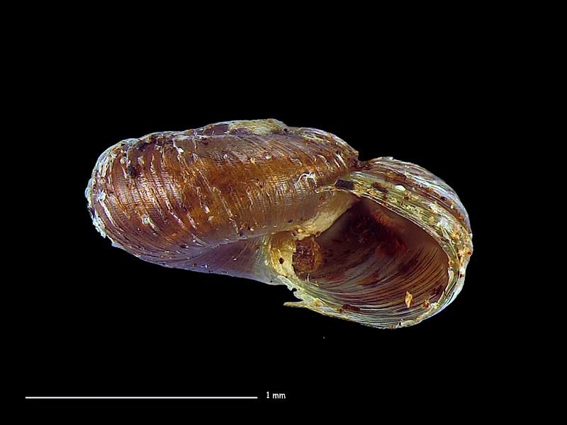
Collected May 2018, Mt. Pirongia, Waikato, NZ. 1.7mm. Reproduced courtesy of Dave Roscoe
Collected May 2018, Mt. Pirongia, Waikato, NZ. 1.7mm. Reproduced courtesy of Dave Roscoe
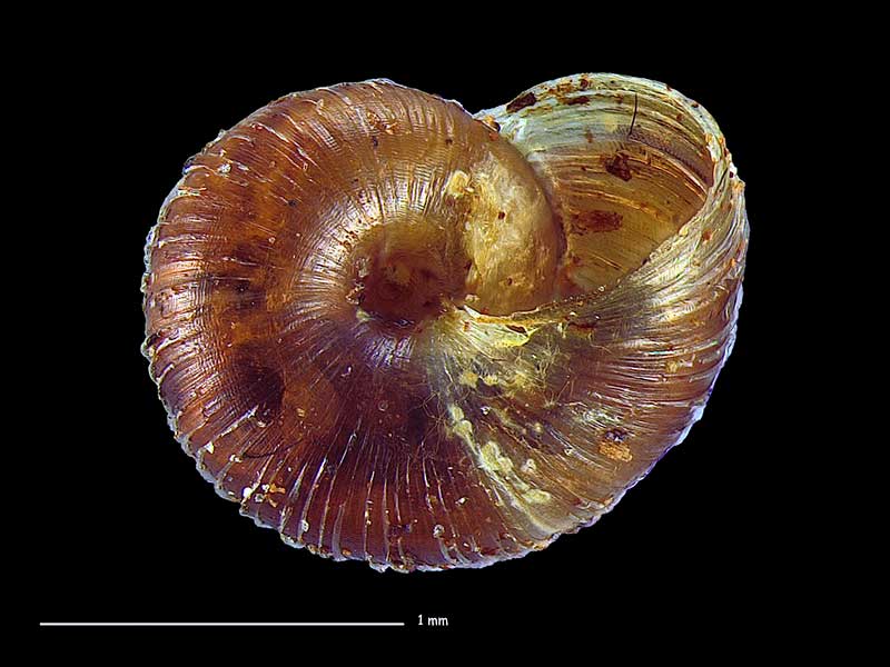
Collected May 2018, Mt. Pirongia, Waikato, NZ. 1.7mm. Reproduced courtesy of Dave Roscoe
Taxonomy
Family: Subfamily: PUNCTIDAE: LAOMINAE Full Classification: Mollusca (Phylum) > Gastropoda (Class) > Heterobranchia (Subclass) > Euthyneura (Infraclass) > Tectipleura (Subterclass) > Eupulmonata (Superorder) > Stylommatophora (Order) > Helicina (Suborder) > [unassigned] Helicina (Infraorder) > Punctoidea (Superfamily) > Punctidae (Family) > Laominae (Subfamily) > Phrixgnathus (Genus) > brunneus (Species) Genus Synonyms: =Laoma (Phrixgnathus) Hutton, 1882 |
Details: Phrixgnathus brunneus Climo & Goulstone, 1993
Size/Grows to:
Width 2.5mm, Height 1.3mm
Distribution:
North Island. Great Barrier Island down to north Volcanic Plateau
Geographical Range:
L.N.
Notes:
Species Links
Distribution Map
References and Publications
- Climo, F.M., Goulstone, J.F. 1993 Descriptions and redescriptions of landsnails (Mollusca: Punctidae) in the genera Phrixgnathus and Taguahelix, Records of the Auckland Institute and Museum, 30 (p.41) Original Description
Key to Geographical Ranges

The symbols K.A.C.F.M.An. are used to indicate the geographical range of the species.
They have been adopted to give an approximation of the range of each species within New Zealand.
K=
Kermadec Islands
A=
Aupourian - Kaipara Harbour, north around North Cape, encompassing the Three Kings Islands and south to East Cape
C=
Cookian - Lower North Island and the northern part of the South Island
F=
Forsterian - Otago, Fiordland and Stewart Island
M=
Moriorian - Chatham Islands, Pitt Island
An=
Antipodean - Subantarctic Islands of New Zealand
Fw =
Freshwater
L =
Land
N =
North Island
S =
South Island
R =
Recent
Sf =
Subfossil
Fo =
Fossil
Recently Viewed
Compare Species (
/6)