Compare Phrixgnathus ariel
| toggle to add to compare list |
Taxonomy
Family: Subfamily: PUNCTIDAE: LAOMINAE Full Classification: Mollusca (Phylum) > Gastropoda (Class) > Heterobranchia (Subclass) > Euthyneura (Infraclass) > Tectipleura (Subterclass) > Eupulmonata (Superorder) > Stylommatophora (Order) > Helicina (Suborder) > [unassigned] Helicina (Infraorder) > Punctoidea (Superfamily) > Punctidae (Family) > Laominae (Subfamily) > Phrixgnathus (Genus) > ariel (Species) Genus Synonyms: =Laoma (Phrixgnathus) Hutton, 1882 |
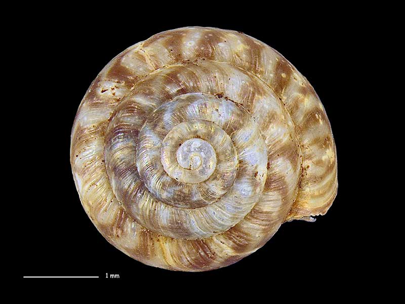
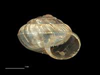
Images: Phrixgnathus ariel Hutton, 1883
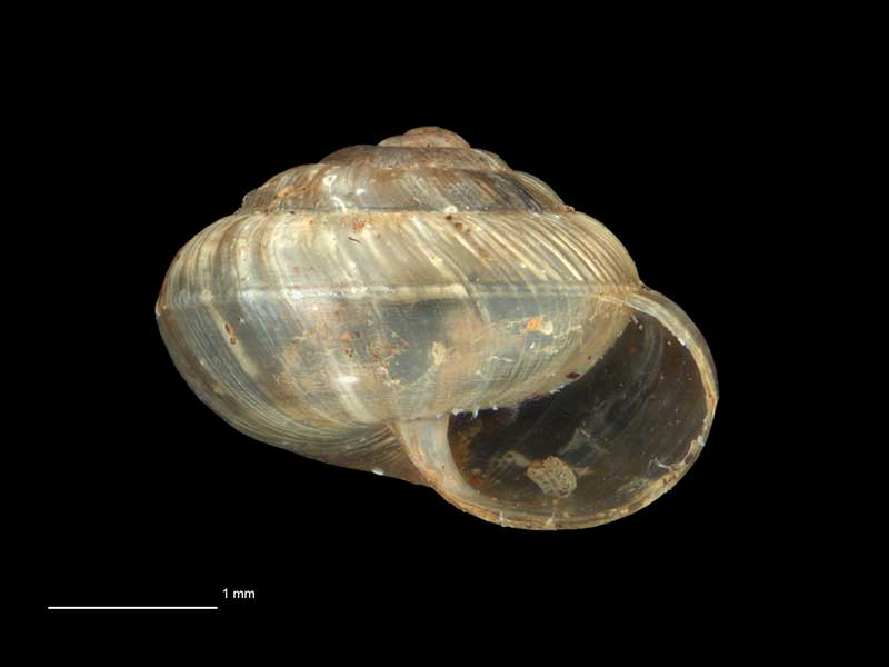
Collected Nov 1979, NE of Tokoroa, Central Plateau, NZ. 3.4mm. Reproduced courtesy of Dave Roscoe
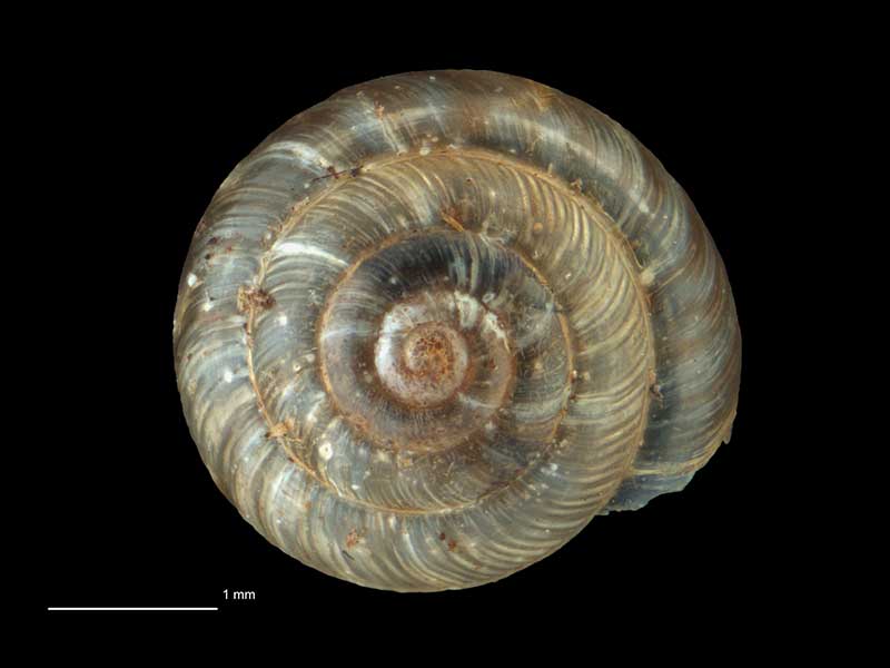
Collected Nov 1979, NE of Tokoroa, Central Plateau, NZ. 3.4mm. Reproduced courtesy of Dave Roscoe
Collected Nov 1979, NE of Tokoroa, Central Plateau, NZ. 3.4mm. Reproduced courtesy of Dave Roscoe
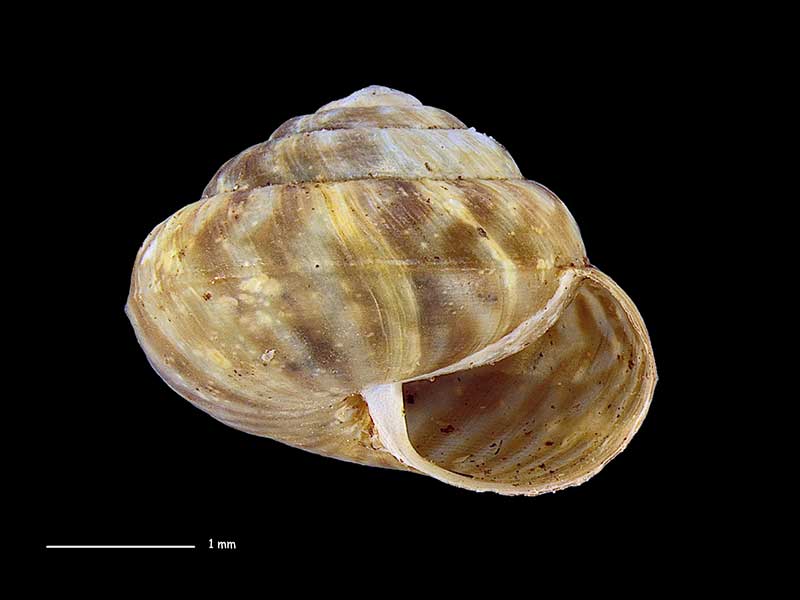
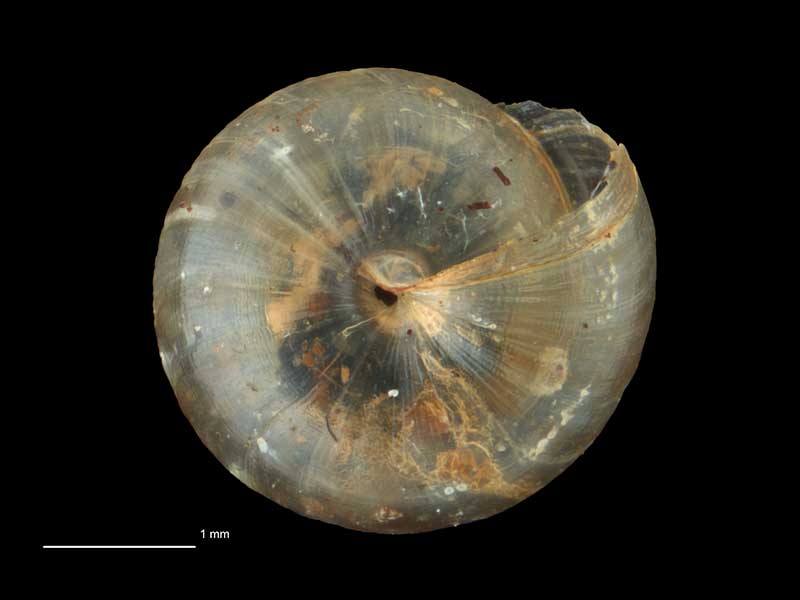
Collected Dec 1994, White Pine Forest, Tangoio Forest, north of Napier, Hawkes Bay, NZ. 3.6mm. Reproduced courtesy of Dave Roscoe
Collected Dec 1994, White Pine Forest, Tangoio Forest, north of Napier, Hawkes Bay, NZ. 3.6mm. Reproduced courtesy of Dave Roscoe
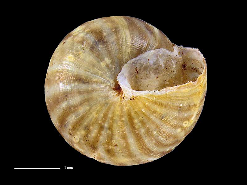
Collected Dec 1994, White Pine Forest, Tangoio Forest, north of Napier, Hawkes Bay, NZ. 3.6mm. Reproduced courtesy of Dave Roscoe
Taxonomy
Family: Subfamily: PUNCTIDAE: LAOMINAE Full Classification: Mollusca (Phylum) > Gastropoda (Class) > Heterobranchia (Subclass) > Euthyneura (Infraclass) > Tectipleura (Subterclass) > Eupulmonata (Superorder) > Stylommatophora (Order) > Helicina (Suborder) > [unassigned] Helicina (Infraorder) > Punctoidea (Superfamily) > Punctidae (Family) > Laominae (Subfamily) > Phrixgnathus (Genus) > ariel (Species) Genus Synonyms: =Laoma (Phrixgnathus) Hutton, 1882 |
Details: Phrixgnathus ariel Hutton, 1883
Size/Grows to:
Width 3.25mm, Height 2.5mm
Distribution:
North and South Island
Geographical Range:
L.N.S.
Notes:
Species Links
Distribution Map
References and Publications
- Powell, A.W.B. 1979 New Zealand Mollusca: Marine, Land and Freshwater Shells, Collins, Auckland (p.326)
- Hutton, F.W. 1883 Notes on some New Zealand land shells, New Zealand Journal of Science, 1(10) (p.476) Original Description
Key to Geographical Ranges

The symbols K.A.C.F.M.An. are used to indicate the geographical range of the species.
They have been adopted to give an approximation of the range of each species within New Zealand.
K=
Kermadec Islands
A=
Aupourian - Kaipara Harbour, north around North Cape, encompassing the Three Kings Islands and south to East Cape
C=
Cookian - Lower North Island and the northern part of the South Island
F=
Forsterian - Otago, Fiordland and Stewart Island
M=
Moriorian - Chatham Islands, Pitt Island
An=
Antipodean - Subantarctic Islands of New Zealand
Fw =
Freshwater
L =
Land
N =
North Island
S =
South Island
R =
Recent
Sf =
Subfossil
Fo =
Fossil
Recently Viewed
Compare Species (
/6)