Compare Pseudallodiscus ponderi
| toggle to add to compare list |
Taxonomy
Family: Subfamily: CHAROPIDAE: PHENACOHELICINAE Full Classification: Mollusca (Phylum) > Gastropoda (Class) > Heterobranchia (Subclass) > Euthyneura (Infraclass) > Tectipleura (Subterclass) > Eupulmonata (Superorder) > Stylommatophora (Order) > Helicina (Suborder) > [unassigned] Helicina (Infraorder) > Punctoidea (Superfamily) > Charopidae (Family) > Phenacohelicinae (Subfamily) > Pseudallodiscus (Genus) > ponderi (Species) |
Images: Pseudallodiscus ponderi Climo, 1971
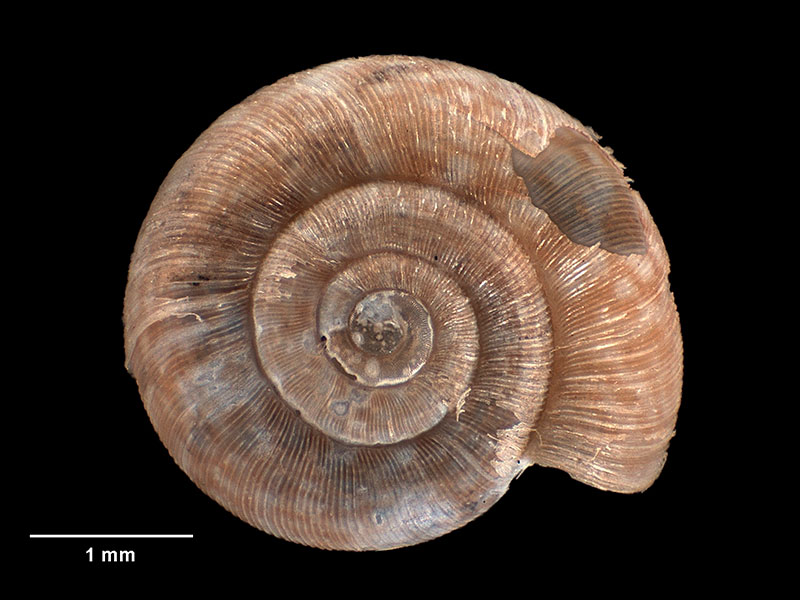
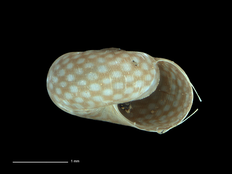
Holotype, collected 14 Oct 1967, Keith Gorge Memorial Park, Silverstream, Hutt Valley, Wellington, NZ (M.022455). 3.5mm. © Museum of New Zealand Te Papa Tongarewa (CC-BY-NC-ND)
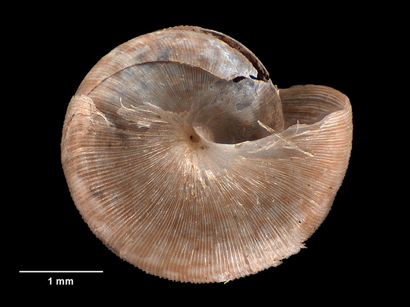
Holotype, collected 14 Oct 1967, Keith Gorge Memorial Park, Silverstream, Hutt Valley, Wellington, NZ (M.022455). 3.5mm. © Museum of New Zealand Te Papa Tongarewa (CC-BY-NC-ND)
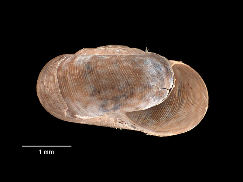
Holotype, collected 14 Oct 1967, Keith Gorge Memorial Park, Silverstream, Hutt Valley, Wellington, NZ (M.022455). 3.5mm. © Museum of New Zealand Te Papa Tongarewa (CC-BY-NC-ND)
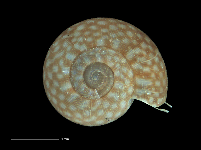
Collected Pohangina Valley, NE of Palmerston North, NZ. 2.7mm. Reproduced courtesy of Dave Roscoe
Collected Pohangina Valley, NE of Palmerston North, NZ. 2.7mm. Reproduced courtesy of Dave Roscoe
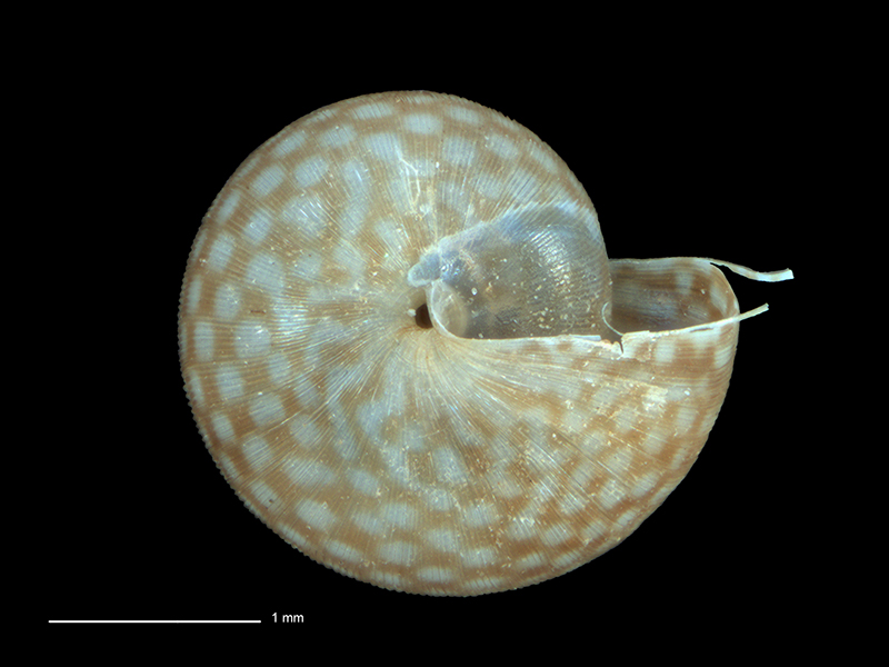
Collected Pohangina Valley, NE of Palmerston North, NZ. 2.7mm. Reproduced courtesy of Dave Roscoe
Taxonomy
Family: Subfamily: CHAROPIDAE: PHENACOHELICINAE Full Classification: Mollusca (Phylum) > Gastropoda (Class) > Heterobranchia (Subclass) > Euthyneura (Infraclass) > Tectipleura (Subterclass) > Eupulmonata (Superorder) > Stylommatophora (Order) > Helicina (Suborder) > [unassigned] Helicina (Infraorder) > Punctoidea (Superfamily) > Charopidae (Family) > Phenacohelicinae (Subfamily) > Pseudallodiscus (Genus) > ponderi (Species) |
Details: Pseudallodiscus ponderi Climo, 1971
Size/Grows to:
Width 3.5mm
Distribution:
North Island. Wellington area
Geographical Range:
L.N.
Notes:
Species Links
Distribution Map
References and Publications
- Marshall, B.A., Barker, G.M. 2008 A revision of the New Zealand land snails referred to Allodiscus Pilsbry, 1892 and Pseudallodiscus Climo, 1971, with the introduction of three new genera (Mollusca: Gastropoda: Charopidae), Tuhinga: Records of the Museum of New Zealand Te Papa Tongarewa, 19 (p.150)
- Powell, A.W.B. 1979 New Zealand Mollusca: Marine, Land and Freshwater Shells, Collins, Auckland (p.322)
- Climo, F.M. 1971 Classification of New Zealand Arionacea (Mollusca: Pulmonata). 5. Descriptions of some new phenacohelicid taxa (Punctidae: Phenacohelicinae), Records of the Dominion Museum, 7 (p.101) Original Description
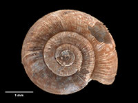
*98 © Museum of New Zealand Te Papa Tongarewa (CC-BY-NC-ND)
Key to Geographical Ranges

The symbols K.A.C.F.M.An. are used to indicate the geographical range of the species.
They have been adopted to give an approximation of the range of each species within New Zealand.
K=
Kermadec Islands
A=
Aupourian - Kaipara Harbour, north around North Cape, encompassing the Three Kings Islands and south to East Cape
C=
Cookian - Lower North Island and the northern part of the South Island
F=
Forsterian - Otago, Fiordland and Stewart Island
M=
Moriorian - Chatham Islands, Pitt Island
An=
Antipodean - Subantarctic Islands of New Zealand
Fw =
Freshwater
L =
Land
N =
North Island
S =
South Island
R =
Recent
Sf =
Subfossil
Fo =
Fossil
Recently Viewed
Compare Species (
/6)