Compare Geminoropa vortex
| toggle to add to compare list |
Taxonomy
Family: Subfamily: CHAROPIDAE: CHAROPINAE Full Classification: Mollusca (Phylum) > Gastropoda (Class) > Heterobranchia (Subclass) > Euthyneura (Infraclass) > Tectipleura (Subterclass) > Eupulmonata (Superorder) > Stylommatophora (Order) > Helicina (Suborder) > [unassigned] Helicina (Infraorder) > Punctoidea (Superfamily) > Charopidae (Family) > Charopinae (Subfamily) > Geminoropa (Genus) > vortex (Species) Genus Synonyms: =Geminoropa Iredale, 1933 |
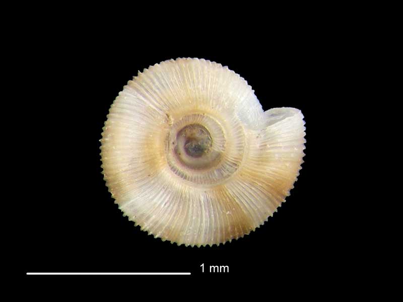
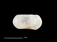
Images: Geminoropa vortex (R. Murdoch, 1897)
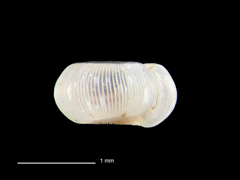
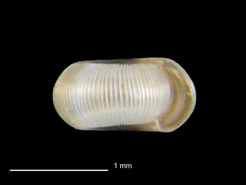
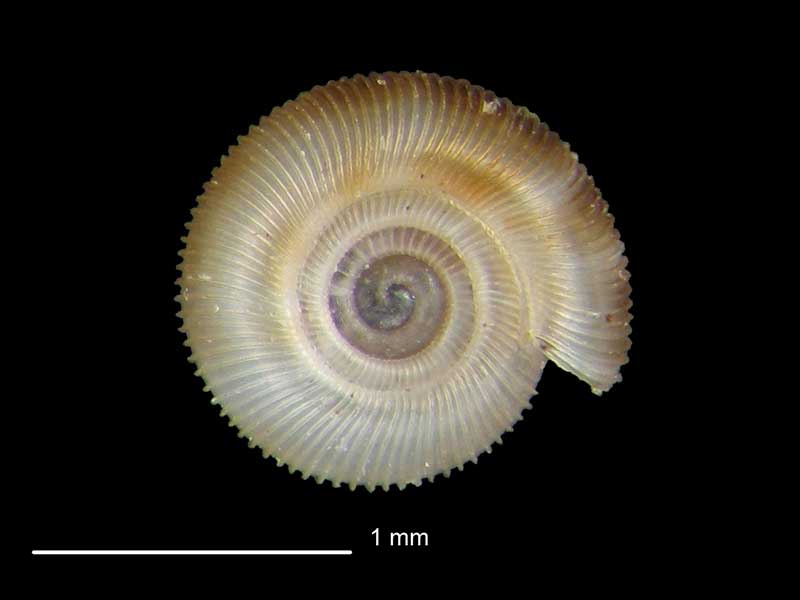
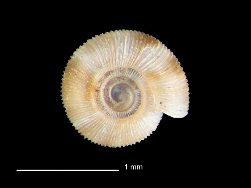
Whirinaki Forest, Bay of Plenty, NZ. 1.2mm. Reproduced courtesy of Dave Roscoe
Whirinaki Forest, Bay of Plenty, NZ. 1.2mm. Reproduced courtesy of Dave Roscoe
Whirinaki Forest, Bay of Plenty, NZ. 1.2mm. Reproduced courtesy of Dave Roscoe
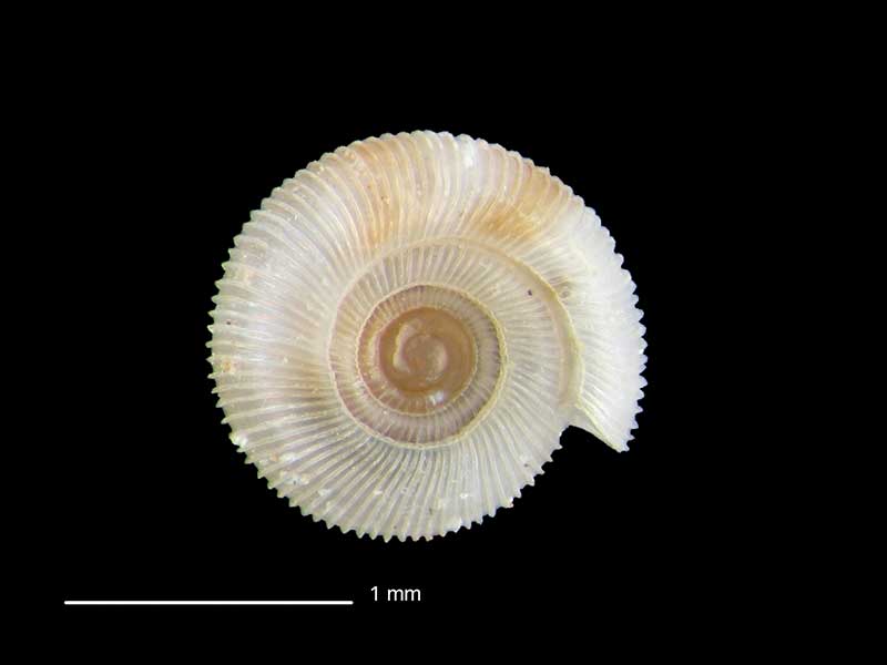
Makahu Tunnel, Strathmore, Taranaki, NZ. 1.5mm. Reproduced courtesy of Dave Roscoe
Makahu Tunnel, Strathmore, Taranaki, NZ. 1.5mm. Reproduced courtesy of Dave Roscoe
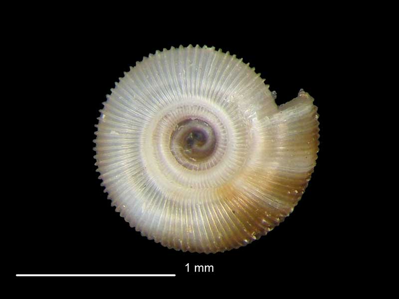
Makahu Tunnel, Strathmore, Taranaki, NZ. 1.5mm. Reproduced courtesy of Dave Roscoe
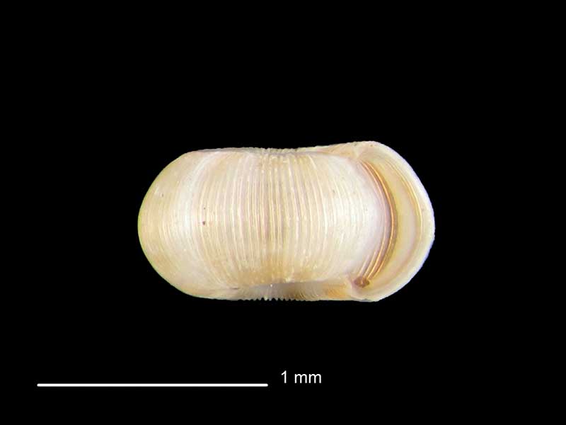
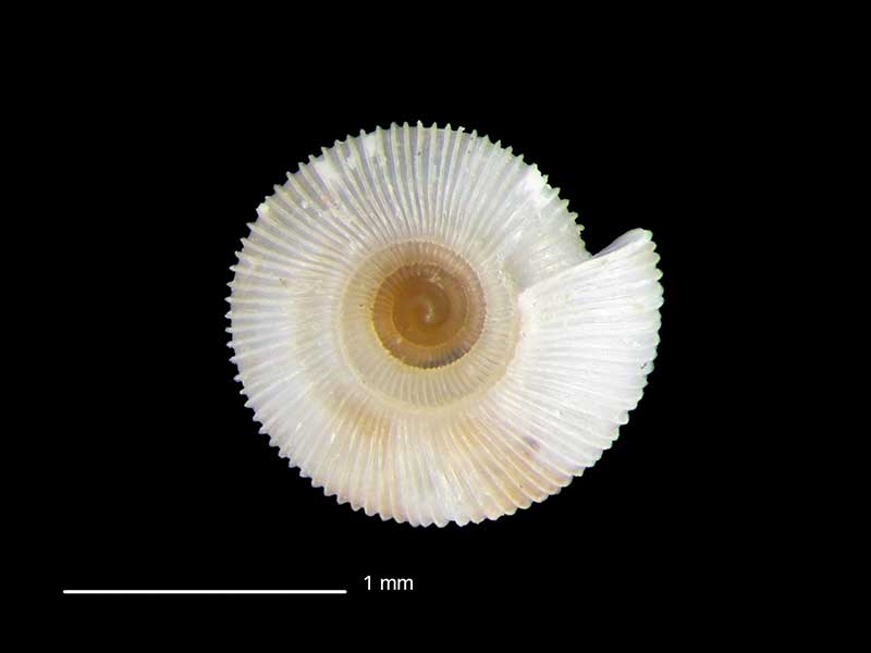
Collected off Paewhenua Road, Otorohanga, Waikato, NZ. 1.3mm. Reproduced courtesy of Dave Roscoe
Collected off Paewhenua Road, Otorohanga, Waikato, NZ. 1.3mm. Reproduced courtesy of Dave Roscoe
Collected off Paewhenua Road, Otorohanga, Waikato, NZ. 1.3mm. Reproduced courtesy of Dave Roscoe
Taxonomy
Family: Subfamily: CHAROPIDAE: CHAROPINAE Full Classification: Mollusca (Phylum) > Gastropoda (Class) > Heterobranchia (Subclass) > Euthyneura (Infraclass) > Tectipleura (Subterclass) > Eupulmonata (Superorder) > Stylommatophora (Order) > Helicina (Suborder) > [unassigned] Helicina (Infraorder) > Punctoidea (Superfamily) > Charopidae (Family) > Charopinae (Subfamily) > Geminoropa (Genus) > vortex (Species) Genus Synonyms: =Geminoropa Iredale, 1933 |
Details: Geminoropa vortex (R. Murdoch, 1897)
Size/Grows to:
Width 1.6mm, Height 0.75mm
Distribution:
North and South Island
Geographical Range:
L.N.S.
Notes:
Species Links
Distribution Map
References and Publications
- Powell, A.W.B. 1979 New Zealand Mollusca: Marine, Land and Freshwater Shells, Collins, Auckland (p.309)
- Murdoch, R. 1897 Descriptions of new species of Endodonta and Flammulina from New Zealand, Proceedings of the Malacological Society of London, 2 (p.160) Original Description
Key to Geographical Ranges

The symbols K.A.C.F.M.An. are used to indicate the geographical range of the species.
They have been adopted to give an approximation of the range of each species within New Zealand.
K=
Kermadec Islands
A=
Aupourian - Kaipara Harbour, north around North Cape, encompassing the Three Kings Islands and south to East Cape
C=
Cookian - Lower North Island and the northern part of the South Island
F=
Forsterian - Otago, Fiordland and Stewart Island
M=
Moriorian - Chatham Islands, Pitt Island
An=
Antipodean - Subantarctic Islands of New Zealand
Fw =
Freshwater
L =
Land
N =
North Island
S =
South Island
R =
Recent
Sf =
Subfossil
Fo =
Fossil
Recently Viewed
Compare Species (
/6)