Compare Chaureopa roscoei
| toggle to add to compare list |
Taxonomy
Family: Subfamily: CHAROPIDAE: CHAROPINAE Full Classification: Mollusca (Phylum) > Gastropoda (Class) > Heterobranchia (Subclass) > Euthyneura (Infraclass) > Tectipleura (Subterclass) > Eupulmonata (Superorder) > Stylommatophora (Order) > Helicina (Suborder) > [unassigned] Helicina (Infraorder) > Punctoidea (Superfamily) > Charopidae (Family) > Charopinae (Subfamily) > Chaureopa (Genus) > roscoei (Species) |
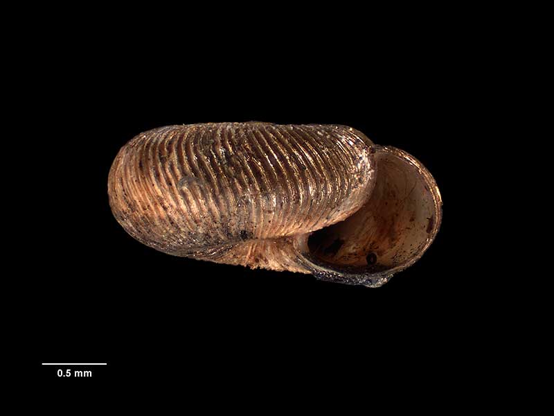
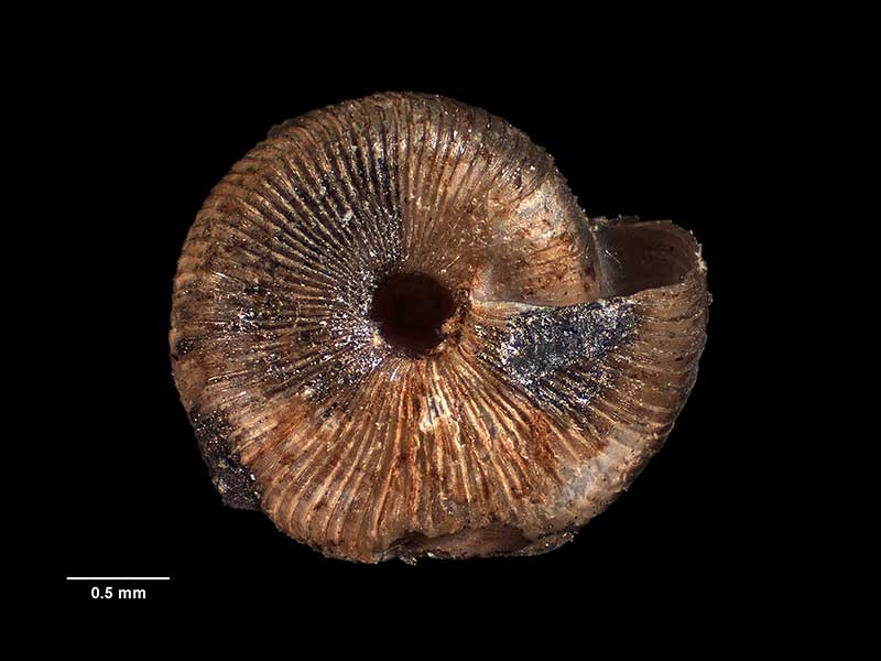
Images: Chaureopa roscoei Climo, 1985
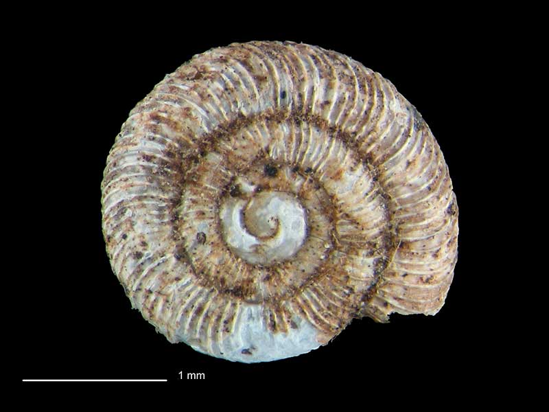
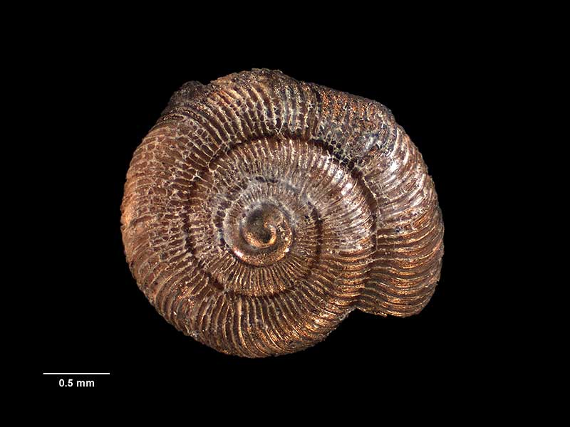
North of Tikitiki, East Cape, NZ. 2.6mm. Reproduced courtesy of Dave Roscoe
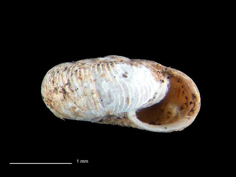
North of Tikitiki, East Cape, NZ. 2.6mm. Reproduced courtesy of Dave Roscoe
North of Tikitiki, East Cape, NZ. 2.6mm. Reproduced courtesy of Dave Roscoe
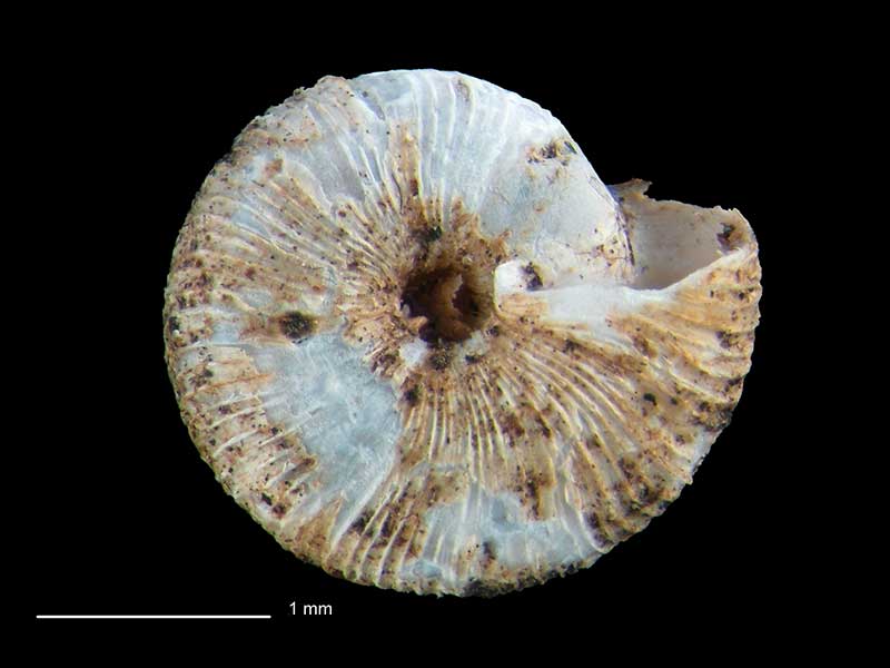
Holotype, collected 8 Jul 1978, Rangitukia East Cape Road, S of Haha Station, SE of Te Araroa, NZ (M.078908). © Museum of New Zealand Te Papa Tongarewa (CC-BY-NC-ND)
Holotype, collected 8 Jul 1978, Rangitukia East Cape Road, S of Haha Station, SE of Te Araroa, NZ (M.078908). © Museum of New Zealand Te Papa Tongarewa (CC-BY-NC-ND)
Holotype, collected 8 Jul 1978, Rangitukia East Cape Road, S of Haha Station, SE of Te Araroa, NZ (M.078908). © Museum of New Zealand Te Papa Tongarewa (CC-BY-NC-ND)
Taxonomy
Family: Subfamily: CHAROPIDAE: CHAROPINAE Full Classification: Mollusca (Phylum) > Gastropoda (Class) > Heterobranchia (Subclass) > Euthyneura (Infraclass) > Tectipleura (Subterclass) > Eupulmonata (Superorder) > Stylommatophora (Order) > Helicina (Suborder) > [unassigned] Helicina (Infraorder) > Punctoidea (Superfamily) > Charopidae (Family) > Charopinae (Subfamily) > Chaureopa (Genus) > roscoei (Species) |
Details: Chaureopa roscoei Climo, 1985
Size/Grows to:
Width 2.6mm
Distribution:
North Island. N of Tikitiki
Geographical Range:
L.N.
Notes:
Species Links
Distribution Map
References and Publications
- Climo, F.M. 1985 Classification of the New Zealand Arionacea (Mollusca: Pulmonata) XI: The new genus Chaureopa and a description of a new species of Paracharopa Climo (Charopidae), New Zealand Journal of Zoology, 12(2) (p.292) Original Description
Key to Geographical Ranges

The symbols K.A.C.F.M.An. are used to indicate the geographical range of the species.
They have been adopted to give an approximation of the range of each species within New Zealand.
K=
Kermadec Islands
A=
Aupourian - Kaipara Harbour, north around North Cape, encompassing the Three Kings Islands and south to East Cape
C=
Cookian - Lower North Island and the northern part of the South Island
F=
Forsterian - Otago, Fiordland and Stewart Island
M=
Moriorian - Chatham Islands, Pitt Island
An=
Antipodean - Subantarctic Islands of New Zealand
Fw =
Freshwater
L =
Land
N =
North Island
S =
South Island
R =
Recent
Sf =
Subfossil
Fo =
Fossil
Recently Viewed

Compare Species (
/6)