Compare Murexsul octogonus
| toggle to add to compare list |
Taxonomy
Family: Subfamily: MURICIDAE: MURICOPSINAE Full Classification: Mollusca (Phylum) > Gastropoda (Class) > Caenogastropoda (Subclass) > Neogastropoda (Order) > Muricoidea (Superfamily) > Muricidae (Family) > Muricopsinae (Subfamily) > Murexsul (Genus) > octogonus (Species) Genus Synonyms: =Hexaplex (Murexsul) Iredale, 1915 =Murexsul (Murexsul) Iredale, 1915 =Muricopsis (Murexsul) Iredale, 1915 Synonymised Names: =Murex octogonus Quoy & Gaimard, 1833 =Murex peruvianus G.B. Sowerby II, 1841 =Murexsul cuvierensis Finlay, 1927 =Muricopsis (Murexsul) octogonus (Quoy & Gaimard, 1833) =Muricopsis octogonus (Quoy & Gaimard, 1833) |
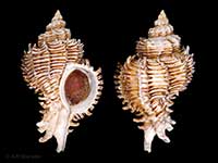
Images: Murexsul octogonus (Quoy & Gaimard, 1833)
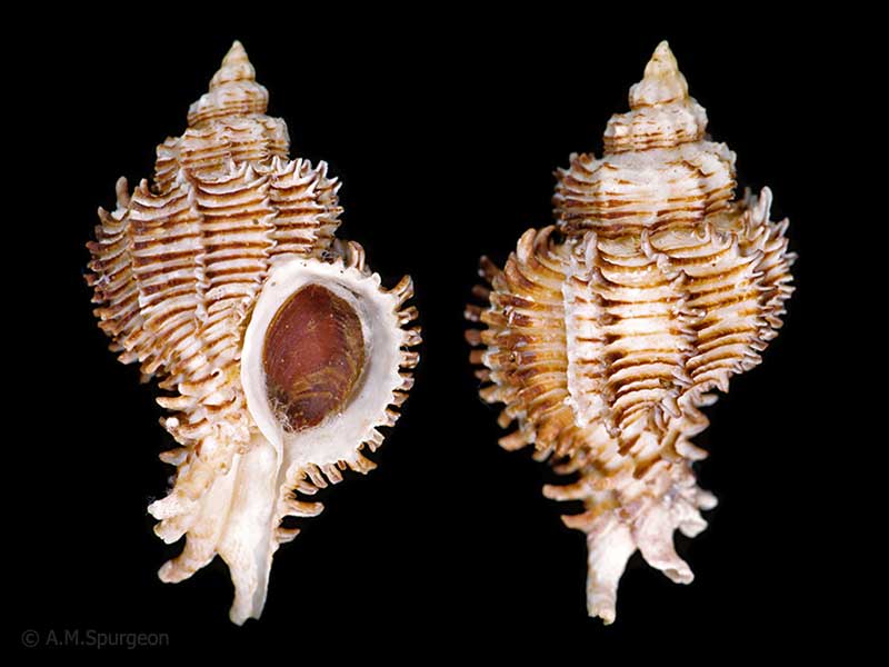
In about 15 metres, northern NZ. 56mm
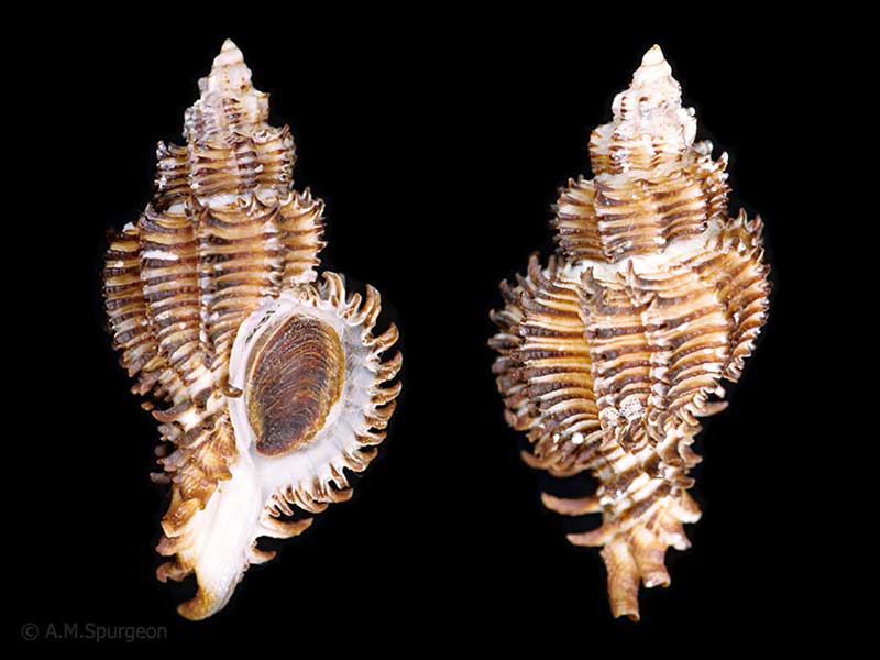
In about 15 metres, northern NZ. 55mm
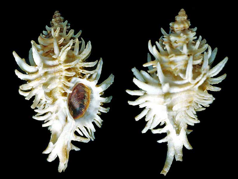
Off Thompsons Point, Waiheke Island, 22 metres. 54mm
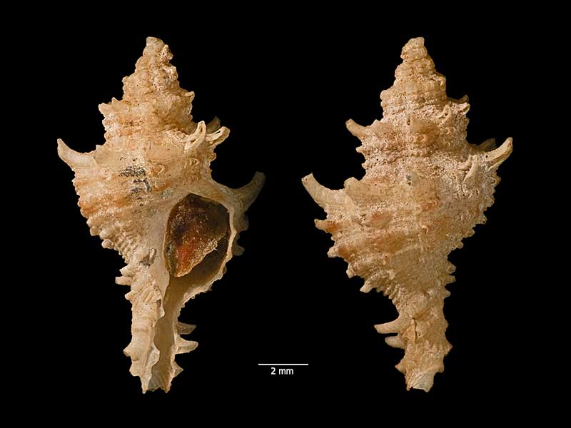
Holotype of Muricopsis cuvierensis Finlay 1927, dredged in 73 metres, off Cuvier Island, Bay of Plenty, NZ (MA70500). © Auckland Museum (CC-BY)
Taxonomy
Family: Subfamily: MURICIDAE: MURICOPSINAE Full Classification: Mollusca (Phylum) > Gastropoda (Class) > Caenogastropoda (Subclass) > Neogastropoda (Order) > Muricoidea (Superfamily) > Muricidae (Family) > Muricopsinae (Subfamily) > Murexsul (Genus) > octogonus (Species) Genus Synonyms: =Hexaplex (Murexsul) Iredale, 1915 =Murexsul (Murexsul) Iredale, 1915 =Muricopsis (Murexsul) Iredale, 1915 Synonymised Names: =Murex octogonus Quoy & Gaimard, 1833 =Murex peruvianus G.B. Sowerby II, 1841 =Murexsul cuvierensis Finlay, 1927 =Muricopsis (Murexsul) octogonus (Quoy & Gaimard, 1833) =Muricopsis octogonus (Quoy & Gaimard, 1833) |
Details: Murexsul octogonus (Quoy & Gaimard, 1833)
Size/Grows to:
Height 89mm, Width 48mm
Distribution:
Three Kings and North Island down to Kapiti Island and Mahia Peninsula
Notes:
Species Links
Distribution Map
References and Publications
- Scott, I. Oct/2000 Murexsul Feeding at Leigh, Poirieria, 26 (p.23)
- Marshall, B.A., Burch, K.W. 2000 The New Zealand Recent species of Muricopsis Bucquoy, Dautzenberg and Dollfus, 1882 (Gastropoda: Muricidae), The Nautilus, 114(1) (p.18)
- Beu, A.G., Maxwell, P.A. 1990 Cenozoic Mollusca of New Zealand, New Zealand Geological Survey, 58 (p.359)
- Scott, I. Apr/1989 A closer look at Muricopsis octogonus, Poirieria, 15(6) (p.6)
- Powell, A.W.B. 1979 New Zealand Mollusca: Marine, Land and Freshwater Shells, Collins, Auckland (p.170)
*98 © Museum of New Zealand Te Papa Tongarewa (CC-BY-NC-ND)
NZ Geographical Regions

Key to symbols used in Checklist.
Fw =
Freshwater
L =
Land
N =
North Island
S =
South Island
R =
Recent
Sf =
Subfossil
Fo =
Fossil
Recently Viewed
Compare Species (
/6)