Compare Gyroscala commutata
| toggle to add to compare list |
Taxonomy
Family: EPITONIIDAE Full Classification: Mollusca (Phylum) > Gastropoda (Class) > Caenogastropoda (Subclass) > [unassigned] Caenogastropoda (Order) > Epitonioidea (Superfamily) > Epitoniidae (Family) > Gyroscala (Genus) > commutata (Species) Genus Synonyms: =Cirsotrema (Gyroscala) de Boury, 1887 =Epitonium (Gyroscala) de Boury, 1887 =Gyroscala (Pomiscala) Iredale, 1936 =Pictoscala Dall, 1917 =Pomiscala Iredale, 1936 Synonymised Names: =Cirsotrema perplexa (Pease, 1868) =Epitonium (Gyroscala) lamellosum (Lamarck, 1822) accepted, alternate representation =Epitonium lamellosum (Lamarck, 1822) =Epitonium perplexum (Pease, 1868) =Gyroscala (Pomiscala) lamellosa (Lamarck, 1822) accepted, alternate representation =Scalaria lamellosa Lamarck, 1822 |
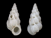
Images: Gyroscala commutata (Monterosato, 1877)
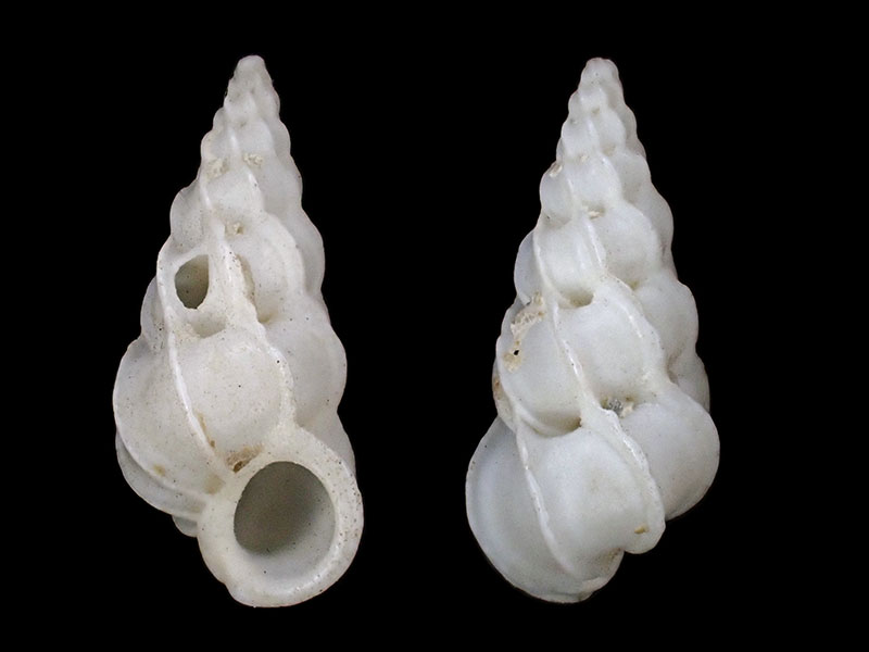
Tokerau Beach, Doubtless Bay, NZ
Taxonomy
Family: EPITONIIDAE Full Classification: Mollusca (Phylum) > Gastropoda (Class) > Caenogastropoda (Subclass) > [unassigned] Caenogastropoda (Order) > Epitonioidea (Superfamily) > Epitoniidae (Family) > Gyroscala (Genus) > commutata (Species) Genus Synonyms: =Cirsotrema (Gyroscala) de Boury, 1887 =Epitonium (Gyroscala) de Boury, 1887 =Gyroscala (Pomiscala) Iredale, 1936 =Pictoscala Dall, 1917 =Pomiscala Iredale, 1936 Synonymised Names: =Cirsotrema perplexa (Pease, 1868) =Epitonium (Gyroscala) lamellosum (Lamarck, 1822) accepted, alternate representation =Epitonium lamellosum (Lamarck, 1822) =Epitonium perplexum (Pease, 1868) =Gyroscala (Pomiscala) lamellosa (Lamarck, 1822) accepted, alternate representation =Scalaria lamellosa Lamarck, 1822 |
Details: Gyroscala commutata (Monterosato, 1877)
Size/Grows to:
Height 32mm, Width 13mm
Distribution:
Kermadec, Australia and Northland, NZ
Geographical Range:
KA
Notes:
Species Links
Distribution Map
References and Publications
- Nakayama, T. 2003 A Review of Northwest Pacific Epitoniids (Gastropoda: Epitoniidae), Monographs of Marine Mollusca, Backhuys, Leiden, Netherlands, 6 (p.78)
- Brook, F.J., Marshall, B.A. 1998 The coastal molluscan fauna of the northern Kermadec Islands, southwest Pacific Ocean, Journal of the Royal Society of New Zealand, 28 (p.224)
- DuShane, H. 1990 Hawaiian Epitoniidae, Hawaiian Shell News (p.6)
- Powell, A.W.B. 1979 New Zealand Mollusca: Marine, Land and Freshwater Shells, Collins, Auckland (p.251)
- Powell, A.W.B. 1965 New Zealand Molluscan Systematics with Descriptions of New Species: Part 5, Records of the Auckland Institute and Museum, 6(2) (p.161)
Key to Geographical Ranges

The symbols K.A.C.F.M.An. are used to indicate the geographical range of the species.
They have been adopted to give an approximation of the range of each species within New Zealand.
K=
Kermadec Islands
A=
Aupourian - Kaipara Harbour, north around North Cape, encompassing the Three Kings Islands and south to East Cape
C=
Cookian - Lower North Island and the northern part of the South Island
F=
Forsterian - Otago, Fiordland and Stewart Island
M=
Moriorian - Chatham Islands, Pitt Island
An=
Antipodean - Subantarctic Islands of New Zealand
Fw =
Freshwater
L =
Land
N =
North Island
S =
South Island
R =
Recent
Sf =
Subfossil
Fo =
Fossil
Recently Viewed
Compare Species (
/6)