Mollusca (Phylum) > Gastropoda (Class) > Caenogastropoda (Subclass) > Littorinimorpha (Order) > Tonnoidea (Superfamily) > Tonnidae (Family) > Tonna (Genus)
 Filter region:
(greyed out images not recorded from filtered region)
 Click here to filter list on Geographical Range
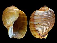
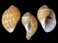
- Tonna cumingii (Reeve, 1849)
Height 90mm, Width 65mm
Marine, The species currently classified as Tonna cumingii in New Zealand could possibly be a new/different species or even more than one species. Until further research has been published, the current name of Tonna cumingii is used here
East Coast Northland
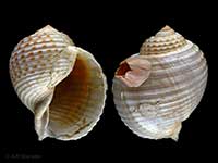
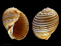
A - Tonna dolium (Lamarck, 1822)
Height 110mm, Width 95mm
Marine
Indo-Pacific, Indian Ocean, Indonesia, Japa, Philippines, Fiji and northern part of North Island
A - Tonna melanostoma (Jay, 1839)
Height 180mm, Width 145mm
Marine, Distinguished by dark-brown spreading parietal callus
Hawaiian Islands to Tonga, Society Islands, Melanesia and Northland east coast
KA - Tonna perdix (Linnaeus, 1758)
Height 225mm
Marine
Indo-Western Pacific, Kermadec Islands and Northland
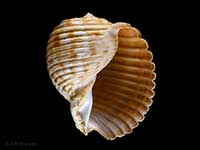
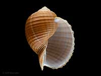
KA - Tonna tankervillii (Hanley, 1860)
Height 250mm, Width 210mm
Common Cask or Tun Shell, Marine, Characterised by a deep canaliculate suture
Northland to Hawkes Bay and Mahia Peninsula. Washups on sandy beaches and alive below low tide
AC - Tonna tetracotula Hedley, 1919
Height 200mm, Width 150mm
Marine
Outer Hauraki Gulf to Bay of Plenty. Also Australia, Queensland to Victoria
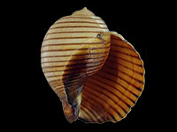
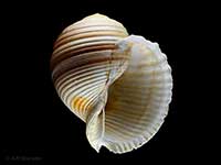
A - Tonna zonata (Green, 1830)
Height 200mm, Width 155mm
Marine
Nortern part of North Island, to western Bay of Plenty. Also Indian Ocean, Japan
A
Key to Geographical Ranges
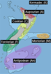
The symbols K.A.C.F.M.An. are used to indicate the geographical range of the species.
They have been adopted to give an approximation of the range of each species within New Zealand.
K=
Kermadec Islands
A=
Aupourian - Kaipara Harbour, north around North Cape, encompassing the Three Kings Islands and south to East Cape
C=
Cookian - Lower North Island and the northern part of the South Island
F=
Forsterian - Otago, Fiordland and Stewart Island
M=
Moriorian - Chatham Islands, Pitt Island
An=
Antipodean - Subantarctic Islands of New Zealand
Fw =
Freshwater
L =
Land
N =
North Island
S =
South Island
R =
Recent
Sf =
Subfossil
Fo =
Fossil
