Compare Xeroplexa intersecta
| toggle to add to compare list |
Taxonomy
Family: Subfamily: GEOMITRIDAE: HELICELLINAE Full Classification: Mollusca (Phylum) > Gastropoda (Class) > Heterobranchia (Subclass) > Euthyneura (Infraclass) > Tectipleura (Subterclass) > Eupulmonata (Superorder) > Stylommatophora (Order) > Helicina (Suborder) > Helicoidei (Infraorder) > Helicoidea (Superfamily) > Geomitridae (Family) > Helicellinae (Subfamily) > Xeroplexa (Genus) > intersecta (Species) Synonymised Names: =Candidula intersecta (Poiret, 1801) =Helix (Xerophila) caperata (Montagu, 1803) =Helix caperata Montagu, 1803 |
Images: Xeroplexa intersecta (Pioret, 1801)
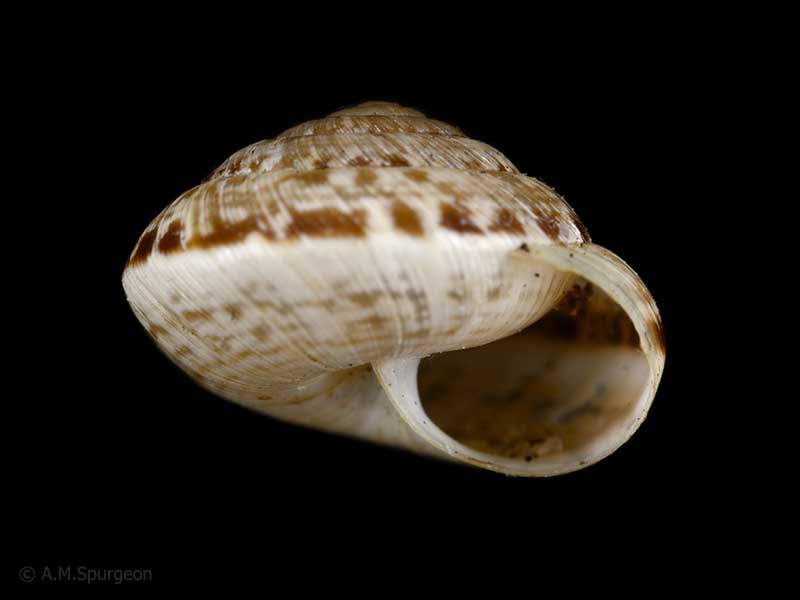
In sand dunes, Papamoa Beach, Bay of Plenty, NZ. 8mm
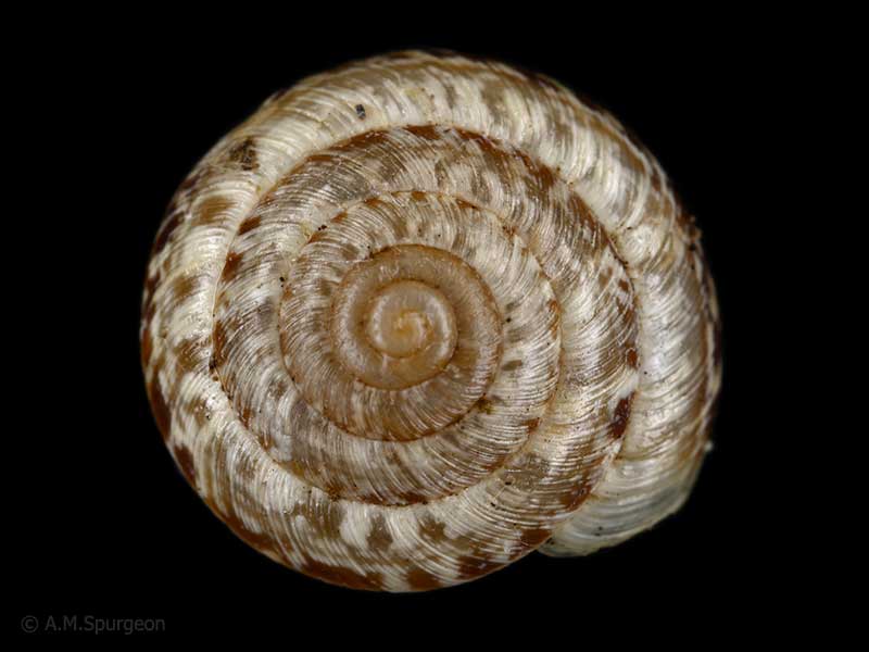
In sand dunes, Papamoa Beach, Bay of Plenty, NZ. 8mm
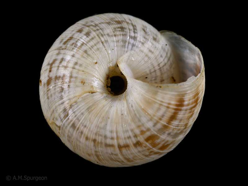
In sand dunes, Papamoa Beach, Bay of Plenty, NZ. 8mm
Taxonomy
Family: Subfamily: GEOMITRIDAE: HELICELLINAE Full Classification: Mollusca (Phylum) > Gastropoda (Class) > Heterobranchia (Subclass) > Euthyneura (Infraclass) > Tectipleura (Subterclass) > Eupulmonata (Superorder) > Stylommatophora (Order) > Helicina (Suborder) > Helicoidei (Infraorder) > Helicoidea (Superfamily) > Geomitridae (Family) > Helicellinae (Subfamily) > Xeroplexa (Genus) > intersecta (Species) Synonymised Names: =Candidula intersecta (Poiret, 1801) =Helix (Xerophila) caperata (Montagu, 1803) =Helix caperata Montagu, 1803 |
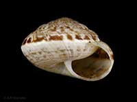
Details: Xeroplexa intersecta (Pioret, 1801)
Size/Grows to:
Width 12mm, Height 7mm
Distribution:
North and South Island. Native to western Europe, from the British Isles, western and northern France, Belgium, and the Netherlands, to scattered localities in Portugal, Germany, Denmark, and southern Sweden. Introduced into Australia and New Zealand
Geographical Range:
L.N.S.
Notes:
Species Links
Distribution Map
References and Publications
- Barker, G.M. 1999 Naturalised Terrestrial Stylommatophora (Mollusca: Gastropoda), Fauna of New Zealand, Manaaki Whenua Press (p.73)
- Goulstone, J.F., Mayhill, P.C., Parrish, G.R. 1993 An Illustrated Guide to the Land Mollusca of the Te Paki ecological region, Northland, New Zealand, New Zealand Journal of Zoology, 34 (p.24)
- Stelfox, A.W. 1912 The Occurrence of Helicella heripensis (Mabille) in Great Britain, Proceedings of the Malacological Society of London, 10(1) (p.39)
Key to Geographical Ranges

The symbols K.A.C.F.M.An. are used to indicate the geographical range of the species.
They have been adopted to give an approximation of the range of each species within New Zealand.
K=
Kermadec Islands
A=
Aupourian - Kaipara Harbour, north around North Cape, encompassing the Three Kings Islands and south to East Cape
C=
Cookian - Lower North Island and the northern part of the South Island
F=
Forsterian - Otago, Fiordland and Stewart Island
M=
Moriorian - Chatham Islands, Pitt Island
An=
Antipodean - Subantarctic Islands of New Zealand
Fw =
Freshwater
L =
Land
N =
North Island
S =
South Island
R =
Recent
Sf =
Subfossil
Fo =
Fossil
Recently Viewed
Compare Species (
/6)