Compare Oxychilus cellarius
| toggle to add to compare list |
Taxonomy
Family: OXYCHILIDAE Full Classification: Mollusca (Phylum) > Gastropoda (Class) > Heterobranchia (Subclass) > Euthyneura (Infraclass) > Tectipleura (Subterclass) > Eupulmonata (Superorder) > Stylommatophora (Order) > Helicina (Suborder) > Limacoidei (Infraorder) > Gastrodontoidea (Superfamily) > Oxychilidae (Family) > Oxychilus (Genus) > cellarius (Species) Synonymised Names: =Oxychilus cellaria (O.F. Müller, 1774) =Suterella novare (L. Pfeiffer, 1862) |
Images: Oxychilus cellarius (O.F. Müller, 1774)
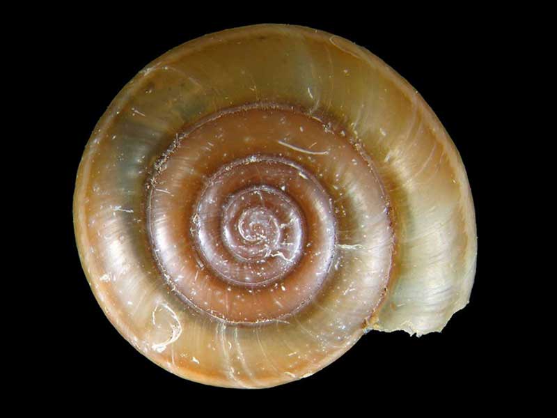
Libby's Reserve, Great Mercury Island, Bay of Plenty, NZ. 10.6mm. Reproduced courtesy of iNaturalist.nz ©openlabnz (D.J.Roscoe)
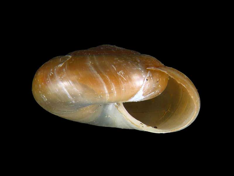
Libby's Reserve, Great Mercury Island, Bay of Plenty, NZ. 10.6mm. Reproduced courtesy of iNaturalist.nz ©openlabnz (D.J.Roscoe)
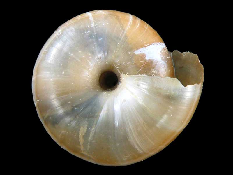
Libby's Reserve, Great Mercury Island, Bay of Plenty, NZ. 10.6mm. Reproduced courtesy of iNaturalist.nz ©openlabnz (D.J.Roscoe)
Taxonomy
Family: OXYCHILIDAE Full Classification: Mollusca (Phylum) > Gastropoda (Class) > Heterobranchia (Subclass) > Euthyneura (Infraclass) > Tectipleura (Subterclass) > Eupulmonata (Superorder) > Stylommatophora (Order) > Helicina (Suborder) > Limacoidei (Infraorder) > Gastrodontoidea (Superfamily) > Oxychilidae (Family) > Oxychilus (Genus) > cellarius (Species) Synonymised Names: =Oxychilus cellaria (O.F. Müller, 1774) =Suterella novare (L. Pfeiffer, 1862) |
Details: Oxychilus cellarius (O.F. Müller, 1774)
Size/Grows to:
Width 14mm, Height 6mm
Distribution:
North and South Island
Geographical Range:
L.N.S.
Notes:
Species Links
Distribution Map
References and Publications
- Barker, G.M. 1999 Naturalised Terrestrial Stylommatophora (Mollusca: Gastropoda), Fauna of New Zealand, Manaaki Whenua Press (p.111)
- Powell, A.W.B. 1979 New Zealand Mollusca: Marine, Land and Freshwater Shells, Collins, Auckland (p.449)
Key to Geographical Ranges

The symbols K.A.C.F.M.An. are used to indicate the geographical range of the species.
They have been adopted to give an approximation of the range of each species within New Zealand.
K=
Kermadec Islands
A=
Aupourian - Kaipara Harbour, north around North Cape, encompassing the Three Kings Islands and south to East Cape
C=
Cookian - Lower North Island and the northern part of the South Island
F=
Forsterian - Otago, Fiordland and Stewart Island
M=
Moriorian - Chatham Islands, Pitt Island
An=
Antipodean - Subantarctic Islands of New Zealand
Fw =
Freshwater
L =
Land
N =
North Island
S =
South Island
R =
Recent
Sf =
Subfossil
Fo =
Fossil
Recently Viewed
Compare Species (
/6)