Compare Bulla quoyii
| toggle to add to compare list |
Taxonomy
Family: BULLIDAE Full Classification: Genus Synonyms: =Bulla (Quibulla) Iredale, 1929 =Bullaria Rafinesque, 1815 =Quibulla Iredale, 1929 =Vesica Swainson, 1840 Synonymised Names: =Bulla australis Gray, 1825 =Bulla botanica (Hedley, 1918) =Bulla castanea A. Adams, 1850 =Bulla dubiosa Mabille, 1896 =Bulla oblonga A. Adams, 1850 =Bulla substriata Menke, 1853 =Bulla tenuissima G.B. Sowerby II, 1868 =Bullaria botanica Hedley, 1918 =Quibulla botanica (Hedley, 1918) =Quibulla quoyii (Gray, 1843) |
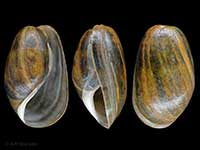
Images: Bulla quoyii Gray in Dieffenbach, 1843
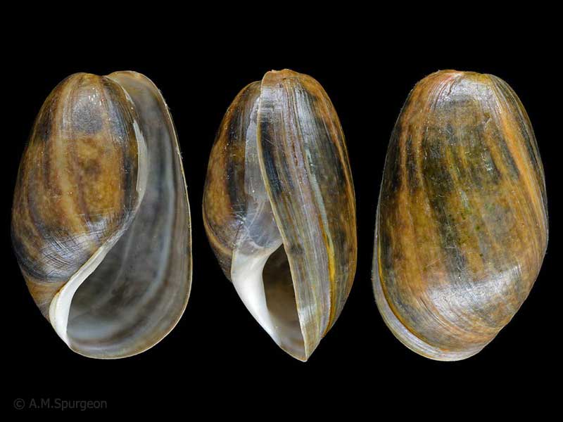
Parengarenga Harbour, Far North. 53mm
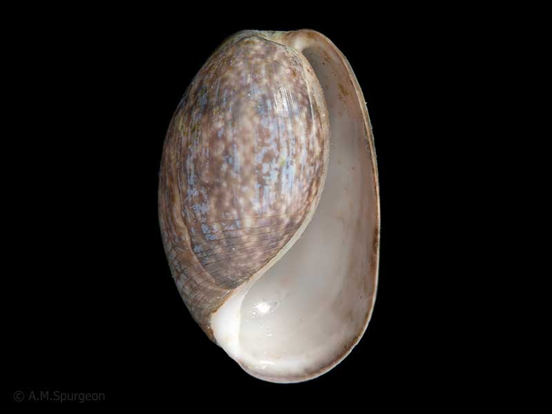
On sea grass, Parengarenga Harbour, Far North, NZ. 36mm
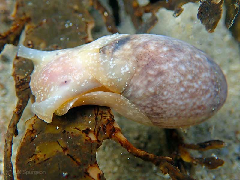
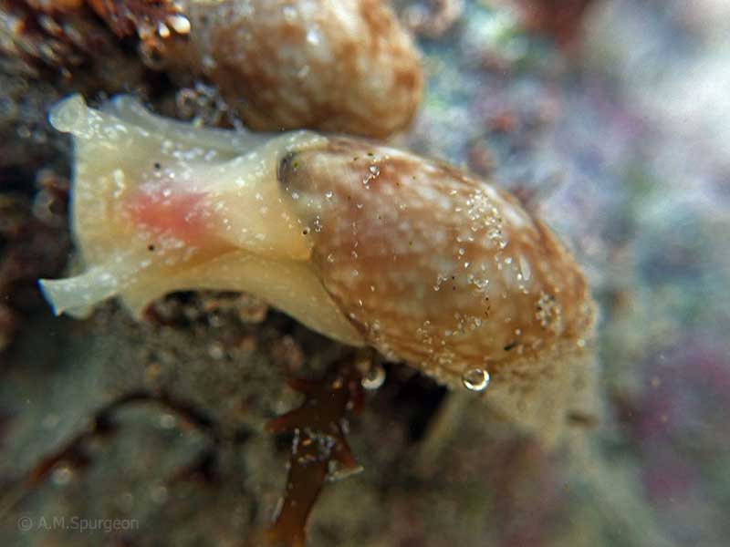
Alive in shallow sandy rock pools at low tide. Henderson Bay, Far North, NZ. 30-40mm
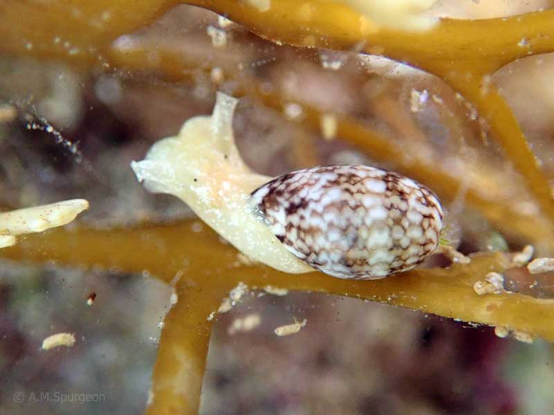
Crawling on seaweed at low tide, Henderson Bay, Far North, NZ. 10mm
Alive in shallow rock pools at low tide. Far North, NZ. 15mm
Taxonomy
Family: BULLIDAE Full Classification: Genus Synonyms: =Bulla (Quibulla) Iredale, 1929 =Bullaria Rafinesque, 1815 =Quibulla Iredale, 1929 =Vesica Swainson, 1840 Synonymised Names: =Bulla australis Gray, 1825 =Bulla botanica (Hedley, 1918) =Bulla castanea A. Adams, 1850 =Bulla dubiosa Mabille, 1896 =Bulla oblonga A. Adams, 1850 =Bulla substriata Menke, 1853 =Bulla tenuissima G.B. Sowerby II, 1868 =Bullaria botanica Hedley, 1918 =Quibulla botanica (Hedley, 1918) =Quibulla quoyii (Gray, 1843) |
Details: Bulla quoyii Gray in Dieffenbach, 1843
Size/Grows to:
Height 66mm, Width 37mm
Distribution:
North Island and Kermadec Islands
Geographical Range:
KAC
Notes:
Species Links
Distribution Map
References and Publications
- Morley, M.S., Hayward, B.W. 2015 Intertidal records of 'sea slugs' (nudibranchs and allied opisthobranch gastropods) from northern North Island, New Zealand, Records of the Auckland Institute and Museum, 50 (p.57)
- Malaquias, M.A.E., Reid, D.G. 2008 Systematic revision of the living species of Bullidae (Mollusca: Gastropoda: Cephalaspidea), with a molecular phylogenetic analysis, Zoological Journal of the Linnean Society, 153(3) (p.524)
- Powell, A.W.B. 1979 New Zealand Mollusca: Marine, Land and Freshwater Shells, Collins, Auckland (p.275)
- Willan, R.C. 1978 The nomenclature of three Pacific Bulla species, Journal of the Malacological Society of Australia, 4(1) (p.58)
Key to Geographical Ranges

The symbols K.A.C.F.M.An. are used to indicate the geographical range of the species.
They have been adopted to give an approximation of the range of each species within New Zealand.
K=
Kermadec Islands
A=
Aupourian - Kaipara Harbour, north around North Cape, encompassing the Three Kings Islands and south to East Cape
C=
Cookian - Lower North Island and the northern part of the South Island
F=
Forsterian - Otago, Fiordland and Stewart Island
M=
Moriorian - Chatham Islands, Pitt Island
An=
Antipodean - Subantarctic Islands of New Zealand
Fw =
Freshwater
L =
Land
N =
North Island
S =
South Island
R =
Recent
Sf =
Subfossil
Fo =
Fossil
Recently Viewed
Compare Species (
/6)