Compare Cominella virgata
| toggle to add to compare list |
Taxonomy
Family: COMINELLIDAE Full Classification: Mollusca (Phylum) > Gastropoda (Class) > Caenogastropoda (Subclass) > Neogastropoda (Order) > Buccinoidea (Superfamily) > Cominellidae (Family) > Cominella (Genus) > virgata (Species) Synonymised Names: =Buccinum lineolatum Quoy & Gaimard, 1833 =Cominella (Cominula) virgata H. & A. Adams, 1853 accepted, alternate representation =Cominella (Cominula) virgata brookesi Powell, 1952 accepted, alternate representation =Cominella (Josepha) virgata H. & A. Adams, 1853 =Cominella virgata brookesi Powell, 1952 =Cominella virgata virgata H. & A. Adams, 1853 |
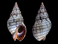
Images: Cominella virgata H. & A. Adams, 1853
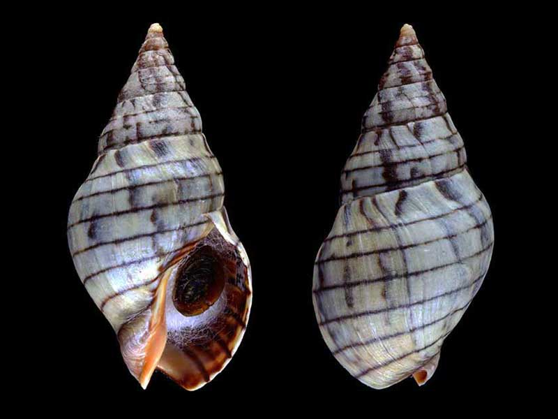
Bland Bay, Northland, 10 metres. 35mm
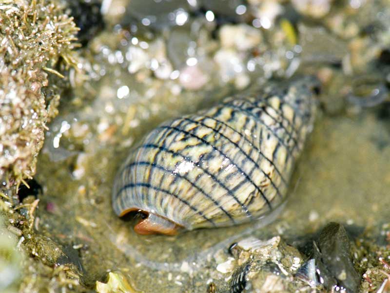
In a shallow rock pool, north of Auckland
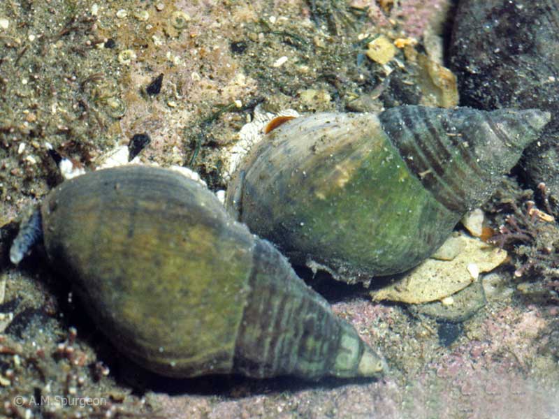
In a shallow rock pool, Tauranga, Bay of Plenty, NZ
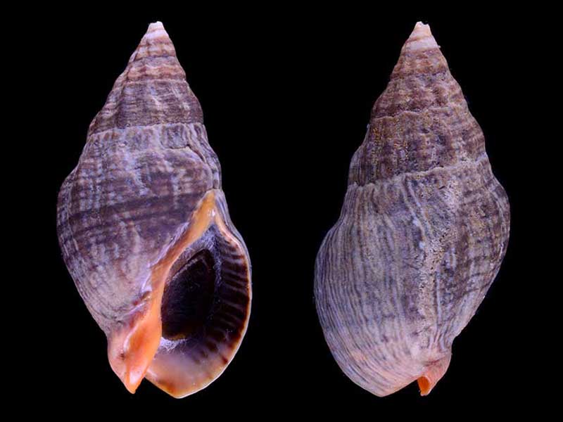
(brookesi form) - From the Far North, NZ. 30mm
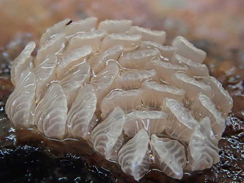
Eggs, under a rock at low tide. Houhora Heads, Far North, NZ
Taxonomy
Family: COMINELLIDAE Full Classification: Mollusca (Phylum) > Gastropoda (Class) > Caenogastropoda (Subclass) > Neogastropoda (Order) > Buccinoidea (Superfamily) > Cominellidae (Family) > Cominella (Genus) > virgata (Species) Synonymised Names: =Buccinum lineolatum Quoy & Gaimard, 1833 =Cominella (Cominula) virgata H. & A. Adams, 1853 accepted, alternate representation =Cominella (Cominula) virgata brookesi Powell, 1952 accepted, alternate representation =Cominella (Josepha) virgata H. & A. Adams, 1853 =Cominella virgata brookesi Powell, 1952 =Cominella virgata virgata H. & A. Adams, 1853 |
Details: Cominella virgata H. & A. Adams, 1853
Size/Grows to:
Height 43mm, Width 20mm
Distribution:
North Island and upper South Island
Notes:
Species Links
Distribution Map
References and Publications
- Powell, A.W.B. 1979 New Zealand Mollusca: Marine, Land and Freshwater Shells, Collins, Auckland (p.193)
- Douglas, W.N. Mar/1970 Cominella virgata, Poirieria, 5(3)
*98 © Museum of New Zealand Te Papa Tongarewa (CC-BY-NC-ND)
NZ Geographical Regions

Key to symbols used in Checklist.
Fw =
Freshwater
L =
Land
N =
North Island
S =
South Island
R =
Recent
Sf =
Subfossil
Fo =
Fossil
Recently Viewed
Compare Species (
/6)