Compare Cominella adspersa
| toggle to add to compare list |
Taxonomy
Family: COMINELLIDAE Full Classification: Mollusca (Phylum) > Gastropoda (Class) > Caenogastropoda (Subclass) > Neogastropoda (Order) > Buccinoidea (Superfamily) > Cominellidae (Family) > Cominella (Genus) > adspersa (Species) Synonymised Names: =Acominia adspersa (Bruguière, 1789) =Acominia adspersa nimia Finlay, 1928 =Buccinum adspersum Bruguière, 1789 =Buccinum maculatum Martyn, 1784 =Buccinum melo Lesson, 1840 =Buccinum quoyii Kiener, 1834 =Buccinum turgitum Gmelin, 1791 =Cominella (Cominella) adspersa (Bruguière, 1789) accepted, alternate representation =Cominella maculata (Gray, 1835) =Cominella maculata melo (Lesson, 1840) =Purpura maculata Gray, 1835 |
Images: Cominella adspersa (Bruguière, 1789)

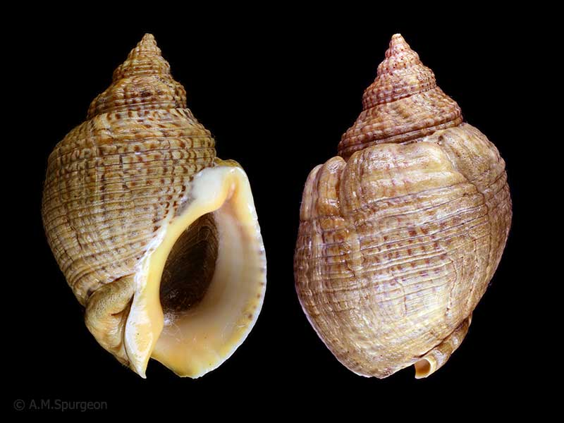
(melo form) - Parengarenga Harbour, Far North, NZ. 46mm
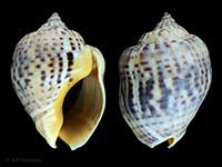
Whangarei Heads, Northland, NZ. 52mm
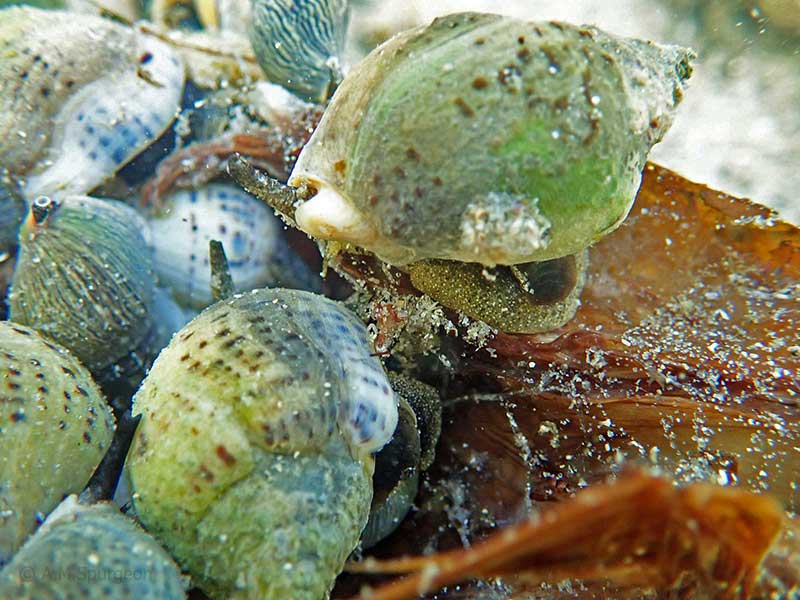
Intertidal, Northland, NZ
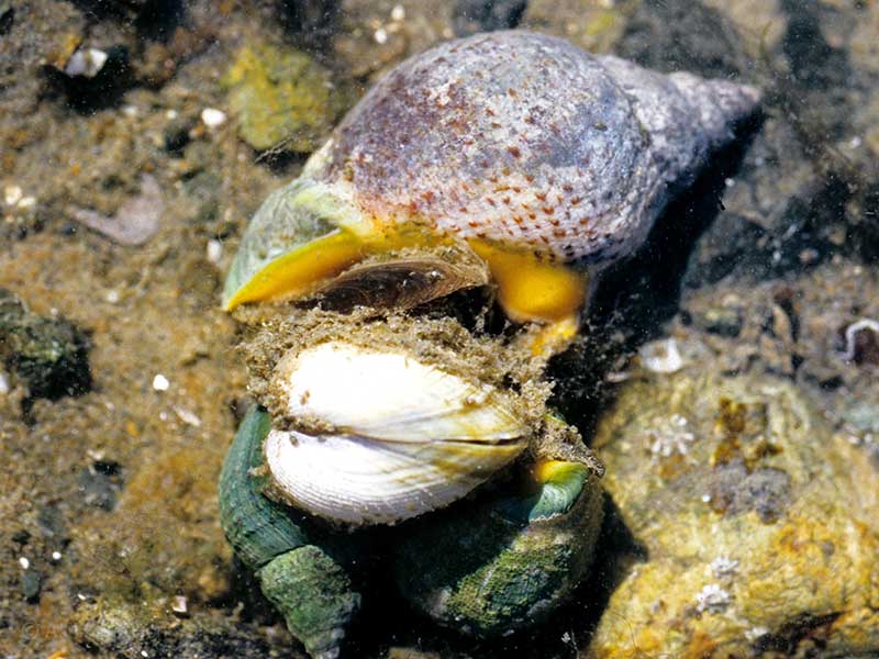
A group devouring some decaying fish, Henderson Bay, Far North, NZ. 30-40mm
Taxonomy
Family: COMINELLIDAE Full Classification: Mollusca (Phylum) > Gastropoda (Class) > Caenogastropoda (Subclass) > Neogastropoda (Order) > Buccinoidea (Superfamily) > Cominellidae (Family) > Cominella (Genus) > adspersa (Species) Synonymised Names: =Acominia adspersa (Bruguière, 1789) =Acominia adspersa nimia Finlay, 1928 =Buccinum adspersum Bruguière, 1789 =Buccinum maculatum Martyn, 1784 =Buccinum melo Lesson, 1840 =Buccinum quoyii Kiener, 1834 =Buccinum turgitum Gmelin, 1791 =Cominella (Cominella) adspersa (Bruguière, 1789) accepted, alternate representation =Cominella maculata (Gray, 1835) =Cominella maculata melo (Lesson, 1840) =Purpura maculata Gray, 1835 |
Details: Cominella adspersa (Bruguière, 1789)
Size/Grows to:
Height 74mm, Width 45mm
Distribution:
North Island, northern part of South Island and Chatham Islands
Notes:
Species Links
Distribution Map
References and Publications
- O'Shea, S. Apr/1985 Variation in shell shape in Cominella adspersa, Poirieria, 14(1) (p.3)
- Powell, A.W.B. 1979 New Zealand Mollusca: Marine, Land and Freshwater Shells, Collins, Auckland (p.192)
NZ Geographical Regions

Key to symbols used in Checklist.
Fw =
Freshwater
L =
Land
N =
North Island
S =
South Island
R =
Recent
Sf =
Subfossil
Fo =
Fossil
Recently Viewed
Compare Species (
/6)