Compare Cabestana tabulata
| toggle to add to compare list |
Taxonomy
Family: CYMATIIDAE Full Classification: Mollusca (Phylum) > Gastropoda (Class) > Caenogastropoda (Subclass) > Littorinimorpha (Order) > Tonnoidea (Superfamily) > Cymatiidae (Family) > Cabestana (Genus) > tabulata (Species) Synonymised Names: =Cabestana (Cymatilesta) otagoensis Powell, 1954 =Cabestana debelior Finlay, 1930 =Cabestana manawatuna C.A. Fleming, 1943 =Cabestana otagoensis Powell, 1954 =Cabestana waterhousei (A. Adams & Angas, 1864) =Cabestana waterhousei segregata Powell, 1933 =Cymatilesta waterhousei tepida Iredale, 1936 =Cymatium waterhousei (A. Adams & Angas, 1864) =Cymatium waterhousei frigidulum Iredale, 1929 =Triton tabulata Menke, 1843 =Triton waterhousei A. Adams & Angas, 1864 |
Images: Cabestana tabulata (Menke, 1843)
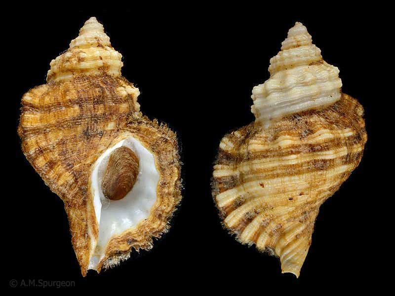
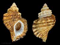
From shallow water Whangarei Heads, Northland, NZ. 47mm
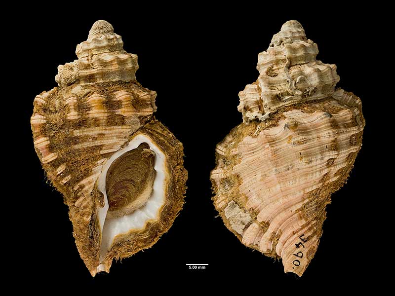
Holotype of Cabestana waterhousei segregata Powell, collected near Cornwallis, Manukau Harbour, Auckland, NZ (MA72036). © Auckland Museum (CC-BY)
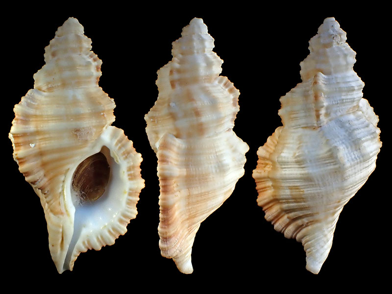
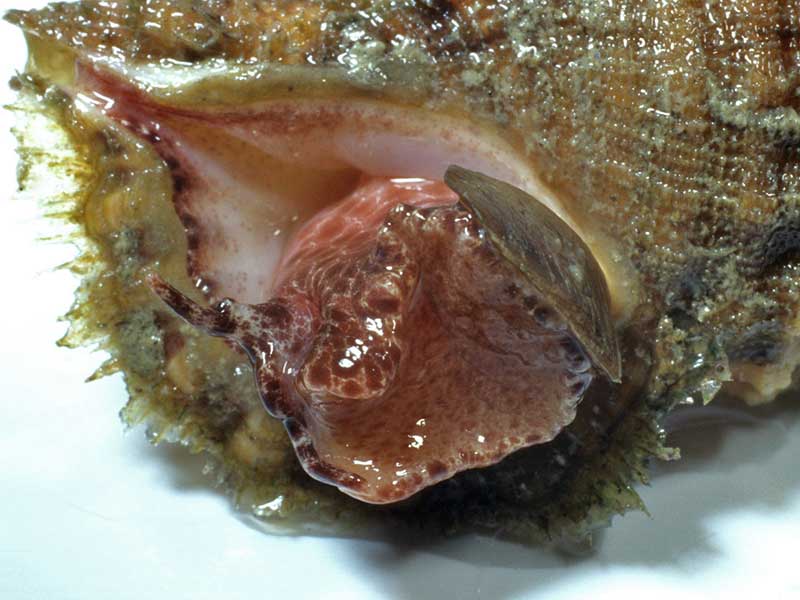
Dredged in approx. 50 metres, Foveaux Strait, NZ
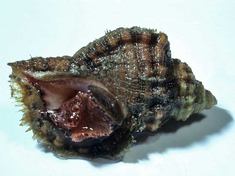
Low tide, Whangarei Heads, Northland, NZ. 47mm
Whangarei Heads, Northland, NZ. 47mm
Taxonomy
Family: CYMATIIDAE Full Classification: Mollusca (Phylum) > Gastropoda (Class) > Caenogastropoda (Subclass) > Littorinimorpha (Order) > Tonnoidea (Superfamily) > Cymatiidae (Family) > Cabestana (Genus) > tabulata (Species) Synonymised Names: =Cabestana (Cymatilesta) otagoensis Powell, 1954 =Cabestana debelior Finlay, 1930 =Cabestana manawatuna C.A. Fleming, 1943 =Cabestana otagoensis Powell, 1954 =Cabestana waterhousei (A. Adams & Angas, 1864) =Cabestana waterhousei segregata Powell, 1933 =Cymatilesta waterhousei tepida Iredale, 1936 =Cymatium waterhousei (A. Adams & Angas, 1864) =Cymatium waterhousei frigidulum Iredale, 1929 =Triton tabulata Menke, 1843 =Triton waterhousei A. Adams & Angas, 1864 |
Details: Cabestana tabulata (Menke, 1843)
Size/Grows to:
Height 91mm, Width 52mm
Distribution:
Australia, Lord Howe Island and New Zealand. Raoul Island, North Island, northern South Island and Chatham Islands
Notes:
Species Links
Distribution Map
References and Publications
- Brook, F.J., Marshall, B.A. 1998 The coastal molluscan fauna of the northern Kermadec Islands, southwest Pacific Ocean, Journal of the Royal Society of New Zealand, 28 (p.220)
- Beu, A.G., Maxwell, P.A. 1990 Cenozoic Mollusca of New Zealand, New Zealand Geological Survey, 58 (p.354)
- Douglas, W.N. Aug/1985 Periostracum preservation, Poirieria, 14(2) (p.11)
- Powell, A.W.B. 1979 New Zealand Mollusca: Marine, Land and Freshwater Shells, Collins, Auckland (p.164)
- Dec/1964 Cabestana from Deep Water, off Bluff, Foveaux Strait, Poirieria, 2(3) (p.47)
- Powell, A.W.B. 1926 On a large Tonna and two other Gastropods of Australian origins, Transactions and Proceedings of the Royal Society of New Zealand, 57 (p.560)
NZ Geographical Regions

Key to symbols used in Checklist.
Fw =
Freshwater
L =
Land
N =
North Island
S =
South Island
R =
Recent
Sf =
Subfossil
Fo =
Fossil
Recently Viewed
Compare Species (
/6)