Compare Trichosirius inornatus
| toggle to add to compare list |
Taxonomy
Family: CAPULIDAE Full Classification: Mollusca (Phylum) > Gastropoda (Class) > Caenogastropoda (Subclass) > Littorinimorpha (Order) > Capuloidea (Superfamily) > Capulidae (Family) > Trichosirius (Genus) > inornatus (Species) Synonymised Names: =Trichosirius (Trichosirius) inornatus (Hutton, 1873) accepted, alternate representation =Trichosirius inornatus chathamensis Finlay, 1928 =Trichotropis clathrata G.B. Sowerby II, 1874 =Trichotropis inornata Hutton, 1873 |
Images: Trichosirius inornatus (Hutton, 1873)
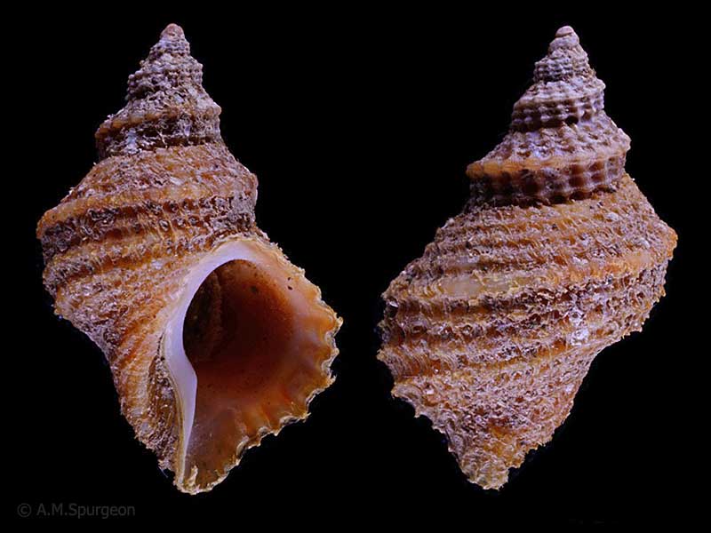
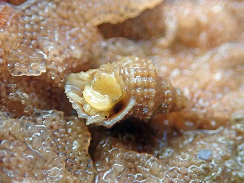
Alive under stones below low tide. Bay of Islands, Northland, NZ. 12mm
Alive under stones, Bay of Islands, Northland, NZ. 12mm
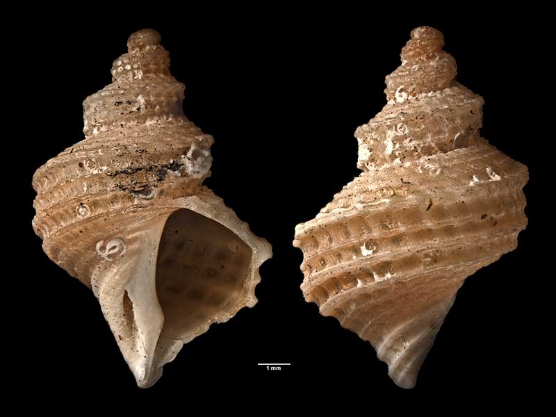
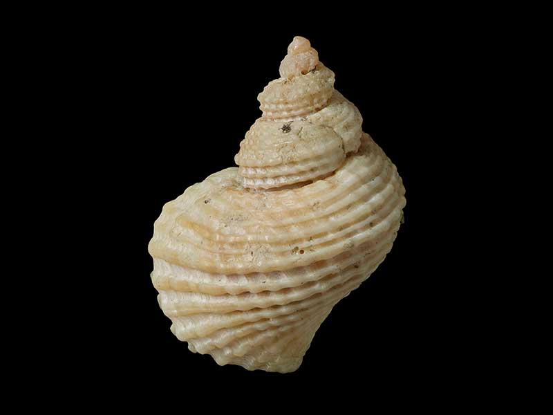
Holotype of Trichosirius inornatus chathamensis Finlay, collected Waitangi, Chatham Islands, NZ (MA70772). © Auckland Museum (CC-BY)
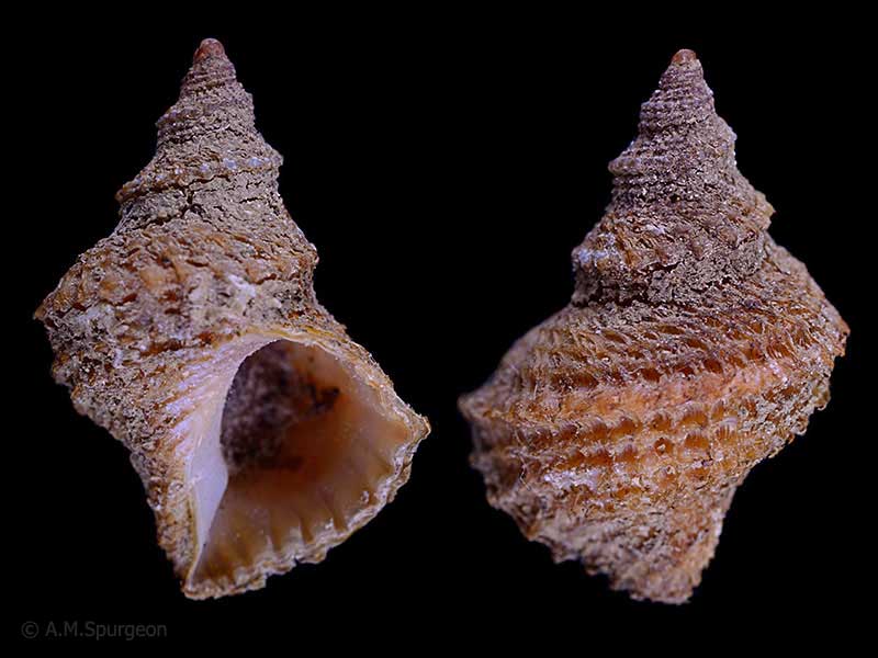
Alive under a rock, Houhora Heads, Far North, NZ. 10mm
Alive under a rock, Houhora Heads, Far North, NZ. 10mm
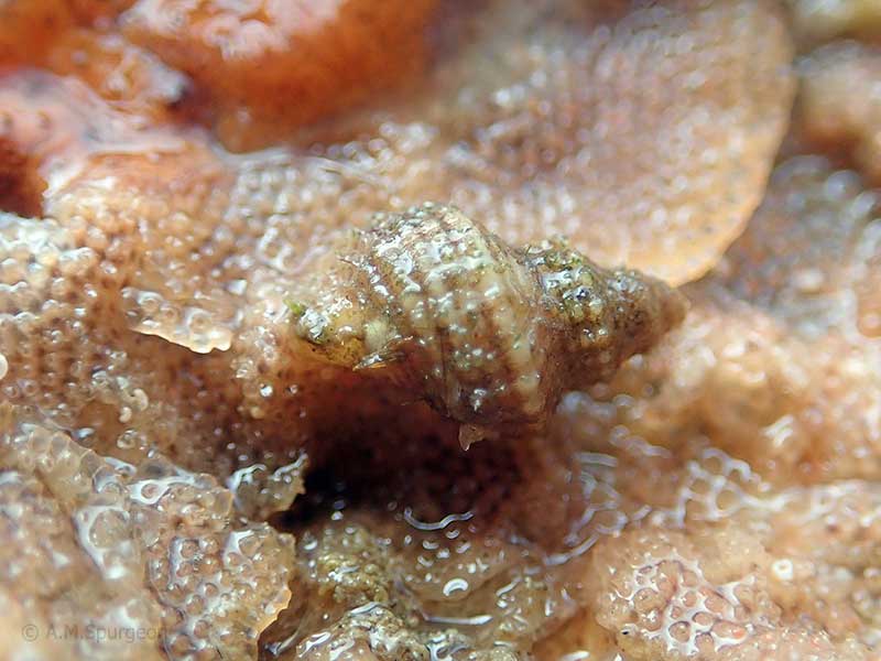
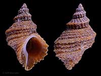
Collected Falcon Shoal, Wellington Harbour, NZ (M.002449). © Museum of New Zealand Te Papa Tongarewa (CC-BY-NC-ND)
Taxonomy
Family: CAPULIDAE Full Classification: Mollusca (Phylum) > Gastropoda (Class) > Caenogastropoda (Subclass) > Littorinimorpha (Order) > Capuloidea (Superfamily) > Capulidae (Family) > Trichosirius (Genus) > inornatus (Species) Synonymised Names: =Trichosirius (Trichosirius) inornatus (Hutton, 1873) accepted, alternate representation =Trichosirius inornatus chathamensis Finlay, 1928 =Trichotropis clathrata G.B. Sowerby II, 1874 =Trichotropis inornata Hutton, 1873 |
Details: Trichosirius inornatus (Hutton, 1873)
Size/Grows to:
Height 22mm, Width 14mm
Distribution:
North, South, Stewart and Chatham Islands, from low tide to 200 metres
Notes:
Species Links
Distribution Map
References and Publications
- Powell, A.W.B. 1979 New Zealand Mollusca: Marine, Land and Freshwater Shells, Collins, Auckland (p.147)
- Hutton, F.W. 1873 Catalogue of the Marine Mollusca of New Zealand, with diagnoses of the species, Dominion Museum (NZ) Original Description
NZ Geographical Regions

Key to symbols used in Checklist.
Fw =
Freshwater
L =
Land
N =
North Island
S =
South Island
R =
Recent
Sf =
Subfossil
Fo =
Fossil
Recently Viewed
Compare Species (
/6)