Compare Trochus camelophorus
| toggle to add to compare list |
Taxonomy
Family: Subfamily: TROCHIDAE: TROCHINAE Full Classification: Genus Synonyms: =Camelotrochus B.A. Marshall, 1998 =Trochus (Camelotrochus) B.A. Marshall, 1998 accepted, alternate representation Synonymised Names: =Trochus (Camelotrochus) camelophorus Webster, 1906 accepted, alternate representation |
Images: Trochus camelophorus Webster, 1906
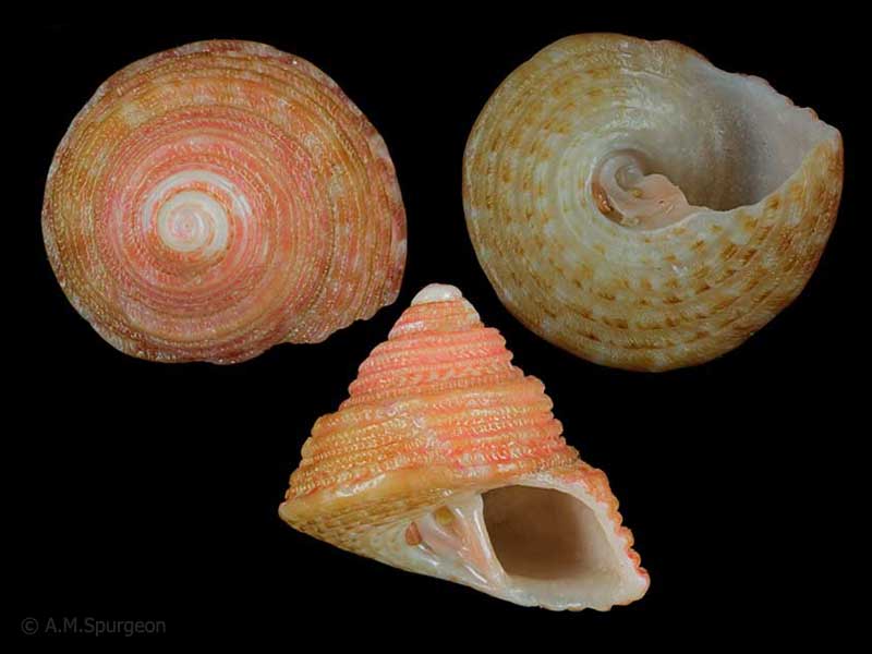
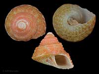
In beach drift from the Far North, NZ. 11mm
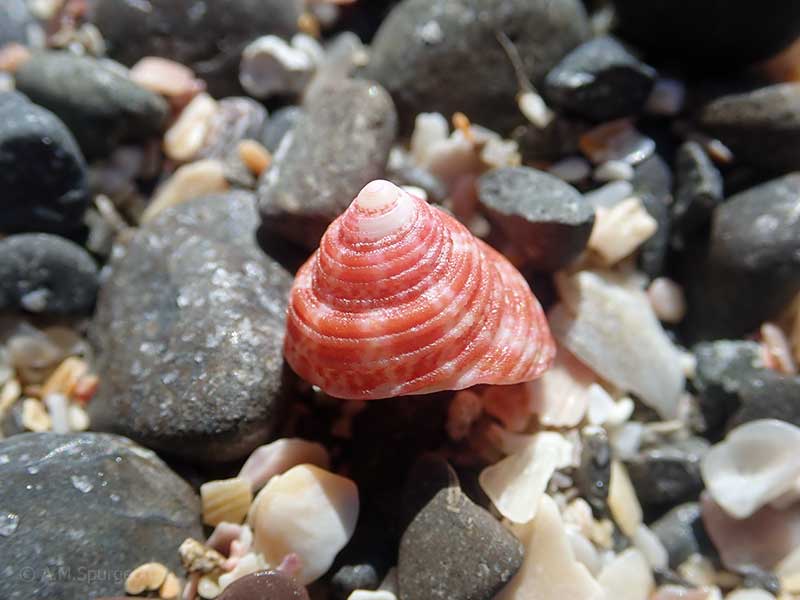
In beach drift from the Far North, NZ. 10mm
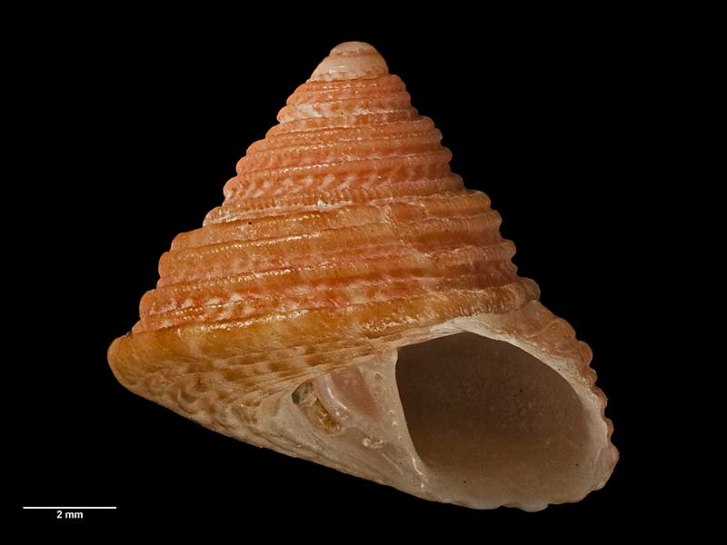
Holotype, collected pre 1929, Cape Maria van Diemen, Far North, NZ (MA70776). © Auckland Museum (CC-BY)
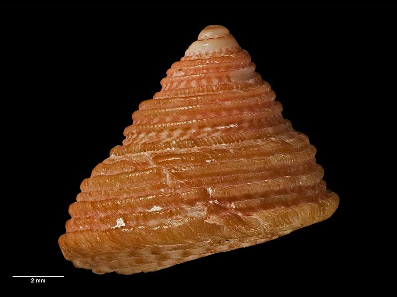
Holotype, collected pre 1929, Cape Maria van Diemen, Far North, NZ (MA70776). © Auckland Museum (CC-BY)
Taxonomy
Family: Subfamily: TROCHIDAE: TROCHINAE Full Classification: Genus Synonyms: =Camelotrochus B.A. Marshall, 1998 =Trochus (Camelotrochus) B.A. Marshall, 1998 accepted, alternate representation Synonymised Names: =Trochus (Camelotrochus) camelophorus Webster, 1906 accepted, alternate representation |
Details: Trochus camelophorus Webster, 1906
Size/Grows to:
Width 13mm, Height 11mm
Distribution:
Off Three Kings Islands, Northland to East Cape. 0-228 metres and in beach drift
Geographical Range:
A
Notes:
Species Links
Distribution Map
References and Publications
- Marshall, B.A. 1998 A review of the Recent Trochini of New Zealand (Mollusca: Gastropoda: Trochidae), Molluscan Research, 19 (p.81)
- Powell, A.W.B. 1979 New Zealand Mollusca: Marine, Land and Freshwater Shells, Collins, Auckland (p.58)
- Webster, W.H. 1906 Additions to the New Zealand fauna, Transactions of the New Zealand Institute, 38 (p.309) Original Description
*98 © Museum of New Zealand Te Papa Tongarewa (CC-BY-NC-ND)
Key to Geographical Ranges

The symbols K.A.C.F.M.An. are used to indicate the geographical range of the species.
They have been adopted to give an approximation of the range of each species within New Zealand.
K=
Kermadec Islands
A=
Aupourian - Kaipara Harbour, north around North Cape, encompassing the Three Kings Islands and south to East Cape
C=
Cookian - Lower North Island and the northern part of the South Island
F=
Forsterian - Otago, Fiordland and Stewart Island
M=
Moriorian - Chatham Islands, Pitt Island
An=
Antipodean - Subantarctic Islands of New Zealand
Fw =
Freshwater
L =
Land
N =
North Island
S =
South Island
R =
Recent
Sf =
Subfossil
Fo =
Fossil
Recently Viewed
Compare Species (
/6)