Compare Coelotrochus tiaratus
| toggle to add to compare list |
Taxonomy
Family: Subfamily: TROCHIDAE: TROCHINAE Full Classification: Mollusca (Phylum) > Gastropoda (Class) > Vetigastropoda (Subclass) > Trochida (Order) > Trochoidea (Superfamily) > Trochidae (Family) > Trochinae (Subfamily) > Coelotrochus (Genus) > tiaratus (Species) Genus Synonyms: =Anthora Gray, 1857 =Chlorostoma (Neozelandia) Cossmann, 1918 =Thorista Iredale, 1915 =Thoristella Iredale, 1915 =Trochus (Anthora) Gray, 1857 =Trochus (Coelotrochus) P. Fischer, 1879 =Trochus (Thorista) Iredale, 1915 Synonymised Names: =Anthora conica Hutton, 1882 =Chlorostoma (Neozelandia) huttoni Cossmann, 1918 =Polydonta elegans Gray, 1835 =Trochus (Coelotrochus) tiaratus Quoy & Gaimard, 1834 =Trochus delicatulus Philippi, 1846 =Trochus tiaratus Quoy & Gaimard, 1834 |
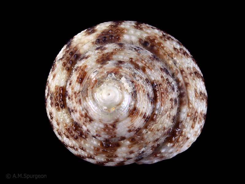
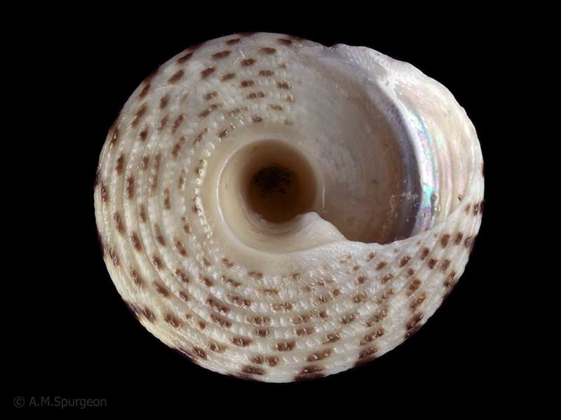
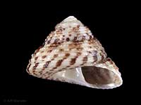
Images: Coelotrochus tiaratus (Quoy & Gaimard, 1834)

In beach drift, Kaimaumau, Far North, NZ. 16mm
In beach drift, Kaimaumau, Far North, NZ. 16mm
In beach drift, Kaimaumau, Far North, NZ. 16mm
Taxonomy
Family: Subfamily: TROCHIDAE: TROCHINAE Full Classification: Mollusca (Phylum) > Gastropoda (Class) > Vetigastropoda (Subclass) > Trochida (Order) > Trochoidea (Superfamily) > Trochidae (Family) > Trochinae (Subfamily) > Coelotrochus (Genus) > tiaratus (Species) Genus Synonyms: =Anthora Gray, 1857 =Chlorostoma (Neozelandia) Cossmann, 1918 =Thorista Iredale, 1915 =Thoristella Iredale, 1915 =Trochus (Anthora) Gray, 1857 =Trochus (Coelotrochus) P. Fischer, 1879 =Trochus (Thorista) Iredale, 1915 Synonymised Names: =Anthora conica Hutton, 1882 =Chlorostoma (Neozelandia) huttoni Cossmann, 1918 =Polydonta elegans Gray, 1835 =Trochus (Coelotrochus) tiaratus Quoy & Gaimard, 1834 =Trochus delicatulus Philippi, 1846 =Trochus tiaratus Quoy & Gaimard, 1834 |
Details: Coelotrochus tiaratus (Quoy & Gaimard, 1834)
Size/Grows to:
Width 18mm, Height 15mm
Distribution:
North, South and Stewart Island
Notes:
Species Links
Distribution Map
References and Publications
- Marshall, B.A. 1998 A review of the Recent Trochini of New Zealand (Mollusca: Gastropoda: Trochidae), Molluscan Research, 19 (p.76)
- Powell, A.W.B. 1979 New Zealand Mollusca: Marine, Land and Freshwater Shells, Collins, Auckland (p.58)
*98 © Museum of New Zealand Te Papa Tongarewa (CC-BY-NC-ND)
NZ Geographical Regions

Key to symbols used in Checklist.
Fw =
Freshwater
L =
Land
N =
North Island
S =
South Island
R =
Recent
Sf =
Subfossil
Fo =
Fossil
Recently Viewed
Compare Species (
/6)