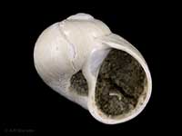
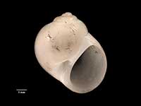
Mollusca (Phylum) > Gastropoda (Class) > Caenogastropoda (Subclass) > Littorinimorpha (Order) > Naticoidea (Superfamily) > Naticidae (Family) > Polinicinae (Subfamily)
 Filter region:
(greyed out images not recorded from filtered region)
 Click here to filter list on Geographical Range
Subfamily: Polinicinae
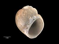
- Friginatica conjuncta Dell, 1953
Height 8.5mm, Width 7.5mm
Marine, Native - Endemic
North, South and Stewart Island. Trawled from around 200-1250 metres
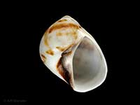
ACFM - Mammilla simiae (Deshayes, 1838)
Height 36mm, Width 30mm
Marine
Northland to East Cape. Also Kermadec and Norfolk Islands. In beach drift and alive from low tide
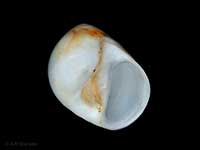
KA - Polinices putealis Garrard, 1961
Height 27mm
Marine, Thinner shell than P.tawhitirahia, with an umbilicus that remains open at all stages of growth. Fawn to greenish periostracum
Australia, Kermadec Islands and Northern NZ
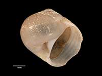
KA - Polinices tawhitirahia Powell, 1965
Height 36mm, Width 32mm
Marine, Heavy shell with thick callus that completely fills umbilicus. Colourless periostracum, fewer protoconch whorls than P. putealis, and a broader first protoconch whorl
Northland to Poor Knights Islands. Also Norfolk Islands
KA - Uberella alacris Dell, 1956
Height 4.7mm, Width 5.1mm
Marine, Native - Endemic
Off eastern Otago, trawled from around 475-550 metres
F - Uberella barrierensis (Marwick, 1924)
Height 5mm, Width 5mm
Marine, Native - Endemic
Off East Coast North Island to Cook Strait and Chatham Islands
ACM - Uberella denticulifera (Marwick, 1924)
Height 9mm, Width 8mm
Marine, Recent, Fossil, Native - Endemic
Off East Cape, off Milford Sound
CFMR.Fo. - Uberella vitrea (Hutton, 1873)
Height 8mm, Width 7mm
Marine, Native - Endemic
Stewart Island, in shell sand. Off Snares, Bounty, Auckland and Chatham Islands
FMAn
Key to Geographical Ranges
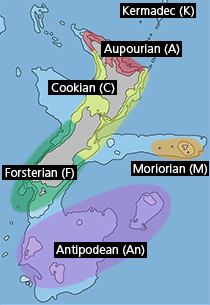
The symbols K.A.C.F.M.An. are used to indicate the geographical range of the species.
They have been adopted to give an approximation of the range of each species within New Zealand.
K=
Kermadec Islands
A=
Aupourian - Kaipara Harbour, north around North Cape, encompassing the Three Kings Islands and south to East Cape
C=
Cookian - Lower North Island and the northern part of the South Island
F=
Forsterian - Otago, Fiordland and Stewart Island
M=
Moriorian - Chatham Islands, Pitt Island
An=
Antipodean - Subantarctic Islands of New Zealand
Fw =
Freshwater
L =
Land
N =
North Island
S =
South Island
R =
Recent
Sf =
Subfossil
Fo =
Fossil
