Compare Talochlamys dichroa
| toggle to add to compare list |
Taxonomy
Family: Subfamily: PECTINIDAE: PEDINAE Full Classification: Mollusca (Phylum) > Bivalvia (Class) > Pteriomorphia (Subclass) > Pectinida (Order) > Pectinoidea (Superfamily) > Pectinidae (Family) > Pedinae (Subfamily) > Talochlamys (Genus) > dichroa (Species) Synonymised Names: =Chlamys (Mimachlamys) taiaroa Powell, 1952 =Chlamys consociata E.A. Smith, 1915 =Pecten (Chlamys) dichrous Suter, 1909 |
Images: Talochlamys dichroa (Suter, 1909)
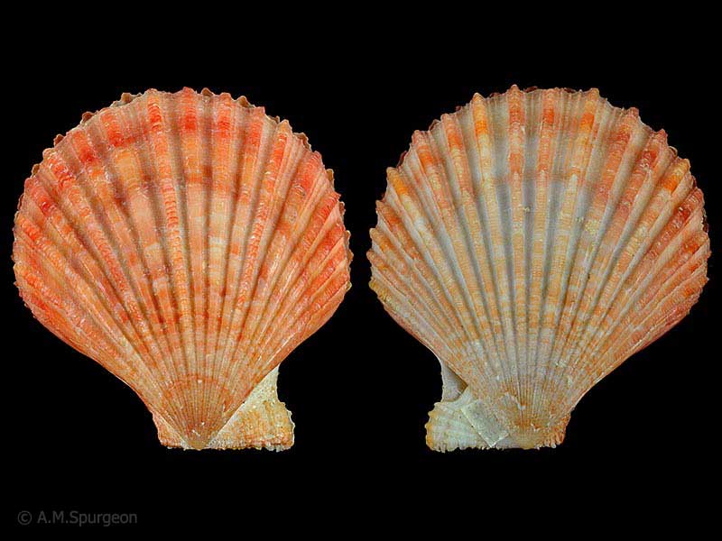
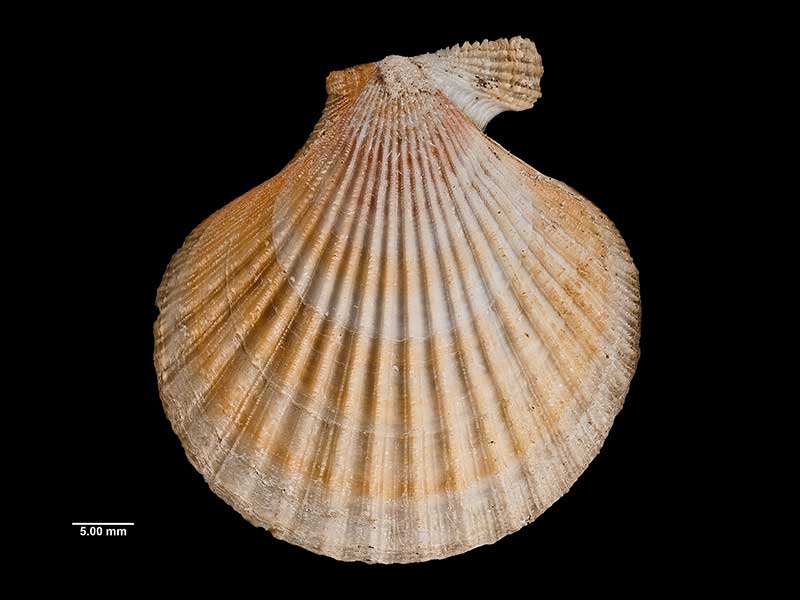
Off Port Adventure, Stewart Island, NZ. 42mm
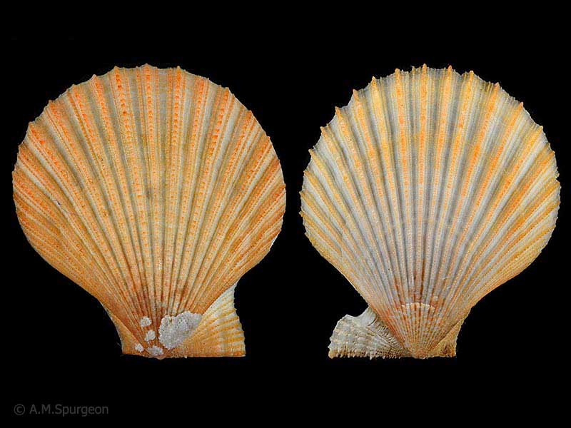
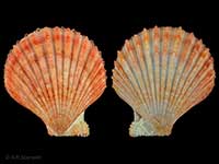
(taiaroa form) - Off Taiaroa Head, Otago, NZ. 34mm
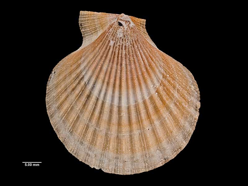
Holotype of Chalamys (Mimachlamys) taiaroa Powell, collected off Otago, NZ (MA71183). © Auckland Museum (CC-BY)
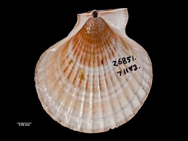
Holotype of Chalamys (Mimachlamys) taiaroa Powell, collected off Otago, NZ (MA71183). © Auckland Museum (CC-BY)
Holotype of Chalamys (Mimachlamys) taiaroa Powell, collected off Otago, NZ (MA71183). © Auckland Museum (CC-BY)
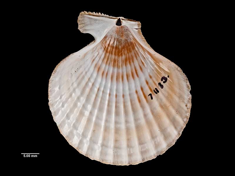
Holotype of Chalamys (Mimachlamys) taiaroa Powell, collected off Otago, NZ (MA71183). © Auckland Museum (CC-BY)
Taxonomy
Family: Subfamily: PECTINIDAE: PEDINAE Full Classification: Mollusca (Phylum) > Bivalvia (Class) > Pteriomorphia (Subclass) > Pectinida (Order) > Pectinoidea (Superfamily) > Pectinidae (Family) > Pedinae (Subfamily) > Talochlamys (Genus) > dichroa (Species) Synonymised Names: =Chlamys (Mimachlamys) taiaroa Powell, 1952 =Chlamys consociata E.A. Smith, 1915 =Pecten (Chlamys) dichrous Suter, 1909 |
Details: Talochlamys dichroa (Suter, 1909)
Size/Grows to:
Height 48mm, Width 46mm
Distribution:
North, South, Chatham and southern Islands. In cod stomachs and trawled around 50-800 metres
Geographical Range:
KACFMAn
Notes:
Species Links
Distribution Map
References and Publications
- Dijkstra, H., Marshall, B.A. 2008 The Recent Pectinoidea of the New Zealand region (Mollusca: Bivalvia: Propeamussiidae, Pectinidae and Spondylidae), Molluscan Research, 28 (p.51)
- Powell, A.W.B. 1979 New Zealand Mollusca: Marine, Land and Freshwater Shells, Collins, Auckland (p.378)
- Suter, H. 1909 Description of new species and subspecies of New Zealand Mollusca, with notes on a few species, Proceedings of the Malacological Society of London, 8 (p.264) Original Description
*98 © Museum of New Zealand Te Papa Tongarewa (CC-BY-NC-ND)
Key to Geographical Ranges

The symbols K.A.C.F.M.An. are used to indicate the geographical range of the species.
They have been adopted to give an approximation of the range of each species within New Zealand.
K=
Kermadec Islands
A=
Aupourian - Kaipara Harbour, north around North Cape, encompassing the Three Kings Islands and south to East Cape
C=
Cookian - Lower North Island and the northern part of the South Island
F=
Forsterian - Otago, Fiordland and Stewart Island
M=
Moriorian - Chatham Islands, Pitt Island
An=
Antipodean - Subantarctic Islands of New Zealand
Fw =
Freshwater
L =
Land
N =
North Island
S =
South Island
R =
Recent
Sf =
Subfossil
Fo =
Fossil
Recently Viewed
Compare Species (
/6)