Compare Potamopyrgus dawbini
| toggle to add to compare list |
Taxonomy
Family: TATEIDAE Full Classification: Mollusca (Phylum) > Gastropoda (Class) > Caenogastropoda (Subclass) > Littorinimorpha (Order) > Truncatelloidea (Superfamily) > Tateidae (Family) > Potamopyrgus (Genus) > dawbini (Species) |
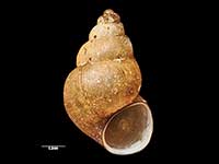
Images: Potamopyrgus dawbini Powell, 1955
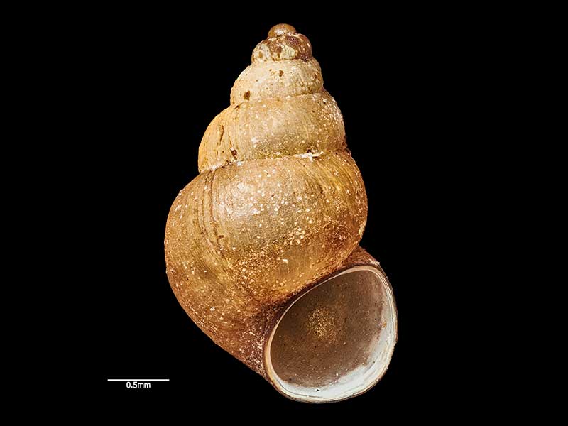
Holotype, collected Mar 1943, Coleridge Tarn, Auckland Islands, NZ (MA71225). © Auckland Museum (CC-BY)
Taxonomy
Family: TATEIDAE Full Classification: Mollusca (Phylum) > Gastropoda (Class) > Caenogastropoda (Subclass) > Littorinimorpha (Order) > Truncatelloidea (Superfamily) > Tateidae (Family) > Potamopyrgus (Genus) > dawbini (Species) |
Details: Potamopyrgus dawbini Powell, 1955
Size/Grows to:
Height 3.1mm, Width 1.8mm
Distribution:
Auckland Islands
Geographical Range:
Fw.
Notes:
Species Links
Distribution Map
References and Publications
- Haase, M. 2008 The radiation of hydrobiid gastropods in New Zealand: a revision including the description of new species based on morphology and mtDNA sequence information, Systematics and Biodiversity, 6(1) (p.104)
- Powell, A.W.B. 1979 New Zealand Mollusca: Marine, Land and Freshwater Shells, Collins, Auckland (p.123)
- Powell, A.W.B. 1955 Mollusca of the southern islands of New Zealand., Department of Scientific and Industrial Research Cape Expedition Series Bulletin, 15 (p.90) Original Description
Key to Geographical Ranges

The symbols K.A.C.F.M.An. are used to indicate the geographical range of the species.
They have been adopted to give an approximation of the range of each species within New Zealand.
K=
Kermadec Islands
A=
Aupourian - Kaipara Harbour, north around North Cape, encompassing the Three Kings Islands and south to East Cape
C=
Cookian - Lower North Island and the northern part of the South Island
F=
Forsterian - Otago, Fiordland and Stewart Island
M=
Moriorian - Chatham Islands, Pitt Island
An=
Antipodean - Subantarctic Islands of New Zealand
Fw =
Freshwater
L =
Land
N =
North Island
S =
South Island
R =
Recent
Sf =
Subfossil
Fo =
Fossil
Recently Viewed
Compare Species (
/6)